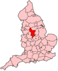
North East Derbyshire
North East Derbyshire is een Engels district in het shire-graafschap (non-metropolitan county OF county) Derbyshire en telt 101.000 inwoners. De oppervlakte bedraagt 276 km². De kantoren van district North East Derbyshire bevinden zich buiten het district in Chesterfield.
| Niet-metropolitaans district in Engeland | |||
|---|---|---|---|
 
| |||
| Situering | |||
| Land | Engeland | ||
| County | Derbyshire | ||
| Regio | East Midlands | ||
| Coördinaten | 53°12'NB, 1°30'WL | ||
| Algemeen | |||
| Oppervlakte | 275,6235[1] km² | ||
| Inwoners (2018[2]) |
101.125 (367 inw./km²) | ||
| ONS-code | E07000038 | ||
| Detailkaart | |||

| |||
| |||
Van de bevolking is 17,9% ouder dan 65 jaar. De werkloosheid bedraagt 3,3% van de beroepsbevolking (cijfers volkstelling 2001).
Plaatsen in district North East Derbyshire
bewerkenCivil parishes in district North East Derbyshire
bewerkenAshover, Barlow, Brackenfield, Brampton, Calow, Clay Cross, Dronfield, Eckington, Grassmoor, Hasland and Winswick, Heath and Holmewood, Holmesfield, Holymoorside and Walton, Killamarsh, Morton, North Wingfield, Pilsley, Shirland and Higham, Stretton, Sutton cum Duckmanton, Temple Normanton, Tupton, Unstone, Wessington, Wingerworth.
Bronnen, noten en/of referenties
- ↑ Office for National Statistics → Download → SAM_for_Administrative_Areas_(2018).zip → SAM_LAD_DEC_2018_UK.xlsx.
- ↑ https://www.ons.gov.uk/file?uri=/peoplepopulationandcommunity/populationandmigration/populationestimates/datasets/populationestimatesforukenglandandwalesscotlandandnorthernireland/mid20182019laboundaries/ukmidyearestimates20182019ladcodes.xls Schatting Office for National Statistics: knop MYE5 → kolom Estimated Population mid-2018]