Bestand:Tyne and Wear County.png
Grootte van deze voorvertoning: 800 × 585 pixels. Andere resoluties: 320 × 234 pixels | 640 × 468 pixels | 1.024 × 749 pixels | 1.280 × 936 pixels | 2.560 × 1.873 pixels | 2.879 × 2.106 pixels.
Oorspronkelijk bestand (2.879 × 2.106 pixels, bestandsgrootte: 495 kB, MIME-type: image/png)
| Dit is een bestand van Wikimedia Commons. Onderstaande beschrijving komt van de beschrijving van het bestand daar. |
Beschrijving
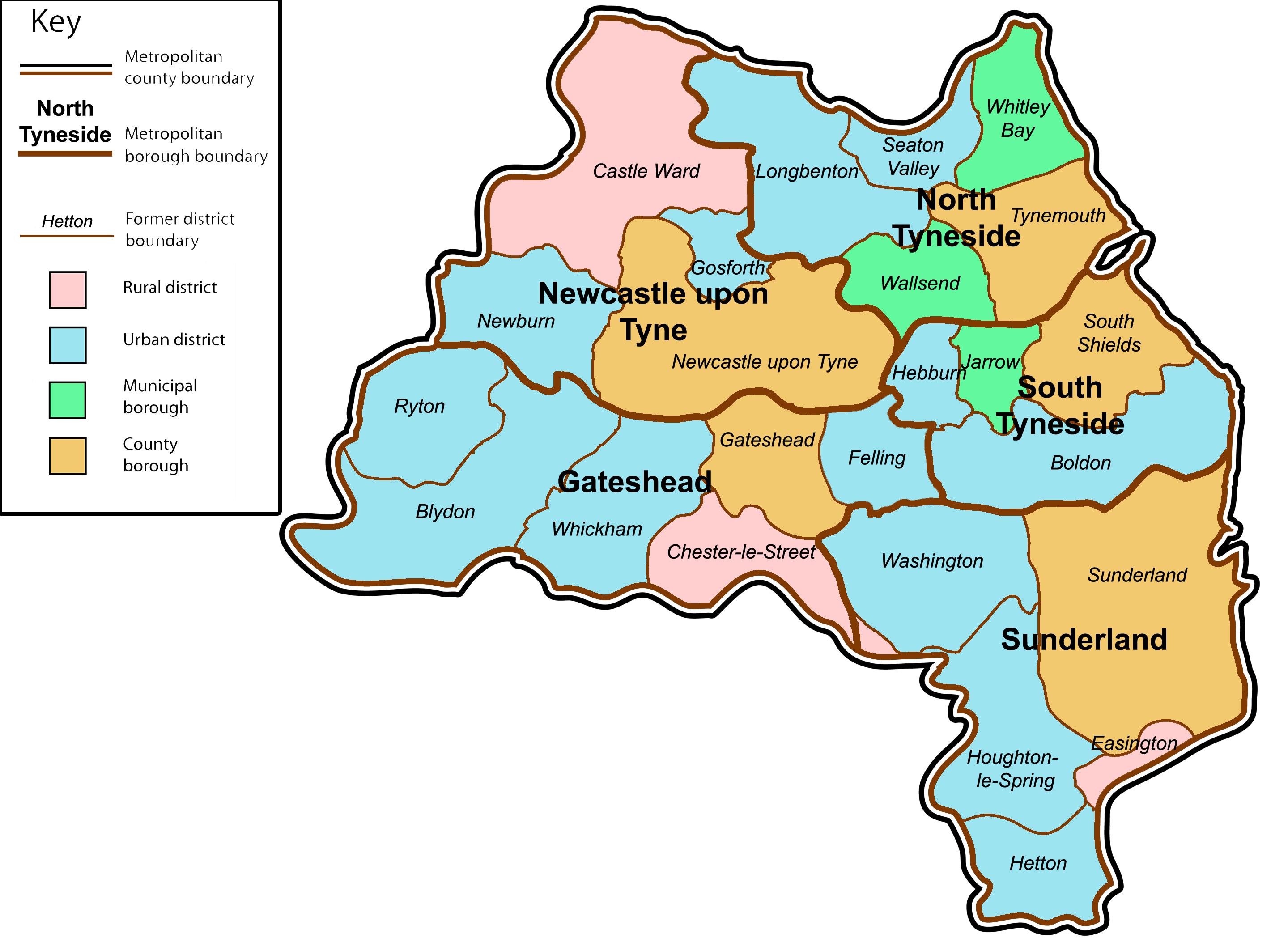
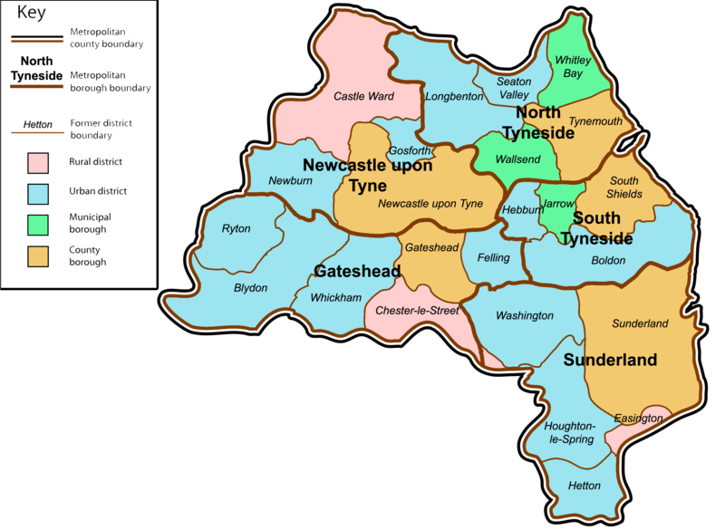
| Beschrijving | A map of the metropolitan county of Tyne and Wear, North East England. This map shows former and modern district boundaries. See key for explanation of colours. |
| Datum | |
| Bron | self-made. Content is verified at Her Majesty's Stationery Office (1974) Local Government in England and Wales: A Guide to the New System, Londen: HMSO ISBN: 0117508470. |
| Auteur | Jza84 |
Licentie
| Ik, de auteursrechthebbende van dit werk, geef dit werk vrij in het publieke domein. Dit is wereldwijd van toepassing. In sommige landen is dit wettelijk niet mogelijk; in die gevallen geldt: Ik sta iedereen toe dit werk voor eender welk doel te gebruiken, zonder enige voorwaarden, tenzij zulke voorwaarden door de wet worden voorgeschreven. |
Bestandsgeschiedenis
Klik op een datum/tijd om het bestand te zien zoals het destijds was.
| Datum/tijd | Miniatuur | Afmetingen | Gebruiker | Opmerking | |
|---|---|---|---|---|---|
| huidige versie | 13 jan 2009 20:02 | | 2.879 × 2.106 (495 kB) | Jza84 | {{Information |Description=A map of the metropolitan county of Tyne and Wear, North East England. This map shows former and modern district boundaries. See key for explanation of colours. |Source=self-made |Date=January 2009 |Author= Jza84 |
Bestandsgebruik
Dit bestand wordt op de volgende pagina gebruikt:
Globaal bestandsgebruik
De volgende andere wiki's gebruiken dit bestand:
- Gebruikt op bg.wikipedia.org
- Gebruikt op en.wikipedia.org
- Gebruikt op et.wikipedia.org
- Gebruikt op it.wikipedia.org
- Gebruikt op ko.wikipedia.org
- Gebruikt op sco.wikipedia.org