Bestand:Tortuga 84.jpg

Grootte van deze voorvertoning: 800 × 384 pixels. Andere resoluties: 320 × 153 pixels | 640 × 307 pixels | 1.264 × 606 pixels.
Oorspronkelijk bestand (1.264 × 606 pixels, bestandsgrootte: 232 kB, MIME-type: image/jpeg)
| Dit is een bestand van Wikimedia Commons. Onderstaande beschrijving komt van de beschrijving van het bestand daar. |
Beschrijving
| Beschrijving |
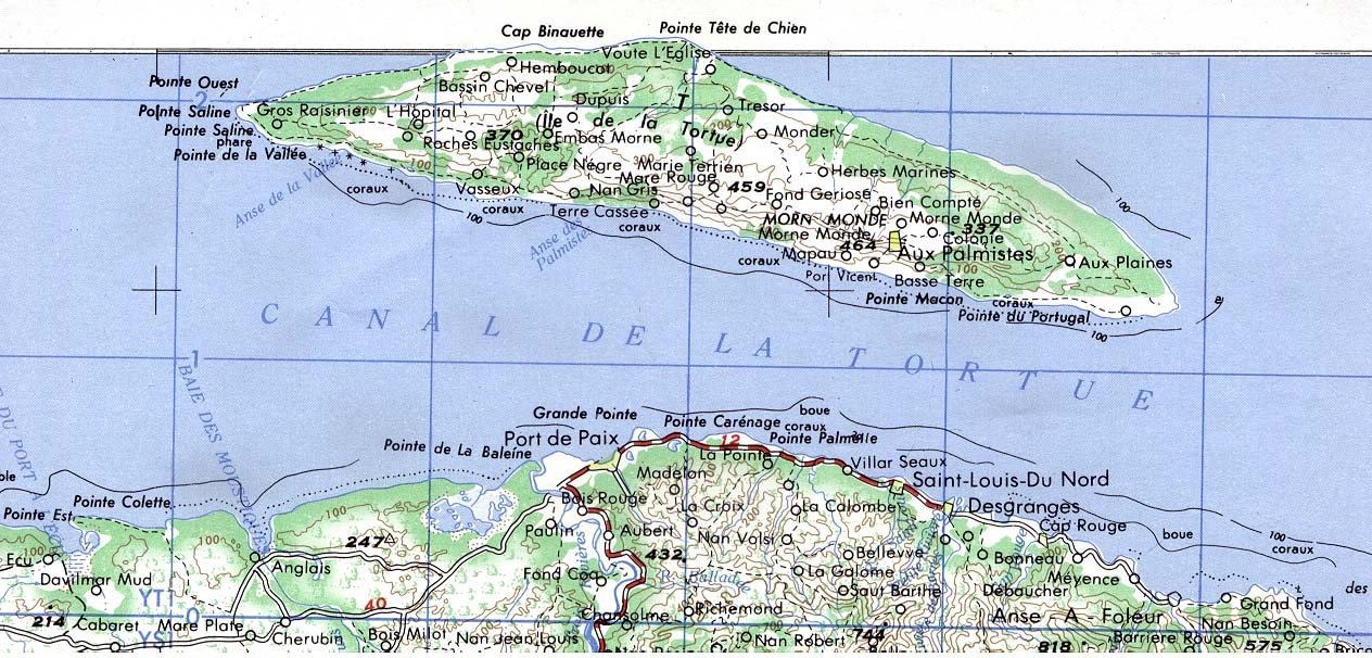
English: Map of Île de la Tortue, Northern Haiti |
| Datum | |
| Bron | http://lib.utexas.edu/maps/americas/tortuga_84.jpg |
| Auteur | USGS |
Licentie
Deze afbeelding bevindt zich in het publiek domein omdat het materiaal bevat dat oorspronkelijk afkomstig is van de United States Geological Survey, een agentschap van de United States Department of the Interior. Voor meer informatie, zie het officiële USGS-auteursrechtenbeleid
|
Bestandsgeschiedenis
Klik op een datum/tijd om het bestand te zien zoals het destijds was.
| Datum/tijd | Miniatuur | Afmetingen | Gebruiker | Opmerking | |
|---|---|---|---|---|---|
| huidige versie | 15 dec 2009 23:11 | | 1.264 × 606 (232 kB) | Ratzer | {{Information |Description={{en|1=map of Île de la Tortue, northern Haiti}} |Source=http://lib.utexas.edu/maps/americas/tortuga_84.jpg |Author=USGS |Date=1984 |Permission= |other_versions= }} Category:Haiti Category:Subdivisions of the Caribbean |
Bestandsgebruik
Dit bestand wordt op de volgende pagina gebruikt:
Globaal bestandsgebruik
De volgende andere wiki's gebruiken dit bestand:
- Gebruikt op de.wikipedia.org
- Gebruikt op fr.wikipedia.org
- Gebruikt op ht.wikipedia.org
- Gebruikt op hu.wikipedia.org
- Gebruikt op ru.wikipedia.org