Bestand:Topographic map of the Ciskei.svg

Afmetingen van deze voorvertoning van het type PNG van dit SVG-bestand: 484 × 599 pixels Andere resoluties: 194 × 240 pixels | 388 × 480 pixels | 620 × 768 pixels | 827 × 1.024 pixels | 1.654 × 2.048 pixels | 492 × 609 pixels.
Oorspronkelijk bestand (SVG-bestand, nominaal 492 × 609 pixels, bestandsgrootte: 807 kB)
| Dit is een bestand van Wikimedia Commons. Onderstaande beschrijving komt van de beschrijving van het bestand daar. |
Beschrijving
| Beschrijving |
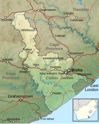
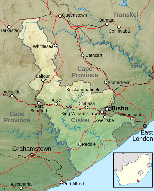
Afrikaans: Topografiese kaart van die voormalige Ciskei-tuisland wat vanaf 1981 tot 1994 nominaal onafhanklik van Suid-Afrika was. Aangedui is die terrein, groter riviere, hoofpaaie, spoorweë en hoofsentra.
English: Topographic map of the Ciskei, a former bantustan that was nominally independent of South Africa from 1981 to 1994. Included are terrain, major rivers, main roads, railways and main towns. |
|||
| Datum | ||||
| Bron |
|
|||
| Auteur | Htonl | |||
| Toestemming (Hergebruik van dit bestand) |
Dit bestand is gelicenseerd onder de Creative Commons-licentie Naamsvermelding-Gelijk delen 3.0 Unported
|
Bestandsgeschiedenis
Klik op een datum/tijd om het bestand te zien zoals het destijds was.
| Datum/tijd | Miniatuur | Afmetingen | Gebruiker | Opmerking | |
|---|---|---|---|---|---|
| huidige versie | 6 apr 2013 00:04 | | 492 × 609 (807 kB) | Htonl | labels |
| 5 apr 2013 13:36 |  | 492 × 609 (824 kB) | Htonl | {{Information |Description ={{en|1=Topographic map of the w:Ciskei, a former bantustan that was nominally independent of South Africa. Includes terrain, major rivers, main roads, railways and main towns.}} |So... |
Bestandsgebruik
Dit bestand wordt op de volgende pagina gebruikt:
Globaal bestandsgebruik
De volgende andere wiki's gebruiken dit bestand:
- Gebruikt op af.wikipedia.org
- Gebruikt op de.wikipedia.org
- Gebruikt op en.wikipedia.org
- Gebruikt op es.wikipedia.org
- Gebruikt op frr.wikipedia.org
- Gebruikt op he.wikipedia.org
- Gebruikt op pl.wikipedia.org
- Gebruikt op zh.wikipedia.org