Bestand:Southampton-town-map.gif
Geen hogere resolutie beschikbaar.
Southampton-town-map.gif (575 × 425 pixels, bestandsgrootte: 34 kB, MIME-type: image/gif)
| Dit is een bestand van Wikimedia Commons. Onderstaande beschrijving komt van de beschrijving van het bestand daar. |
Beschrijving
| Beschrijving | |
| Datum | |
| Bron | http://factfinder.census.gov |
| Auteur | United States Census Bureau |
| Toestemming (Hergebruik van dit bestand) |
Public domain |
Licentie
This image or file is a work of a United States Census Bureau employee, taken or made as part of that person's official duties. As a work of the U.S. federal government, the image is in the public domain.
|
 |
Oorspronkelijk uploadlogboek
De oorspronkelijke beschrijving van deze afbeelding stond hier. Alle volgende gebruikersnamen verwijzen naar en.wikipedia.
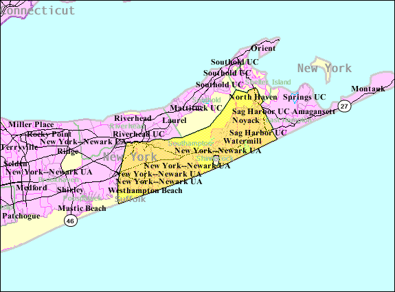
- 2007-10-22 08:29 Americasroof 575×425× (34945 bytes) [[Southampton (town), New York]] map from United States Census
Bestandsgeschiedenis
Klik op een datum/tijd om het bestand te zien zoals het destijds was.
| Datum/tijd | Miniatuur | Afmetingen | Gebruiker | Opmerking | |
|---|---|---|---|---|---|
| huidige versie | 23 aug 2013 07:04 | | 575 × 425 (34 kB) | Dcirovic | {{Information |Description={{en|en:U.S. Census 2000 reference map for en:Southampton (town), New York}} |Source=Transferred from [http://en.wikipedia.org en.wikipedia]<br/> (Original text : ''http://factfinder.census.gov'') |Date=2007<br/> ... |
Bestandsgebruik
Dit bestand wordt op de volgende pagina gebruikt:
Globaal bestandsgebruik
De volgende andere wiki's gebruiken dit bestand:
- Gebruikt op arz.wikipedia.org
- Gebruikt op azb.wikipedia.org
- Gebruikt op cy.wikipedia.org
- Gebruikt op es.wikipedia.org
- Gebruikt op eu.wikipedia.org
- Gebruikt op fa.wikipedia.org
- Gebruikt op fr.wikipedia.org
- Gebruikt op ht.wikipedia.org
- Gebruikt op it.wikipedia.org
- Gebruikt op no.wikipedia.org
- Gebruikt op pl.wikipedia.org
- Gebruikt op sh.wikipedia.org
- Gebruikt op sr.wikipedia.org
- Gebruikt op tt.wikipedia.org
- Gebruikt op www.wikidata.org
- Gebruikt op zh.wikipedia.org