Bestand:South Orkney Islands-en.svg

Afmetingen van deze voorvertoning van het type PNG van dit SVG-bestand: 800 × 476 pixels Andere resoluties: 320 × 190 pixels | 640 × 381 pixels | 1.024 × 609 pixels | 1.280 × 761 pixels | 2.560 × 1.523 pixels | 2.303 × 1.370 pixels.
Oorspronkelijk bestand (SVG-bestand, nominaal 2.303 × 1.370 pixels, bestandsgrootte: 252 kB)
| Dit is een bestand van Wikimedia Commons. Onderstaande beschrijving komt van de beschrijving van het bestand daar. |
Beschrijving
| Beschrijving |
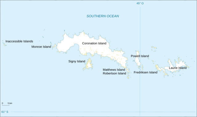
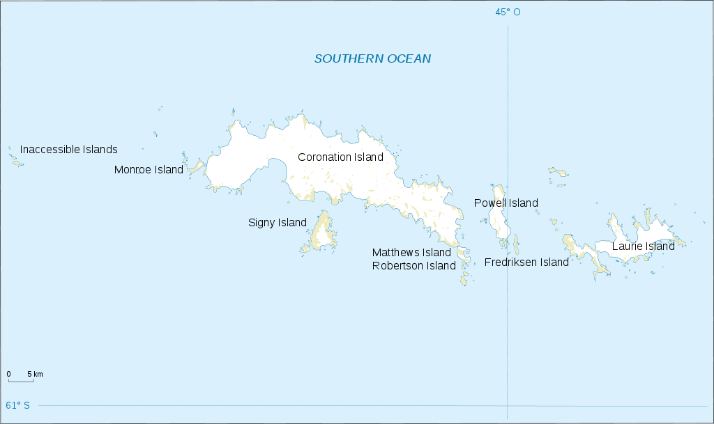
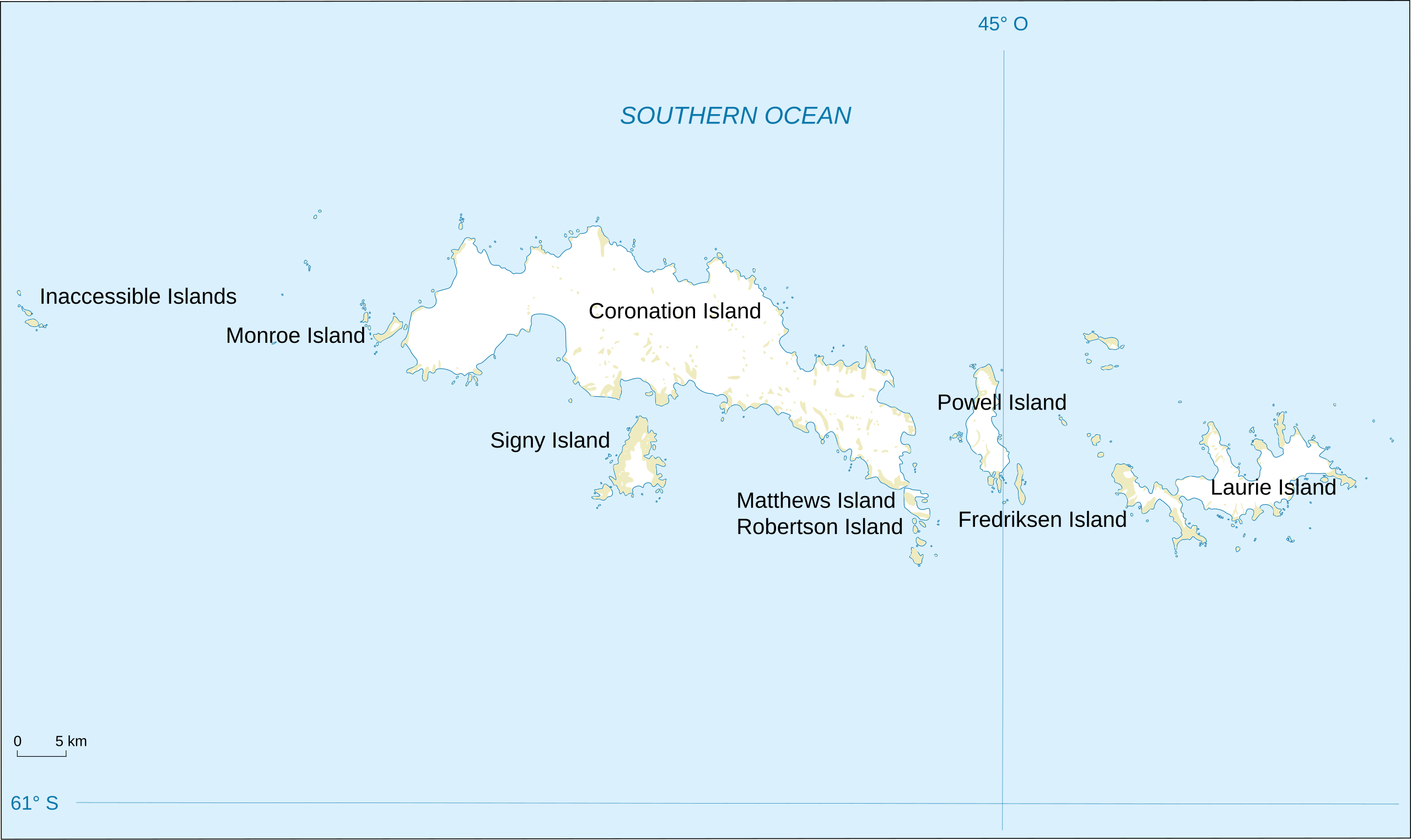
English: Map of South Orkney Islands.
Français : Carte des Iles Orcades du Sud.
Italiano: Mappa delle Isole Orcadi Meridionali. |
| Datum | |
| Bron | Landsat Image Mosaic Of Antarctica (LIMA) |
| Auteur | Shakki |
| Andere versies |
|


Licentie
Deze afbeelding bevindt zich in het publiek domein omdat het materiaal bevat dat oorspronkelijk afkomstig is van de United States Geological Survey, een agentschap van de United States Department of the Interior. Voor meer informatie, zie het officiële USGS-auteursrechtenbeleid
|
Bestandsgeschiedenis
Klik op een datum/tijd om het bestand te zien zoals het destijds was.
| Datum/tijd | Miniatuur | Afmetingen | Gebruiker | Opmerking | |
|---|---|---|---|---|---|
| huidige versie | 17 mrt 2008 20:32 | | 2.303 × 1.370 (252 kB) | Shakki | {{Information |Description={{en|Map of South Orkney Islands}} {{fr|Carte des Iles Orcades du Sud}} |Source=[http://gisdata.usgs.gov/website/antarctic_research_atlas/ Landsat Image Mosaic Of Antarctica (LIMA)] |Date=Mar 2008 |Author=Shakki |
Bestandsgebruik
Dit bestand wordt op de volgende pagina gebruikt:
Globaal bestandsgebruik
De volgende andere wiki's gebruiken dit bestand:
- Gebruikt op af.wikipedia.org
- Gebruikt op ang.wikipedia.org
- Gebruikt op ar.wikipedia.org
- Gebruikt op ast.wikipedia.org
- Gebruikt op az.wikipedia.org
- Gebruikt op be.wikipedia.org
- Gebruikt op br.wikipedia.org
- Gebruikt op bs.wikipedia.org
- Gebruikt op ca.wikipedia.org
- Gebruikt op ceb.wikipedia.org
- Gebruikt op cs.wikipedia.org
- Gebruikt op da.wikipedia.org
- Gebruikt op de.wikipedia.org
- Gebruikt op el.wikipedia.org
- Gebruikt op en.wikipedia.org
- South Orkney Islands
- Scottish National Antarctic Expedition
- Laws Glacier
- Buchanan Point
- Orwell Glacier
- Jane Peak
- Sunshine Glacier
- Cape Murdoch
- Cape Mabel
- McLeod Glacier (South Orkney Islands)
- Thomson Point
- Cape Valavielle
- Cape Robertson
- Roald Glacier
- Tioga Lake (South Orkney Islands)
- Three Lakes Valley (South Orkney Islands)
- Module:Location map/data/South Orkney Islands
- Module:Location map/data/South Orkney Islands/doc
- Gebruikt op es.wikipedia.org
Globaal gebruik van dit bestand bekijken.