Bestand:Sogn og Fjordane Municipalities.png
Grootte van deze voorvertoning: 800 × 487 pixels. Andere resoluties: 320 × 195 pixels | 640 × 390 pixels | 1.025 × 624 pixels.
Oorspronkelijk bestand (1.025 × 624 pixels, bestandsgrootte: 29 kB, MIME-type: image/png)
| Dit is een bestand van Wikimedia Commons. Onderstaande beschrijving komt van de beschrijving van het bestand daar. |

|
Deze kaartafbeelding zou opnieuw moeten worden aangemaakt als een SVG-bestand door vectorafbeeldingen te gebruiken. Dit heeft een aantal voordelen; zie Commons:Media for cleanup voor meer informatie. Als er een SVG-formaat van deze afbeelding bestaat, dan deze graag uploaden. Nadat u dit heeft gedaan, gelieve dit sjabloon te vervangen door het sjabloon {{vector version available|nieuwe bestandsnaam.svg}} op deze afbeeldingspagina.
|
Verplaatst vanaf en.wikipedia naar Commons door Maksim.
De oorspronkelijke beschrijving van deze afbeelding stond hier. Alle volgende gebruikersnamen verwijzen naar en.wikipedia.
Beschrijving
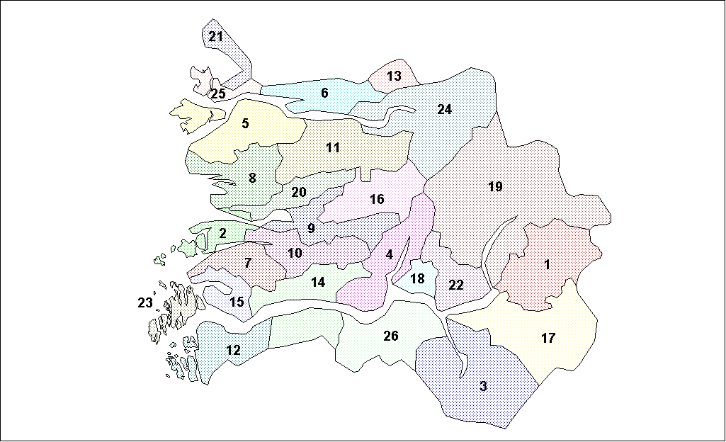
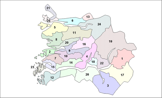
Map of the municipalities of Sogn og Fjordane County in Norway. Created by Rarelibra for public domain use. Created using MapInfo Professional v7.5 and various mapping resources.
Licentie
| Ik, de auteursrechthebbende van dit werk, geef dit werk vrij in het publieke domein. Dit is wereldwijd van toepassing. In sommige landen is dit wettelijk niet mogelijk; in die gevallen geldt: Ik sta iedereen toe dit werk voor eender welk doel te gebruiken, zonder enige voorwaarden, tenzij zulke voorwaarden door de wet worden voorgeschreven. |
| date/time | username | edit summary |
|---|---|---|
| 14:58, 26 January 2006 | en:User:Rarelibra | (Map of the municipalities of Sogn og Fjordane County in Norway. Created by <a href="/wiki/User:Rarelibra" title="User:Rarelibra">Rarelibra</a> for public domain use. Created using MapInfo Professional v7.5 and various mapping resources.) |
Oorspronkelijk uploadlogboek
Legend: (cur) = this is the current file, (del) = delete this old version, (rev) = revert to this old version.
Click on date to download the file or see the image uploaded on that date.
- (del) (cur) 18:36, 26 January 2006 . . en:User:Rarelibra Rarelibra ( en:User_talk:Rarelibra Talk) . . 1025x624 (30045 bytes) (Map of the municipalities of Sogn og Fjordane County in Norway. Created by en:User:Rarelibra Rarelibra for public domain use. Created using MapInfo Professional v7.5 and various mapping resources.)
- (del) (rev) 14:58, 26 January 2006 . . en:User:Rarelibra Rarelibra ( en:User_talk:Rarelibra Talk) . . 1025x624 (30510 bytes) (Map of the municipalities of Sogn og Fjordane County in Norway. Created by en:User:Rarelibra Rarelibra for public domain use. Created using MapInfo Professional v7.5 and various mapping resources.)
Bestandsgeschiedenis
Klik op een datum/tijd om het bestand te zien zoals het destijds was.
| Datum/tijd | Miniatuur | Afmetingen | Gebruiker | Opmerking | |
|---|---|---|---|---|---|
| huidige versie | 26 mrt 2006 10:57 | | 1.025 × 624 (29 kB) | Maksim | La bildo estas kopiita de wikipedia:en. La originala priskribo estas: == Summary == Map of the municipalities of Sogn og Fjordane County in Norway. Created by Rarelibra for public domain use. Created using MapInfo Professional v7.5 and |
Bestandsgebruik
Dit bestand wordt op de volgende pagina gebruikt:
Globaal bestandsgebruik
De volgende andere wiki's gebruiken dit bestand:
- Gebruikt op bat-smg.wikipedia.org
- Gebruikt op en.wikipedia.org
- Gebruikt op eo.wikipedia.org
- Gebruikt op es.wikipedia.org
- Gebruikt op et.wikipedia.org
- Gebruikt op eu.wikipedia.org
- Gebruikt op hr.wikipedia.org
- Gebruikt op hu.wikipedia.org
- Gebruikt op id.wikipedia.org
- Gebruikt op ja.wikipedia.org
- Gebruikt op ka.wikipedia.org
- Gebruikt op ko.wikipedia.org
- Gebruikt op lt.wikipedia.org
- Gebruikt op pt.wikipedia.org
- Gebruikt op ru.wikipedia.org
- Gebruikt op sr.wikipedia.org
- Gebruikt op sw.wikipedia.org
- Gebruikt op uk.wikipedia.org
- Gebruikt op vi.wikipedia.org
- Gebruikt op zea.wikipedia.org
- Gebruikt op zh.wikipedia.org