Bestand:Papua Locator Topography.png

Grootte van deze voorvertoning: 600 × 600 pixels. Andere resoluties: 240 × 240 pixels | 480 × 480 pixels | 768 × 768 pixels | 1.024 × 1.024 pixels | 1.591 × 1.591 pixels.
Oorspronkelijk bestand (1.591 × 1.591 pixels, bestandsgrootte: 1,57 MB, MIME-type: image/png)
| Dit is een bestand van Wikimedia Commons. Onderstaande beschrijving komt van de beschrijving van het bestand daar. |
Beschrijving
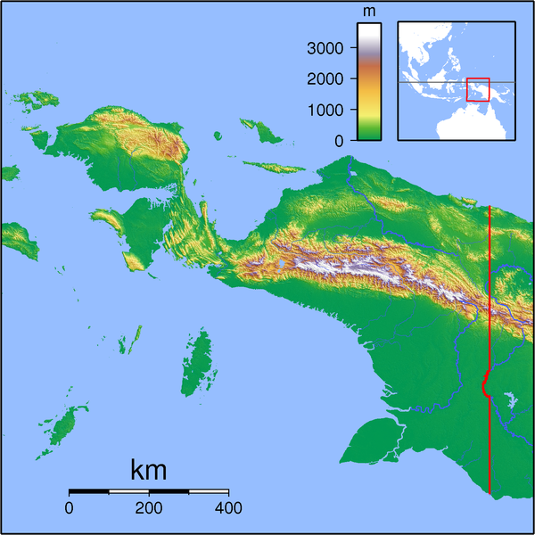
| Beschrijving | Topographic locator map for Papua (Indonesian part of New Guinea). Created with GMT from SRTM data. Left: 130, Bottom: -10, Right: 142, Top: 2 |
| Datum | |
| Bron | Eigen werk |
| Auteur | Sadalmelik |
Licentie
Ik, de auteursrechthebbende van dit werk, maak het hierbij onder de volgende licenties beschikbaar:

|
Toestemming wordt verleend voor het kopiëren, verspreiden en/of wijzigen van dit document onder de voorwaarden van de GNU-licentie voor vrije documentatie, versie 1.2 of enige latere versie als gepubliceerd door de Free Software Foundation; zonder Invariant Sections, zonder Front-Cover Texts, en zonder Back-Cover Texts. Een kopie van de licentie is opgenomen in de sectie GNU-licentie voor vrije documentatie. |
Dit bestand is gelicenseerd onder de Creative Commons-licenties Naamsvermelding-Gelijk delen 3.0 Unported, 2.5 Algemeen, 2.0 Algemeen en 1.0 Algemeen.
- De gebruiker mag:
- Delen – het werk kopiëren, verspreiden en doorgeven
- Remixen – afgeleide werken maken
- Onder de volgende voorwaarden:
- naamsvermelding – U moet op een gepaste manier aan naamsvermelding doen, een link naar de licentie geven, en aangeven of er wijzigingen in het werk zijn aangebracht. U mag dit op elke redelijke manier doen, maar niet zodanig dat de indruk wordt gewekt dat de licentiegever instemt met uw werk of uw gebruik van zijn werk.
- Gelijk delen – Als u het werk heeft geremixt, veranderd, of erop heeft voortgebouwd, moet u het gewijzigde materiaal verspreiden onder dezelfde licentie als het oorspronkelijke werk, of een daarmee compatibele licentie.
U mag zelf één van de licenties kiezen.
Bestandsgeschiedenis
Klik op een datum/tijd om het bestand te zien zoals het destijds was.
| Datum/tijd | Miniatuur | Afmetingen | Gebruiker | Opmerking | |
|---|---|---|---|---|---|
| huidige versie | 11 sep 2007 21:54 | | 1.591 × 1.591 (1,57 MB) | Sadalmelik | {{Information |Description=Topographic locator map for Papua (Indonesian part of New Guinea). Created with GMT from SRTM data. Left: 130, Bottom: -10, Right: 142, Top: 2 |Source=self-made |Date=Sep 11, 2007 |Author= Sadalmelik }} [[Ca |
Bestandsgebruik
Dit bestand wordt op de volgende 37 pagina's gebruikt:
- Aardbeving Papoea 2010
- Biak-stad
- Bintuni
- Boven Digoel (regentschap)
- Ertsberg (berg)
- Fakfak
- Fort Du Bus
- Grasbergmijn
- Jayapura (stad)
- Jayawijayagebergte
- Kaimana
- Luchthaven Sentani
- Manokwari
- Mansinam
- Maokegebergte
- Merauke
- Nabire
- Nationaal Park Lorentz
- Nederlands-Nieuw-Guinea
- Republiek van West-Papoea
- Sarmi (regentschap)
- Serui
- Sorong
- Straat Buaya
- Straat Muli
- Sudirmangebergte
- Taman Nasional Wasur
- Tariku
- Timika
- United Nations Temporary Executive Authority
- Waisai
- Wamena
- Waropen
- Gebruiker:Arjuno3/Kladblok/Lijst van rivieren in Westelijk Nieuw-Guinea
- Sjabloon:Positiekaart Papoea
- Portaal:Indonesië/Uitgelicht
- Portaal:Indonesië/Uitgelicht/08
Globaal bestandsgebruik
De volgende andere wiki's gebruiken dit bestand:
- Gebruikt op ar.wikipedia.org
- Gebruikt op arz.wikipedia.org
- Gebruikt op bg.wikipedia.org
- Gebruikt op ca.wikipedia.org
- Gebruikt op ceb.wikipedia.org
- Gebruikt op cs.wikipedia.org
- Gebruikt op en.wikipedia.org
- Gebruikt op eo.wikipedia.org
- Gebruikt op es.wikipedia.org
- Gebruikt op fa.wikipedia.org
- Gebruikt op fi.wikipedia.org
- Gebruikt op fr.wikipedia.org
- Gebruikt op id.wikipedia.org
- Nabire, Nabire
- Taman Nasional Teluk Cenderawasih
- Taman Nasional Wasur
- Templat:Location map Papua
- Lapangan Terbang Middelburg
- Lapangan Terbang Sansapor
- Bandar Udara Mopah-Merauke
- Gempa bumi Biak 1996
- Komolom, Kimaam, Merauke
- Jalur Lipatan Anjakan Lengguru
- Merauke (distrik)
- Merauke, Merauke
- Liga 3 2023 Papua
- Gempa bumi Laut Banda November 2023
- Gebruikt op ilo.wikipedia.org
- Gebruikt op it.wikipedia.org
- Gebruikt op it.wikivoyage.org
- Gebruikt op ja.wikipedia.org
- Gebruikt op ka.wikipedia.org
- Gebruikt op kn.wikipedia.org
- Gebruikt op ko.wikipedia.org
- Gebruikt op lv.wikipedia.org
Globaal gebruik van dit bestand bekijken.