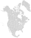
Bestand:North America second level political division 2 and Greenland.svg

Oorspronkelijk bestand(SVG-bestand, nominaal 1.789 × 2.154 pixels, bestandsgrootte: 367 kB)


Beschrijving
English: Map of North America and its second-level political divisions. Canadian provinces and territories, US and Mexican states. Canada, Mexico, United States.

Non-contiguous parts of a states/provinces are "grouped" together with the main area of the state/provinces, so any state/provinces can be coloured in completion with one click anywhere on the state/provinces's area.

Also, all states/provinces have a "id" attached to them, making them easy to find. Select "find" and then enter in the state/provinces's ISO 3166-2 code in the "id" field to find it. The codes can be found here (Canada), here (USA) and here (Mexico).
Datum
Bron

Canada and US map: BlankMap-USA-states-Canada-provinces, HI closer.svg by Lokal_Profil.
Mexico map: Mexico template.svg by Mario Fuente Cid
Greenland map: Image:Greenland.svg
Combined by Alex Covarrubias, Greenland added by carol.

 
De broncode van dit SVG-bestand is deugdelijk.
 
Deze vectorafbeelding is gemaakt met Inkscape, en dan handmatig gewijzigd
.
 
W3C-validity not checked.
Auteur Alex Covarrubias
Toestemming
(Hergebruik van dit bestand)
w:nl:Creative Commons
naamsvermelding Gelijk delen
Dit bestand is gelicenseerd onder de Creative Commons-licentie Naamsvermelding-Gelijk delen 2.5 Unported
De gebruiker mag:
  • Delen – het werk kopiëren, verspreiden en doorgeven
  • Remixen – afgeleide werken maken
Onder de volgende voorwaarden:
  • naamsvermelding – U moet op een gepaste manier aan naamsvermelding doen, een link naar de licentie geven, en aangeven of er wijzigingen in het werk zijn aangebracht. U mag dit op elke redelijke manier doen, maar niet zodanig dat de indruk wordt gewekt dat de licentiegever instemt met uw werk of uw gebruik van zijn werk.
  • Gelijk delen – Als u het werk heeft geremixt, veranderd, of erop heeft voortgebouwd, moet u het gewijzigde materiaal verspreiden onder dezelfde licentie als het oorspronkelijke werk, of een daarmee compatibele licentie.
Andere versies

Afgeleide werken van dit bestand:

Bijschriften

Beschrijf in één regel wat dit bestand voorstelt

Items getoond in dit bestand

beeldt af

Bestandsgeschiedenis

Klik op een datum/tijd om het bestand te zien zoals het destijds was.

Datum/tijdMiniatuurAfmetingenGebruikerOpmerking
huidige versie18 mrt 2008 15:57Miniatuurafbeelding voor de versie van 18 mrt 2008 15:571.789 × 2.154 (367 kB)CarolSpearsminor validation problems repaired
18 mrt 2008 15:41Miniatuurafbeelding voor de versie van 18 mrt 2008 15:411.789 × 2.154 (367 kB)CarolSpears{{Information |Description={{en|Map of North America and its second-level political divisions. Canadian provinces, US and Mexican states. Canada, Mexico, United States. Non-contiguous parts of a states/provinces are "grouped" together with the main area

Geen enkele pagina gebruikt dit bestand.

Globaal bestandsgebruik