Bestand:Netherlands location map 1944.svg

Afmetingen van deze voorvertoning van het type PNG van dit SVG-bestand: 532 × 600 pixels Andere resoluties: 213 × 240 pixels | 426 × 480 pixels | 681 × 768 pixels | 908 × 1.024 pixels | 1.817 × 2.048 pixels | 888 × 1.001 pixels.
Oorspronkelijk bestand (SVG-bestand, nominaal 888 × 1.001 pixels, bestandsgrootte: 1,32 MB)
| Dit is een bestand van Wikimedia Commons. Onderstaande beschrijving komt van de beschrijving van het bestand daar. |
Beschrijving
| Beschrijving |
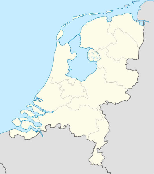
Deutsch: Positionskarte der Niederlande für das Jahr 1944
Quadratische Plattkarte, N-S-Streckung 160 %. Geographische Begrenzung der Karte:
English: Location map of the Netherlands as of 1944
Equirectangular projection, N/S stretching 160 %. Geographic limits of the map:
|
| Datum | |
| Bron |
Eigen werk Deze niet W3C-verklaarde vectorafbeelding is gemaakt met Adobe Illustrator. Deze vectorafbeelding bevat onderdelen die afkomstig zijn uit van: |
| Auteur | Lencer |

|
Deze kaart is gemaakt of verbeterd in de Duitse Kartenwerkstatt (Map Lab). Je kunt ook zelf kaarten ter verbetering voorstellen.
|
Licentie
Ik, de auteursrechthebbende van dit werk, maak het hierbij onder de volgende licenties beschikbaar:

|
Toestemming wordt verleend voor het kopiëren, verspreiden en/of wijzigen van dit document onder de voorwaarden van de GNU-licentie voor vrije documentatie, versie 1.2 of enige latere versie als gepubliceerd door de Free Software Foundation; zonder Invariant Sections, zonder Front-Cover Texts, en zonder Back-Cover Texts. Een kopie van de licentie is opgenomen in de sectie GNU-licentie voor vrije documentatie. |
Dit bestand is gelicenseerd onder de Creative Commons-licentie Naamsvermelding-Gelijk delen 3.0 Unported
- De gebruiker mag:
- Delen – het werk kopiëren, verspreiden en doorgeven
- Remixen – afgeleide werken maken
- Onder de volgende voorwaarden:
- naamsvermelding – U moet op een gepaste manier aan naamsvermelding doen, een link naar de licentie geven, en aangeven of er wijzigingen in het werk zijn aangebracht. U mag dit op elke redelijke manier doen, maar niet zodanig dat de indruk wordt gewekt dat de licentiegever instemt met uw werk of uw gebruik van zijn werk.
- Gelijk delen – Als u het werk heeft geremixt, veranderd, of erop heeft voortgebouwd, moet u het gewijzigde materiaal verspreiden onder dezelfde licentie als het oorspronkelijke werk, of een daarmee compatibele licentie.
U mag zelf één van de licenties kiezen.
Bestandsgeschiedenis
Klik op een datum/tijd om het bestand te zien zoals het destijds was.
| Datum/tijd | Miniatuur | Afmetingen | Gebruiker | Opmerking | |
|---|---|---|---|---|---|
| huidige versie | 9 jul 2011 11:34 | | 888 × 1.001 (1,32 MB) | TUBS | Lauwerszee was keeen maar, Europoort nok niet; Sloe was niet afsluiten, Neeltje Jans en de eilanden bij Goeree es Schouwen was nog niet, Sint Philipsland was en eiland |
| 6 jul 2011 19:52 |  | 888 × 1.001 (281 kB) | TUBS | corr | |
| 6 jul 2011 16:04 |  | 888 × 1.001 (281 kB) | TUBS | corr | |
| 6 jul 2011 15:59 |  | 888 × 1.001 (281 kB) | TUBS | == {{int:filedesc}} == {{Information |Description= {{de|Positionskarte der Niederlande für das Jahr 1944}} Quadratische Plattkarte, N-S-Streckung 160 %. Geographische Begrenzung der Karte: * N: 53.7° N * S: 50.6° N * W: 3.1° |
Bestandsgebruik
Geen enkele pagina gebruikt dit bestand.
Globaal bestandsgebruik
De volgende andere wiki's gebruiken dit bestand:
- Gebruikt op als.wikipedia.org
- Gebruikt op ar.wikipedia.org
- Gebruikt op ceb.wikipedia.org
- Gebruikt op ckb.wikipedia.org
- Gebruikt op de.wikipedia.org
- Gebruikt op es.wikipedia.org
- Gebruikt op frr.wikipedia.org
- Gebruikt op ka.wikipedia.org
- Gebruikt op mk.wikipedia.org
- Gebruikt op ml.wikipedia.org
- Gebruikt op mn.wikipedia.org
- Gebruikt op pl.wikipedia.org
- Gebruikt op pl.wikibooks.org
- Gebruikt op sco.wikipedia.org
- Gebruikt op sl.wikipedia.org
- Gebruikt op sq.wikipedia.org
- Gebruikt op tg.wikipedia.org
- Gebruikt op war.wikipedia.org
- Gebruikt op xmf.wikipedia.org
- Gebruikt op zh.wikipedia.org