Bestand:NWS 2013 Moore EF5 damage.jpg
Grootte van deze voorvertoning: 800 × 600 pixels. Andere resoluties: 320 × 240 pixels | 640 × 480 pixels | 1.024 × 768 pixels | 1.280 × 960 pixels.
Oorspronkelijk bestand (1.280 × 960 pixels, bestandsgrootte: 1,16 MB, MIME-type: image/jpeg)
| Dit is een bestand van Wikimedia Commons. Onderstaande beschrijving komt van de beschrijving van het bestand daar. |
Beschrijving
| Beschrijving |
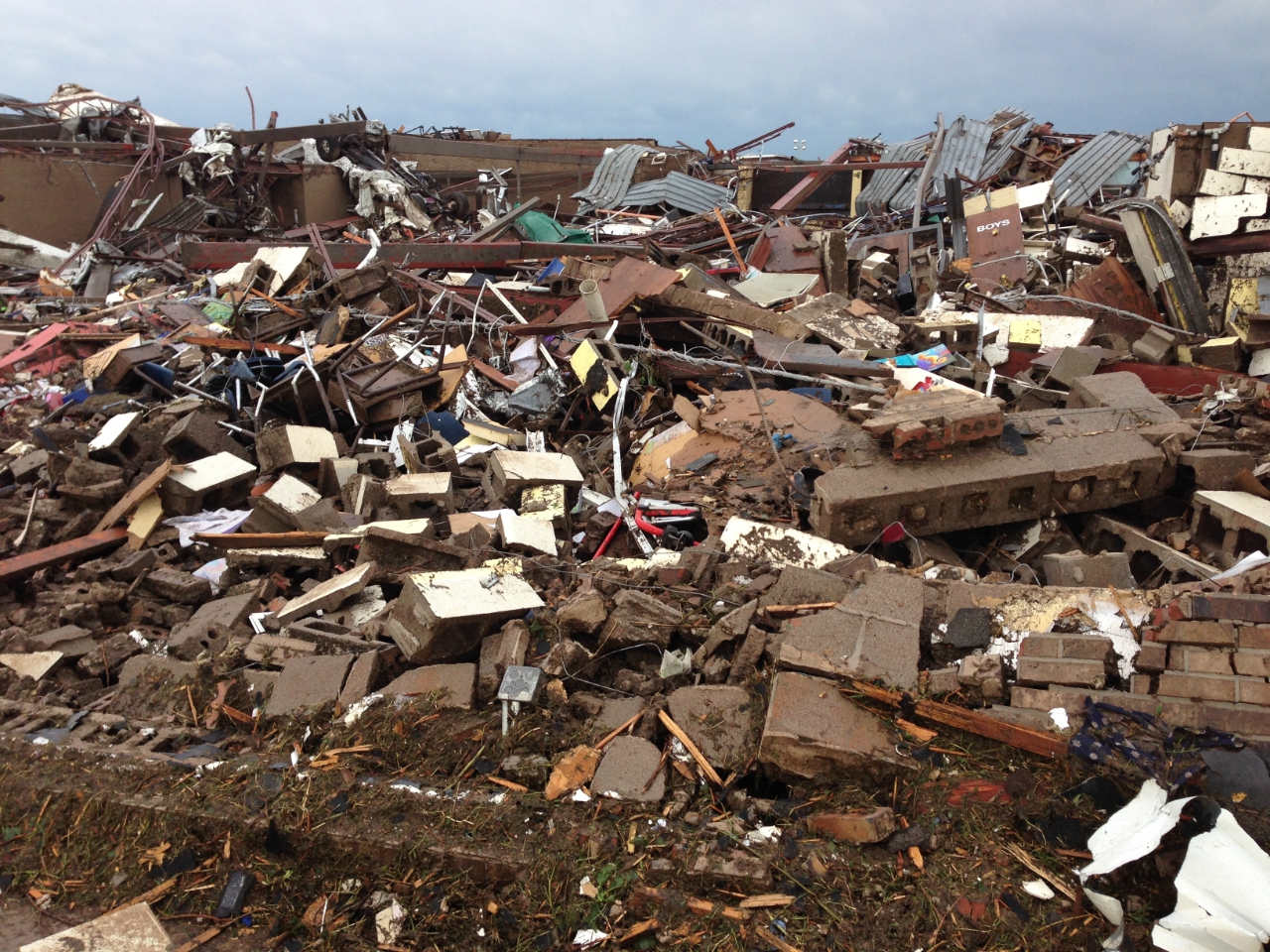
English: 2013 Moore tornado damage at Briarwood Elementary School, EF5 rated by NWS WFO Norman, OK |
| Datum | |
| Bron | http://arcgis-nwsdatsecurestd-560264031.us-east-1.elb.amazonaws.com/arcgis/rest/services/DamageAssessmentToolkit/DamageFlexViewer/MapServer/0/141947/attachments/98967 from http://www.srh.noaa.gov/images/oun/wxevents/20130520/20130520-storm_survey_path_points.kmz as linked from http://www.srh.noaa.gov/oun/?n=events-20130520 |
| Auteur | NWS WFO Norman, OK |
| Date of Damage | 05/20/2013 15:48 UTC |
| Date of Survey | 05/21/2013 19:31 UTC |
| EF Rating | EF5 |
| Damage Indicator | Elementary School [Single Story; Interior or Exterior Hallways] (ES) |
| Degree of Damage | Total destruction of a large section of building or entire building |
| Latitude | 35.32133326 |
| Longitude | -97.52087024 |
| Cameralocatie | | Deze en andere afbeeldingen in: OpenStreetMap |
|---|
This File:NWS_2013_Moore_EF5_damage.jpg photo is explicitly identified as an example of EF5 damage in the NWS's kml file http://www.srh.noaa.gov/images/oun/wxevents/20130520/20130520-storm_survey_path_points.kmz as linked from http://www.srh.noaa.gov/oun/?n=events-20130520 as retrieved on 2013-06-17.
Licentie
Deze afbeelding is in het publiek domein omdat het materiaal bevat dat oorspronkelijk van de National Oceanic and Atmospheric Administration kwam in de Verenigde Staten en genomen of gemaakt is tijdens de officiële werkzaamheden van een werknemer.
|
Bestandsgeschiedenis
Klik op een datum/tijd om het bestand te zien zoals het destijds was.
| Datum/tijd | Miniatuur | Afmetingen | Gebruiker | Opmerking | |
|---|---|---|---|---|---|
| huidige versie | 23 mei 2013 01:30 | | 1.280 × 960 (1,16 MB) | Sitic | {{Information |Description ={{en|1=2013 Moore tornado damage at Briarwood Elementary School, EF5 rated by NWS WFO Norman, OK}} |Source =http://arcgis-nwsdatsecurestd-560264031.us-east-1.elb.amazonaws.com/arcgis/rest/services/DamageAssessment... |
Bestandsgebruik
Dit bestand wordt op de volgende 3 pagina's gebruikt:
Globaal bestandsgebruik
De volgende andere wiki's gebruiken dit bestand:
- Gebruikt op am.wikipedia.org
- Gebruikt op ca.wikipedia.org
- Gebruikt op cs.wikipedia.org
- Gebruikt op da.wikipedia.org
- Gebruikt op de.wikipedia.org
- Gebruikt op en.wikipedia.org
- Gebruikt op gl.wikipedia.org
- Gebruikt op it.wikipedia.org
- Gebruikt op ja.wikipedia.org
- Gebruikt op ru.wikipedia.org
- Gebruikt op ta.wikipedia.org
- Gebruikt op zh.wikipedia.org