Geen hogere resolutie beschikbaar.
Beschrijving
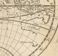
English: Herman Moll: A map of the world, shewing the course of Mr. Dampiers voyage round it: from 1679, to 1691, London 1697
Herman Moll
(1654–1732)   |
 |
| Aliassen |
Moll, Hermann |
| Beschrijving |
Brits cartograaf, graveur en uitgever |
| Geboorte- en sterfdatum |
ca. 1654 date QS:P,+1654-00-00T00:00:00Z/9,P1480,Q5727902 |
22 september 1732  |
| Geboorte- en sterfplaats |
OnbekendUnknown place |
Londen |
| Werklocatie |
|
| Bibliografische informatie |
|
creator QS:P170,Q1610319
Licentie
| Public domainPublic domainfalsefalse
|

|
Dit werk bevindt zich in het publiek domein in landen en gebieden waar de auteursrechttermijn het leven van de auteur plus 100 jaar of minder is.
 Je dient ook een Amerikaans publiek domein-tag in te voegen om aan te geven waarom dit werk zich in het publiek domein bevindt in de Verenigde Staten. Je dient ook een Amerikaans publiek domein-tag in te voegen om aan te geven waarom dit werk zich in het publiek domein bevindt in de Verenigde Staten.
|
| Van dit bestand is vastgesteld dat er geen bekende auteursrechtaanspraken op rusten, alle aanverwante en naburige rechten daarbij inbegrepen.
|
https://creativecommons.org/publicdomain/mark/1.0/PDMCreative Commons Public Domain Mark 1.0falsefalse
Beschrijf in één regel wat dit bestand voorstelt
Lilliput and Blefescu islands in Gulliver's Travels
Bestandsgeschiedenis
Klik op een datum/tijd om het bestand te zien zoals het destijds was.
| Datum/tijd | Miniatuur | Afmetingen | Gebruiker | Opmerking |
|---|
| huidige versie | 23 apr 2020 08:54 |  | 383 × 370 (199 kB) | Hansmuller | File:Moll - A map of the world shewing the course of Mr Dampiers voyage round it from 1679 to 1691.png cropped 78 % horizontally, 62 % vertically using CropTool with precise mode. |
Bestandsgebruik
Dit bestand wordt op de volgende 2 pagina's gebruikt:
Globaal bestandsgebruik
De volgende andere wiki's gebruiken dit bestand:
- Gebruikt op en.wikipedia.org
Dit bestand bevat metadata met EXIF-informatie, die door een fotocamera, scanner of fotobewerkingsprogramma toegevoegd kan zijn.


