Bestand:Moll - A map of the world shewing the course of Mr Dampiers voyage round it from 1679 to 1691.png
Grootte van deze voorvertoning: 800 × 460 pixels. Andere resoluties: 320 × 184 pixels | 640 × 368 pixels | 1.024 × 589 pixels | 1.709 × 983 pixels.
Oorspronkelijk bestand (1.709 × 983 pixels, bestandsgrootte: 2,25 MB, MIME-type: image/png)
Dit is een bestand van Wikimedia Commons.
Onderstaande beschrijving komt van de beschrijving van het bestand daar.
Onderstaande beschrijving komt van de beschrijving van het bestand daar.
Beschrijving
| Beschrijving |
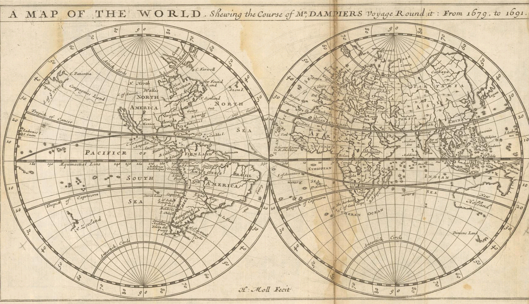
English: "A Map of the World Shewing the Course of Mr. Dampiers Voyage Round It from 1679 to 1691" (London, 1697) |
|||||||||||||||||||||||
| Datum | ||||||||||||||||||||||||
| Bron | Unprovided | |||||||||||||||||||||||
| Auteur |
|
|||||||||||||||||||||||
| Andere versies |
|
|||||||||||||||||||||||

_-_New_Holland_-_Dimens_Land.png)
Licentie
|
Dit werk bevindt zich in het publiek domein in landen en gebieden waar de auteursrechttermijn het leven van de auteur plus 100 jaar of minder is. | |
| Van dit bestand is vastgesteld dat er geen bekende auteursrechtaanspraken op rusten, alle aanverwante en naburige rechten daarbij inbegrepen. | |
| Aantekeningen | Deze afbeelding is aangetekend: Bekijk de aantekeningen op Commons |
Bestandsgeschiedenis
Klik op een datum/tijd om het bestand te zien zoals het destijds was.
| Datum/tijd | Miniatuur | Afmetingen | Gebruiker | Opmerking | |
|---|---|---|---|---|---|
| huidige versie | 16 sep 2005 23:45 | | 1.709 × 983 (2,25 MB) | Frank Schulenburg | Herman Moll: ''A map of the world, shewing the course of Mr. Dampiers voyage round it: from 1679, to 1691'', London 1697 {{Creator:Herman Moll}} Category:17th century maps |
Bestandsgebruik
Geen enkele pagina gebruikt dit bestand.
Globaal bestandsgebruik
De volgende andere wiki's gebruiken dit bestand:
- Gebruikt op ca.wikipedia.org
- Gebruikt op de.wikipedia.org
- Gebruikt op en.wikipedia.org
- Gebruikt op fr.wikipedia.org
- Gebruikt op hr.wikipedia.org
- Gebruikt op pl.wikipedia.org
- Gebruikt op sh.wikipedia.org
- Gebruikt op tr.wikipedia.org