Bestand:Minustah.png
Minustah.png (603 × 449 pixels, bestandsgrootte: 181 kB, MIME-type: image/png)
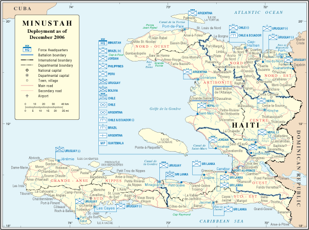
Onderstaande beschrijving komt van de beschrijving van het bestand daar.
| Beschrijving | Map of Haiti | |||
| Datum | ||||
| Bron | http://www.un.org/Depts/Cartographic/map/dpko/minustah.pdf | |||
| Auteur | Department of Peacekeeping Operations Cartographic Section | |||
| Toestemming (Hergebruik van dit bestand) |
|

Bestandsgeschiedenis
Klik op een datum/tijd om het bestand te zien zoals het destijds was.
| Datum/tijd | Miniatuur | Afmetingen | Gebruiker | Opmerking | |
|---|---|---|---|---|---|
| huidige versie | 23 okt 2007 04:01 | | 603 × 449 (181 kB) | Jeroen | Bottom line is allowed according permissions by the UN: "UN maps are open source material and you can use them in your work or for making your own map. We request however that you '''delete the UN name and reference number upon any modification''' to the |
| 23 jan 2007 01:17 |  | 609 × 466 (181 kB) | Cro-Cop2 | {{Information| |Description=Map of Haiti |Source=http://www.un.org/Depts/Cartographic/map/dpko/minustah.pdf |Date=December, 2006 |Author=Department of Peacekeeping Operations Cartographic Section |Permission={{UN map}} }} |
Bestandsgebruik
Dit bestand wordt op de volgende pagina gebruikt:
Globaal bestandsgebruik
De volgende andere wiki's gebruiken dit bestand:
- Gebruikt op bg.wikipedia.org
- Gebruikt op ca.wikipedia.org
- Gebruikt op ckb.wikipedia.org
- Gebruikt op de.wikipedia.org
- Gebruikt op en.wikipedia.org
- Gebruikt op en.wikinews.org
- Gebruikt op es.wikipedia.org
- Gebruikt op fa.wikipedia.org
- Gebruikt op fr.wikipedia.org
- Gebruikt op ht.wikipedia.org
- Gebruikt op id.wikipedia.org
- Gebruikt op mzn.wikipedia.org
- Gebruikt op ru.wikipedia.org
- Gebruikt op www.wikidata.org