Bestand:Mcchord-afb-20-06-02-01.jpg
Grootte van deze voorvertoning: 317 × 599 pixels. Andere resoluties: 127 × 240 pixels | 321 × 607 pixels.
Oorspronkelijk bestand (321 × 607 pixels, bestandsgrootte: 98 kB, MIME-type: image/jpeg)
| Dit is een bestand van Wikimedia Commons. Onderstaande beschrijving komt van de beschrijving van het bestand daar. |
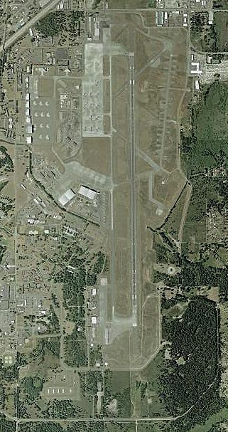
Beschrijving
| Beschrijving | USGS orthophoto of McChord Air Force Base (Washington State) |
| Datum | |
| Bron | USGS The National Map via MSR Maps (formerly TerraServer-USA) |
| Auteur | United States Geological Survey (USGS) |
| Toestemming (Hergebruik van dit bestand) |
Public domain |
Licentie
Deze afbeelding bevindt zich in het publiek domein omdat het materiaal bevat dat oorspronkelijk afkomstig is van de United States Geological Survey, een agentschap van de United States Department of the Interior. Voor meer informatie, zie het officiële USGS-auteursrechtenbeleid
|
Bestandsgeschiedenis
Klik op een datum/tijd om het bestand te zien zoals het destijds was.
| Datum/tijd | Miniatuur | Afmetingen | Gebruiker | Opmerking | |
|---|---|---|---|---|---|
| huidige versie | 5 jan 2007 05:21 | | 321 × 607 (98 kB) | Mike-tango | {{Information |Description=Satellite view from Mcchord Air Force Base (Washington state) |Source=http://terraserver-usa.com |Date=2002-06-02 |Author=Image courtesy of the USGS |Permission= |other_versions= }} Category:United States Air Force bases |
Bestandsgebruik
Dit bestand wordt op de volgende pagina gebruikt:
Globaal bestandsgebruik
De volgende andere wiki's gebruiken dit bestand:
- Gebruikt op ar.wikipedia.org
- Gebruikt op ceb.wikipedia.org
- Gebruikt op de.wikipedia.org
- Gebruikt op eo.wikipedia.org
- Gebruikt op es.wikipedia.org
- Gebruikt op fa.wikipedia.org
- Gebruikt op fr.wikipedia.org
- Gebruikt op no.wikipedia.org
- Gebruikt op pl.wikipedia.org
- Gebruikt op pt.wikipedia.org
- Gebruikt op sr.wikipedia.org
- Gebruikt op ur.wikipedia.org
- Gebruikt op uz.wikipedia.org
- Gebruikt op vo.wikipedia.org
- Gebruikt op www.wikidata.org
- Gebruikt op zh-min-nan.wikipedia.org