Bestand:Maskat & Oman map.png

Grootte van deze voorvertoning: 567 × 599 pixels. Andere resoluties: 227 × 240 pixels | 454 × 480 pixels | 763 × 806 pixels.
Oorspronkelijk bestand (763 × 806 pixels, bestandsgrootte: 21 kB, MIME-type: image/png)
| Dit is een bestand van Wikimedia Commons. Onderstaande beschrijving komt van de beschrijving van het bestand daar. |

|
Deze kaartafbeelding zou opnieuw moeten worden aangemaakt als een SVG-bestand door vectorafbeeldingen te gebruiken. Dit heeft een aantal voordelen; zie Commons:Media for cleanup voor meer informatie. Als er een SVG-formaat van deze afbeelding bestaat, dan deze graag uploaden. Nadat u dit heeft gedaan, gelieve dit sjabloon te vervangen door het sjabloon {{vector version available|nieuwe bestandsnaam.svg}} op deze afbeeldingspagina.
|
| Beschrijving |
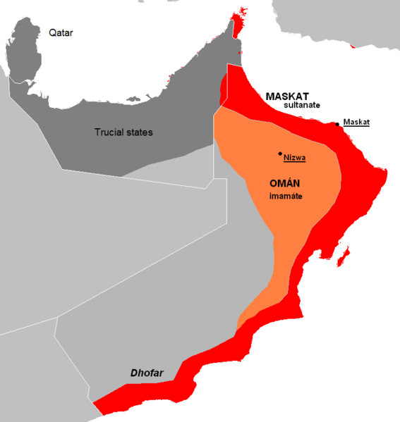
English: The approximate map of historic state of Mascat and Oman.
Čeština: Přibližná mapa historického státu Maskat a Omán |
| Datum | (UTC) |
| Bron | |
| Auteur |
|
| Andere versies | العربيَّة |
| Dit is een geretoucheerde foto, wat betekent dat de originele versie digitaal aangepast is. Aanpassingen: de facto new map, viz. description. Het origineel kan hier bekeken worden: Al Hajar mountain woodlands map.png. Aanpassingen gedaan door Kolomaznik.
|
| Ik, de auteursrechthebbende van dit werk, geef dit werk vrij in het publieke domein. Dit is wereldwijd van toepassing. In sommige landen is dit wettelijk niet mogelijk; in die gevallen geldt: Ik sta iedereen toe dit werk voor eender welk doel te gebruiken, zonder enige voorwaarden, tenzij zulke voorwaarden door de wet worden voorgeschreven. |
Oorspronkelijk uploadlogboek
This image is a derivative work of the following images:
- File:AT1306_map.png licensed with PD-self
- 2008-02-27T09:16:44Z Doreano 763x806 (23794 Bytes) {{Information |Description=Gulf of Oman desert and semi-desert ecoregion map |Source=self-made |Date=2008/2/27 |Author= [[User:Altatoron|Altatoron]] |Permission= |other_versions= }} [[Category:Biomes]] [[Category:Biogeography
- File:AT0801_map.png licensed with PD-self
- 2008-02-27T09:10:47Z Doreano 676x806 (18852 Bytes) {{Information |Description=Al Hajar montane woodlands ecoregion map |Source=self-made |Date=2008/2/27 |Author= [[User:Altatoron|Altatoron]] |Permission= |other_versions= }} [[Category:Biomes]] [[Category:Biogeography]] [[Cate
Uploaded with derivativeFX
Bestandsgeschiedenis
Klik op een datum/tijd om het bestand te zien zoals het destijds was.
| Datum/tijd | Miniatuur | Afmetingen | Gebruiker | Opmerking | |
|---|---|---|---|---|---|
| huidige versie | 8 jul 2015 00:36 | | 763 × 806 (21 kB) | History of Persia | Made it easier to understand. |
| 28 mei 2010 21:06 |  | 763 × 806 (27 kB) | Kolomaznik | {{Information |Description={{en}}The approximate map of historic state of Mascat and Oman. {{cs}}Přibližná mapa historického státu Maskat a Omán |Source=*File:AT1306_map.png *File:AT0801_map.png |Date=2010-05-28 19:02 (UTC) |Author=*[[:F |
Bestandsgebruik
Dit bestand wordt op de volgende pagina gebruikt:
Globaal bestandsgebruik
De volgende andere wiki's gebruiken dit bestand:
- Gebruikt op ar.wikipedia.org
- Gebruikt op az.wikipedia.org
- Gebruikt op cs.wikipedia.org
- Gebruikt op de.wikipedia.org
- Gebruikt op el.wikipedia.org
- Gebruikt op en.wikipedia.org
- Gebruikt op es.wikipedia.org
- Gebruikt op eu.wikipedia.org
- Gebruikt op fa.wikipedia.org
- Gebruikt op fi.wikipedia.org
- Gebruikt op fr.wikipedia.org
- Gebruikt op he.wikipedia.org
- Gebruikt op id.wikipedia.org
- Gebruikt op it.wikipedia.org
- Gebruikt op ko.wikipedia.org
- Gebruikt op mn.wikipedia.org
- Gebruikt op ms.wikipedia.org
- Gebruikt op pl.wikipedia.org
- Gebruikt op pt.wikipedia.org
- Gebruikt op ru.wikipedia.org
- Gebruikt op sl.wikipedia.org
- Gebruikt op th.wikipedia.org
- Gebruikt op tr.wikipedia.org
- Gebruikt op uk.wikipedia.org
- Gebruikt op vi.wikipedia.org
- Gebruikt op www.wikidata.org
- Gebruikt op zh.wikipedia.org