Bestand:Maps-roman-empire-peak-150AD.jpg
Oorspronkelijk bestand (2.620 × 2.076 pixels, bestandsgrootte: 1,12 MB, MIME-type: image/jpeg)
| Dit is een bestand van Wikimedia Commons. Onderstaande beschrijving komt van de beschrijving van het bestand daar. |
Beschrijving
| Beschrijving |
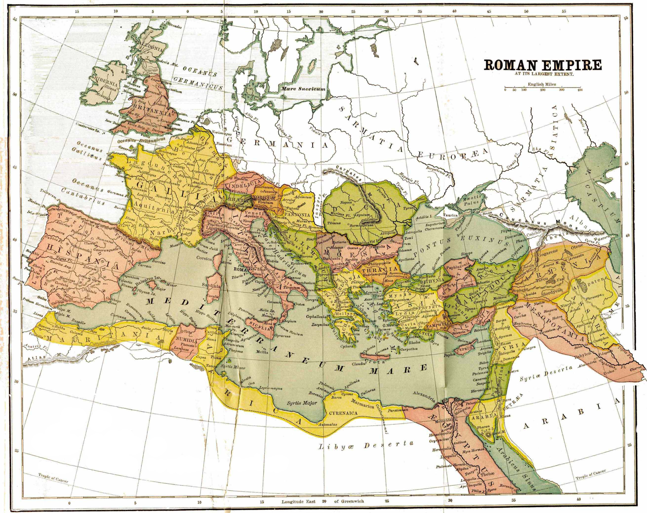
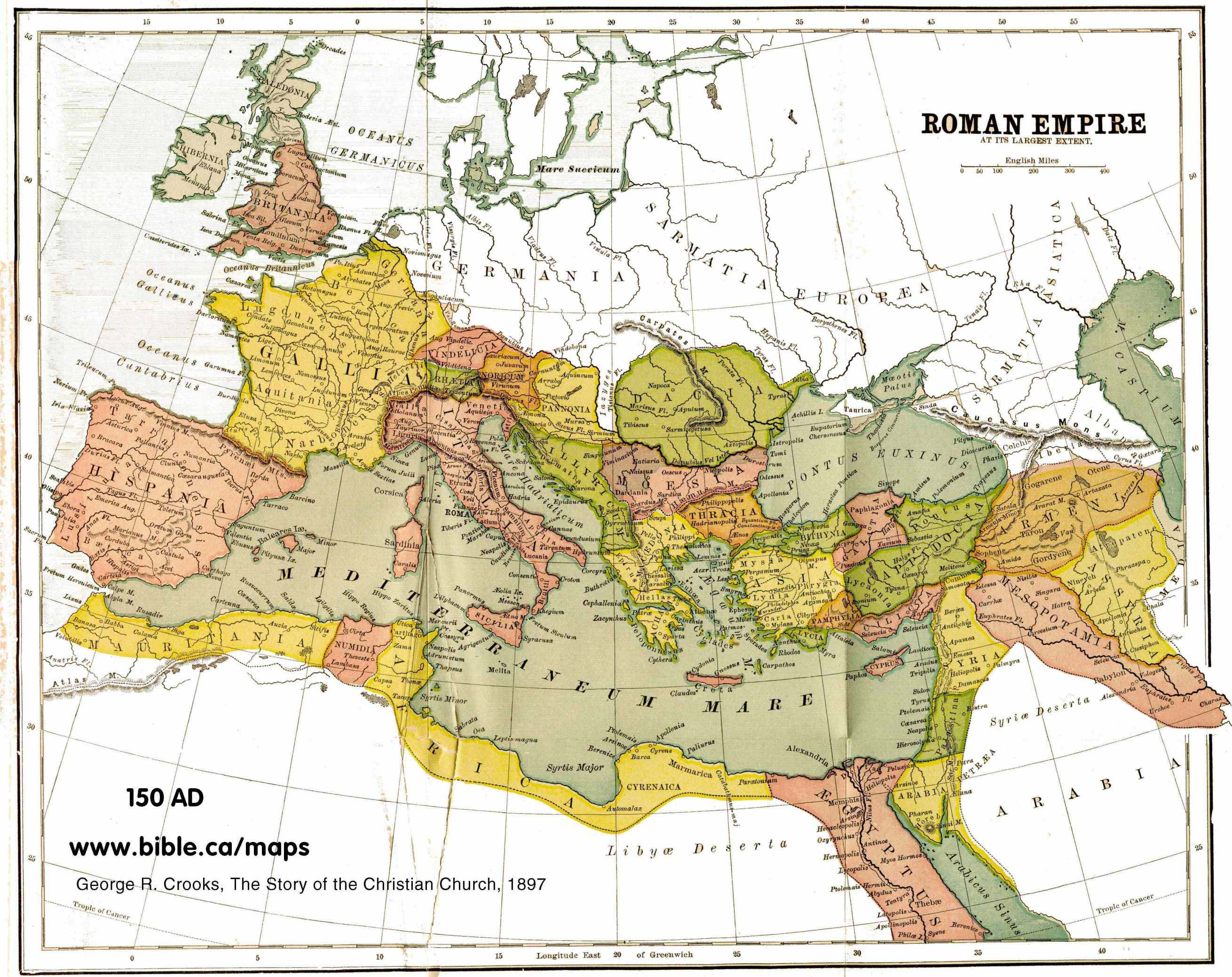
English: map of the Roman Empire, with provinces, in 150 AD |
| Datum | |
| Bron | http://www.bible.ca/maps/maps-roman-empire-peak-150AD.jpg |
| Auteur | George R. Crooks |
Licentie
|
Dit werk bevindt zich in het publiek domein in landen en gebieden waar de auteursrechttermijn het leven van de auteur plus 70 jaar of minder is.
| |
| Van dit bestand is vastgesteld dat er geen bekende auteursrechtaanspraken op rusten, alle aanverwante en naburige rechten daarbij inbegrepen. | |
Bestandsgeschiedenis
Klik op een datum/tijd om het bestand te zien zoals het destijds was.
| Datum/tijd | Miniatuur | Afmetingen | Gebruiker | Opmerking | |
|---|---|---|---|---|---|
| huidige versie | 12 feb 2012 21:50 | | 2.620 × 2.076 (1,12 MB) | Quibik | Removed the watermark. |
| 21 aug 2010 21:35 |  | 2.620 × 2.076 (823 kB) | Ratzer | {{Information |Description={{en|1=map of the Roman Empire, with provinces, in 150 AD}} |Source=http://www.bible.ca/maps/maps-roman-empire-peak-150AD.jpg |Author=George R. Crooks |Date=1897 |Permission= |other_versions= }} [[Category:Maps of the Roman Emp |
Bestandsgebruik
Dit bestand wordt op de volgende pagina gebruikt:
Globaal bestandsgebruik
De volgende andere wiki's gebruiken dit bestand:
- Gebruikt op af.wikipedia.org
- Gebruikt op ast.wikipedia.org
- Gebruikt op ba.wikipedia.org
- Gebruikt op en.wikipedia.org
- Gebruikt op hu.wikipedia.org
- Gebruikt op incubator.wikimedia.org
- Gebruikt op it.wikipedia.org
- Gebruikt op lez.wikipedia.org
- Gebruikt op pt.wikipedia.org
- Gebruikt op ru.wikipedia.org