Bestand:Map of Rakhine (Arakan) State in Myanmar.png

Grootte van deze voorvertoning: 373 × 600 pixels. Andere resoluties: 149 × 240 pixels | 298 × 480 pixels | 651 × 1.047 pixels.
Oorspronkelijk bestand (651 × 1.047 pixels, bestandsgrootte: 56 kB, MIME-type: image/png)
| Dit is een bestand van Wikimedia Commons. Onderstaande beschrijving komt van de beschrijving van het bestand daar. |
_State_in_Myanmar.png)
Beschrijving
| Beschrijving |
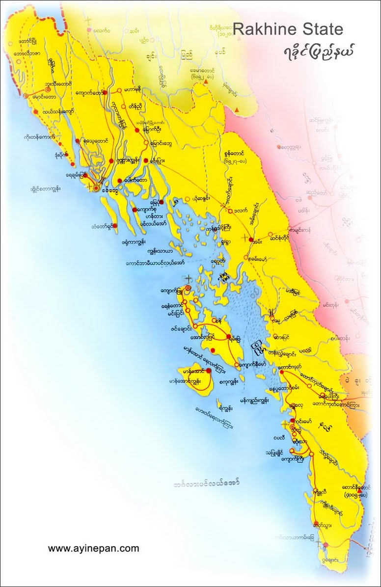
English: Map of the Rakhine (Arakan) State in Myanmar. |
| Datum | |
| Bron | Eigen werk |
| Auteur | PANONIAN |
Licentie
Ik, de auteursrechthebbende van dit werk, maak het hierbij onder de volgende licentie beschikbaar:
| Dit bestand is beschikbaar onder Creative Commons CC0 1.0 Universele Public Domain Dedication. | |
| De persoon die een werk voorziet van deze licentie stelt dit werk beschikbaar aan het publieke domein door, voor zover dit wettelijk is toegestaan, afstand te doen van alle rechten op het werk in de zin van het auteursrecht, met inbegrip van alle aanverwante of naburige rechten. U kunt het werk kopiëren, aanpassen, distribueren en uitvoeren, ook voor commerciële doeleinden, zonder dat u daarvoor toestemming hoeft te vragen.
|
References
- http://www.myanmars.net/myanmar-map/rakhine.jpg
- http://www.edenhilltravels.com/wp-content/uploads/2013/08/rakhine-modified.jpg
- http://www.rfa.org/english/news/myanmar/violence-10252012182913.html/rakhine-map-new-390.jpg
- http://www.asterism.info/states/7/map.jpg
- http://www.allthingsburmese.com/images/Rakhine%20State%20Map.gif
- http://www.guideformyanmar.com/images/touristplace/rakhine_state.jpg
- https://arakanindobhasa.files.wordpress.com/2009/11/12.jpg
- http://reliefweb.int/sites/reliefweb.int/files/resources/map_2466.pdf
- http://maps.maphill.com/burma/arakan-rakhine/maps/savanna-style-map/savanna-style-map-of-arakan-rakhine.jpg
- http://maps.maphill.com/burma/arakan-rakhine/maps/satellite-map/cropped-outside/satellite-map-of-arakan-rakhine-cropped-outside.jpg
- http://maps.maphill.com/burma/arakan-rakhine/maps/shaded-relief-map/shaded-relief-map-of-arakan-rakhine.jpg
- http://www.burmalibrary.org/docs08/HRDU_YB-2008/multimedia/maps/townships.jpg
Bestandsgeschiedenis
Klik op een datum/tijd om het bestand te zien zoals het destijds was.
| Datum/tijd | Miniatuur | Afmetingen | Gebruiker | Opmerking | |
|---|---|---|---|---|---|
| huidige versie | 4 jul 2015 14:34 | | 651 × 1.047 (56 kB) | PANONIAN | minor fix |
| 4 jul 2015 13:30 |  | 651 × 1.047 (56 kB) | PANONIAN | {{Information |Description ={{en|1=Map of the Rakhine (Arakan) State in Myanmar.}} |Source ={{own}} |Author =PANONIAN |Date =2015 |Permission = |other_versions = }} |
Bestandsgebruik
Dit bestand wordt op de volgende pagina gebruikt:
Globaal bestandsgebruik
De volgende andere wiki's gebruiken dit bestand:
- Gebruikt op as.wikipedia.org
- Gebruikt op blk.wikipedia.org
- Gebruikt op en.wikipedia.org
- Gebruikt op id.wikipedia.org
- Gebruikt op sat.wikipedia.org
- Gebruikt op sh.wikipedia.org
- Gebruikt op sr.wikipedia.org
- Gebruikt op ta.wikipedia.org
_State_in_Myanmar.png)