Bestand:Map of Massachusetts highlighting Dukes County.svg

Afmetingen van deze voorvertoning van het type PNG van dit SVG-bestand: 800 × 489 pixels Andere resoluties: 320 × 196 pixels | 640 × 391 pixels | 1.024 × 626 pixels | 1.280 × 782 pixels | 2.560 × 1.565 pixels | 2.976 × 1.819 pixels.
Oorspronkelijk bestand (SVG-bestand, nominaal 2.976 × 1.819 pixels, bestandsgrootte: 43 kB)
| Dit is een bestand van Wikimedia Commons. Onderstaande beschrijving komt van de beschrijving van het bestand daar. |
Beschrijving
| Beschrijving |
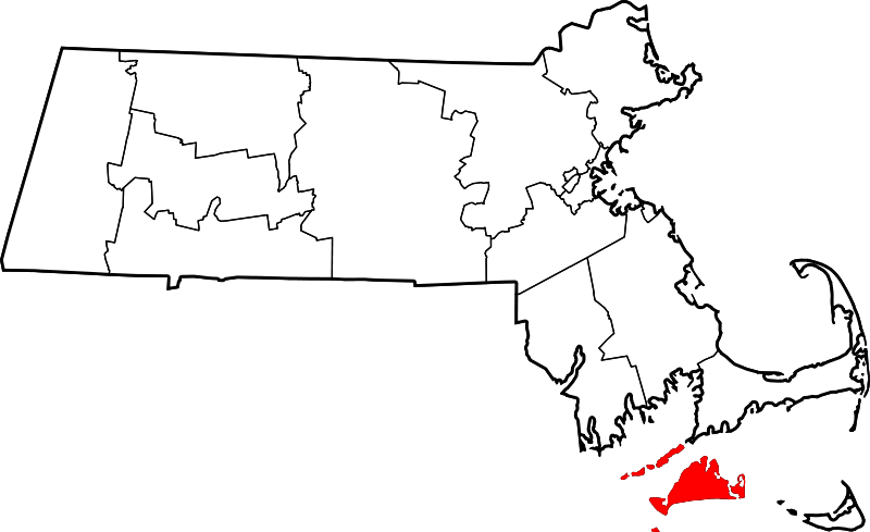
English: This is a locator map showing Dukes County in Massachusetts. For more information, see Commons:United States county locator maps. |
| Datum | |
| Bron |
Eigen werk: English: The maps use data from nationalatlas.gov, specifically countyp020.tar.gz on the Raw Data Download page. The maps also use state outline data from statesp020.tar.gz. The Florida maps use hydrogm020.tar.gz to display Lake Okeechobee. |
| Auteur | David Benbennick |
Licentie
| Ik, de auteursrechthebbende van dit werk, geef dit werk vrij in het publieke domein. Dit is wereldwijd van toepassing. In sommige landen is dit wettelijk niet mogelijk; in die gevallen geldt: Ik sta iedereen toe dit werk voor eender welk doel te gebruiken, zonder enige voorwaarden, tenzij zulke voorwaarden door de wet worden voorgeschreven. |
Bestandsgeschiedenis
Klik op een datum/tijd om het bestand te zien zoals het destijds was.
| Datum/tijd | Miniatuur | Afmetingen | Gebruiker | Opmerking | |
|---|---|---|---|---|---|
| huidige versie | 12 feb 2006 14:49 | | 2.976 × 1.819 (43 kB) | David Benbennick | {{subst:User:Dbenbenn/clm|county=Dukes County|state=Massachusetts|type=county}} |
Bestandsgebruik
Dit bestand wordt op de volgende 2 pagina's gebruikt:
Globaal bestandsgebruik
De volgende andere wiki's gebruiken dit bestand:
- Gebruikt op ar.wikipedia.org
- Gebruikt op bg.wikipedia.org
- Gebruikt op bpy.wikipedia.org
- Gebruikt op ca.wikipedia.org
- Gebruikt op cdo.wikipedia.org
- Gebruikt op ceb.wikipedia.org
- Gebruikt op ce.wikipedia.org
- Gebruikt op cy.wikipedia.org
- Gebruikt op da.wikipedia.org
- Gebruikt op de.wikipedia.org
- Dukes County
- Cape Poge Light
- Cape Poge Wildlife Refuge
- Long Point Wildlife Refuge
- Menemsha Hills
- Mytoi
- Vorlage:Navigationsleiste Schutzgebiete der Trustees of Reservations im Dukes County
- Norton Point Beach
- Wasque
- Liste der Einträge im National Register of Historic Places im Dukes County
- Vorlage:Navigationsleiste Orte im Dukes County
- Gebruikt op en.wikipedia.org
- Dukes County, Massachusetts
- List of counties in Massachusetts
- Aquinnah, Massachusetts
- Chilmark, Massachusetts
- Edgartown, Massachusetts
- Gosnold, Massachusetts
- Oak Bluffs, Massachusetts
- Tisbury, Massachusetts
- Vineyard Haven, Massachusetts
- West Tisbury, Massachusetts
- Dukes County, Province of New York
- Makonikey
- Cuttyhunk Island
Globaal gebruik van dit bestand bekijken.