Bestand:Map of La Guajira municipalities.png
Grootte van deze voorvertoning: 712 × 599 pixels. Andere resoluties: 285 × 240 pixels | 570 × 480 pixels | 912 × 768 pixels | 1.216 × 1.024 pixels | 2.018 × 1.699 pixels.
Oorspronkelijk bestand (2.018 × 1.699 pixels, bestandsgrootte: 589 kB, MIME-type: image/png)
| Dit is een bestand van Wikimedia Commons. Onderstaande beschrijving komt van de beschrijving van het bestand daar. |
Beschrijving
| Beschrijving |
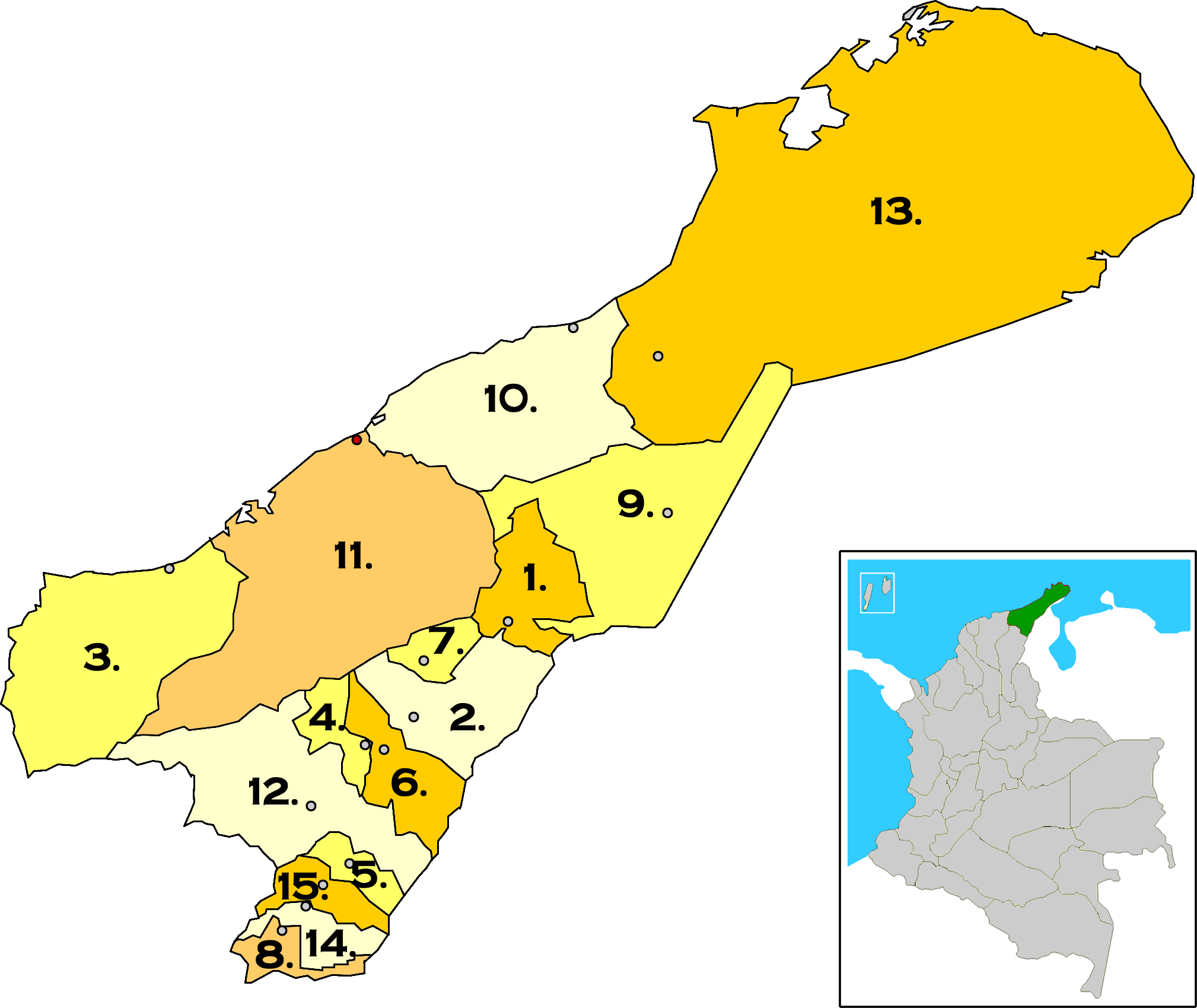
Map of La Guajira municipalities, Colombia. |
| Datum | |
| Bron | Eigen werk |
| Auteur | F3rn4nd0 |
Licentie
Ik, de auteursrechthebbende van dit werk, maak het hierbij onder de volgende licenties beschikbaar:

|
Toestemming wordt verleend voor het kopiëren, verspreiden en/of wijzigen van dit document onder de voorwaarden van de GNU-licentie voor vrije documentatie, versie 1.2 of enige latere versie als gepubliceerd door de Free Software Foundation; zonder Invariant Sections, zonder Front-Cover Texts, en zonder Back-Cover Texts. Een kopie van de licentie is opgenomen in de sectie GNU-licentie voor vrije documentatie. |
Dit bestand is gelicenseerd onder de Creative Commons-licentie Naamsvermelding 3.0 Unported
- De gebruiker mag:
- Delen – het werk kopiëren, verspreiden en doorgeven
- Remixen – afgeleide werken maken
- Onder de volgende voorwaarden:
- naamsvermelding – U moet op een gepaste manier aan naamsvermelding doen, een link naar de licentie geven, en aangeven of er wijzigingen in het werk zijn aangebracht. U mag dit op elke redelijke manier doen, maar niet zodanig dat de indruk wordt gewekt dat de licentiegever instemt met uw werk of uw gebruik van zijn werk.
U mag zelf één van de licenties kiezen.
Bestandsgeschiedenis
Klik op een datum/tijd om het bestand te zien zoals het destijds was.
| Datum/tijd | Miniatuur | Afmetingen | Gebruiker | Opmerking | |
|---|---|---|---|---|---|
| huidige versie | 3 apr 2008 17:32 | | 2.018 × 1.699 (589 kB) | F3rn4nd0 | {{Information |Description=Map of La Guajira municipalities, Colombia 1. Albania<br> 2. Barrancas<br> 3. Dibulla<br> 4. Distracción<br> 5. El Molino<br> 6. Fonseca<br> 7. Hatonuevo<br> 8. La Jagua del Pilar<br> 9. Maicao<br> 10. Manaure<br> 11. Riohacha |
Bestandsgebruik
Dit bestand wordt op de volgende pagina gebruikt:
Globaal bestandsgebruik
De volgende andere wiki's gebruiken dit bestand:
- Gebruikt op en.wikipedia.org
- Gebruikt op hr.wikipedia.org
- Gebruikt op ja.wikipedia.org
- Gebruikt op ms.wikipedia.org
- Gebruikt op pap.wikipedia.org
- Gebruikt op qu.wikipedia.org
- Gebruikt op ru.wikipedia.org
- Gebruikt op simple.wikipedia.org
- Gebruikt op uk.wikipedia.org