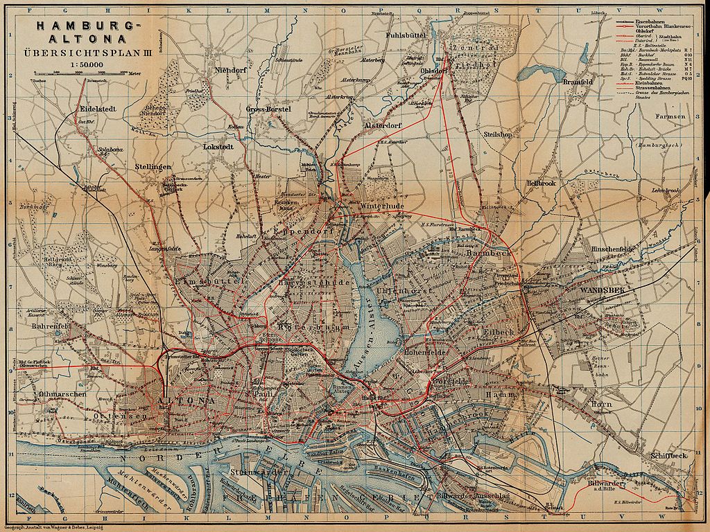
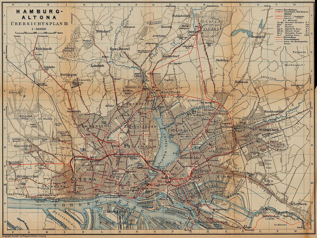
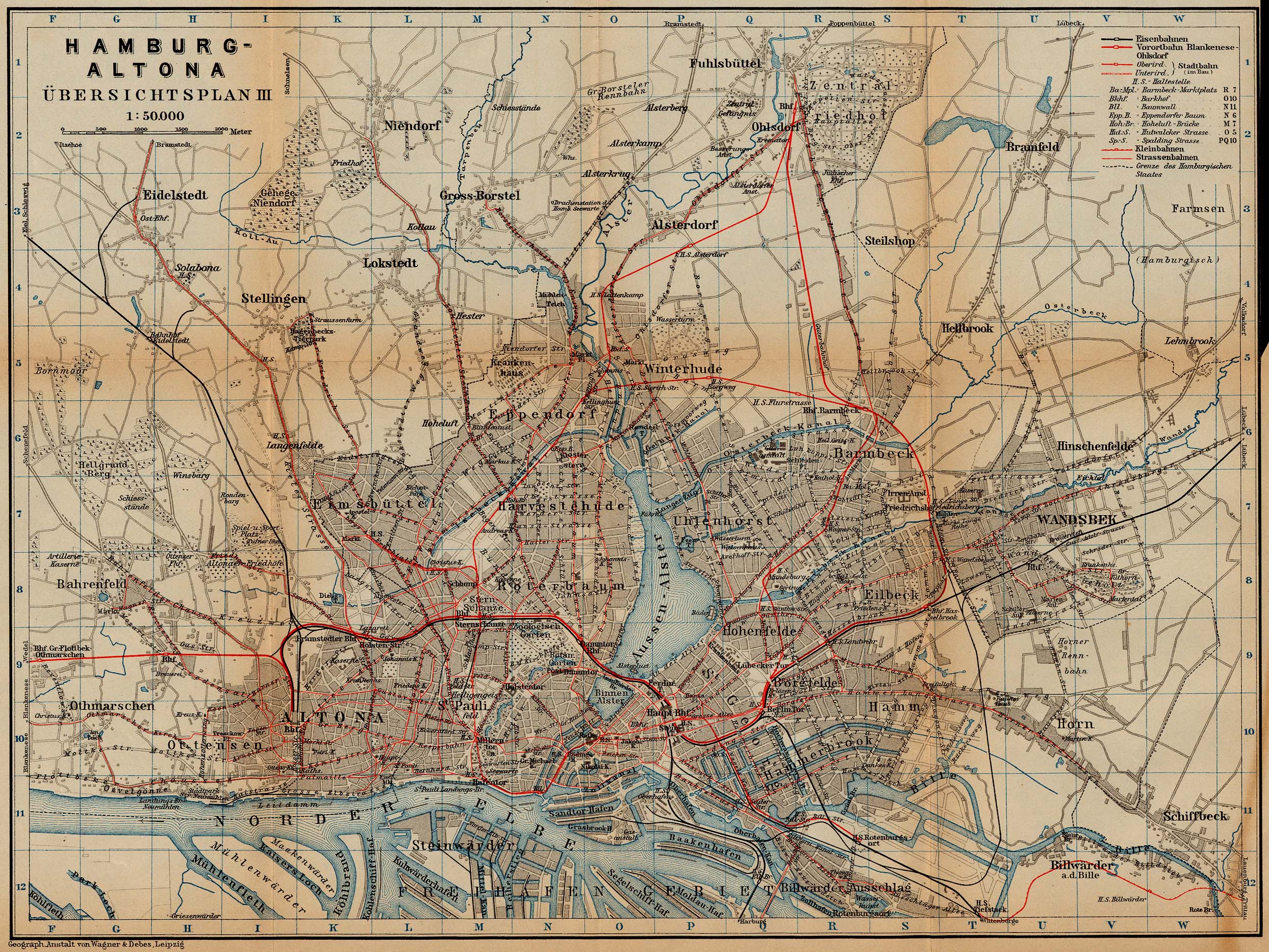
Bestand:Map hamburg rail 1910.jpg

Oorspronkelijk bestand (2.488 × 1.867 pixels, bestandsgrootte: 1,29 MB, MIME-type: image/jpeg)
| Dit is een bestand van Wikimedia Commons. Onderstaande beschrijving komt van de beschrijving van het bestand daar. |
Beschrijving
| Beschrijving | Railway and tramway map of Hamburg and Altona, about 1910 |
| Datum | |
| Bron | http://www.lib.utexas.edu/maps/historical/baedeker_n_germany_1910/hamburg_rail_1910.jpg |
| Auteur | "Northern Germany as far as the Bavarian and Austrian Frontiers; Handbook for Travellers" by Karl Baedeker. Fifteenth Revised Edition. Leipzig, Karl Baedeker; New York, Charles Scribner's Sons 1910. |
| Toestemming (Hergebruik van dit bestand) |
"Courtesy of the University of Texas Libraries, The University of Texas at Austin." http://www.lib.utexas.edu/maps/map_sites/hist_sites.html |
Licentie
|
Dit werk bevindt zich in het publiek domein in landen en gebieden waar de auteursrechttermijn het leven van de auteur plus 70 jaar of minder is.
| |
| Van dit bestand is vastgesteld dat er geen bekende auteursrechtaanspraken op rusten, alle aanverwante en naburige rechten daarbij inbegrepen. | |
Bestandsgeschiedenis
Klik op een datum/tijd om het bestand te zien zoals het destijds was.
| Datum/tijd | Miniatuur | Afmetingen | Gebruiker | Opmerking | |
|---|---|---|---|---|---|
| huidige versie | 23 apr 2006 02:41 | | 2.488 × 1.867 (1,29 MB) | 700 MB | {{Information| |Description=Hamburg and Altona (railway and tramway map) |Source=http://www.lib.utexas.edu/maps/historical/baedeker_n_germany_1910/hamburg_rail_1910.jpg |Date=1910 |Author="Northern Germany as far as the Bavarian and Austrian Frontiers; H |
Bestandsgebruik
Dit bestand wordt op de volgende pagina gebruikt:
Globaal bestandsgebruik
De volgende andere wiki's gebruiken dit bestand:
- Gebruikt op de.wikipedia.org
- Gebruikt op en.wikipedia.org
- Gebruikt op ja.wikipedia.org
- Gebruikt op ru.wikipedia.org