Bestand:Map Transsib Railway 1897.png
Oorspronkelijk bestand (2.223 × 1.113 pixels, bestandsgrootte: 717 kB, MIME-type: image/png)
Onderstaande beschrijving komt van de beschrijving van het bestand daar.
Beschrijving
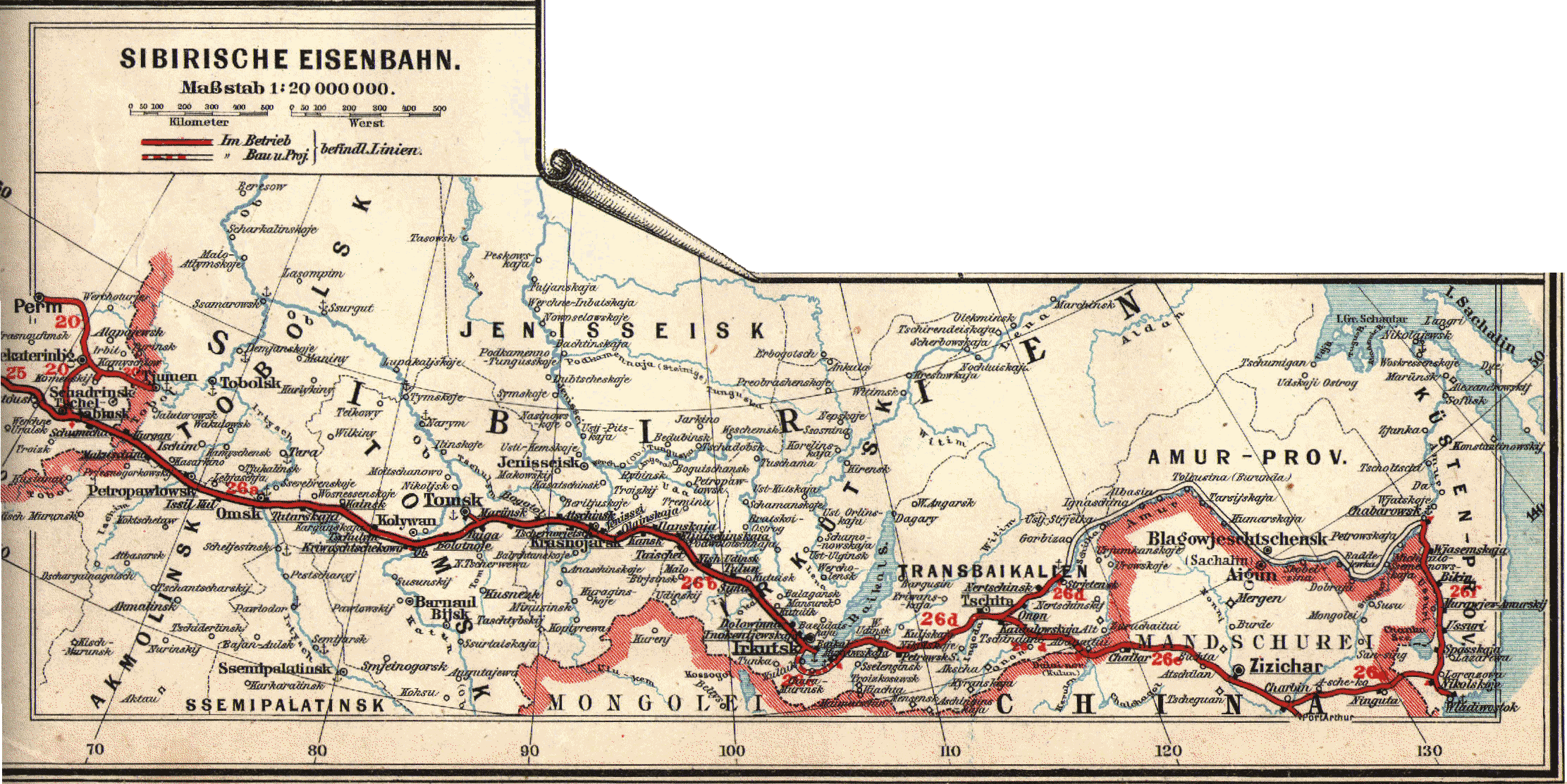
| Beschrijving | Historical map of the Transsiberian Railway |
| Datum | |
| Bron | Eisenbahn- und Verkehrsatlas von Europa |
| Auteur | Der geographischen Anstalt von J.J. Arnd in Leipzig |
| Toestemming (Hergebruik van dit bestand) |
PD - the company does not exist any more |
| Andere versies |
Licentie
|
Dit werk bevindt zich in het publiek domein in landen en gebieden waar de auteursrechttermijn het leven van de auteur plus 70 jaar of minder is.
| |
| Van dit bestand is vastgesteld dat er geen bekende auteursrechtaanspraken op rusten, alle aanverwante en naburige rechten daarbij inbegrepen. | |
Bestandsgeschiedenis
Klik op een datum/tijd om het bestand te zien zoals het destijds was.
| Datum/tijd | Miniatuur | Afmetingen | Gebruiker | Opmerking | |
|---|---|---|---|---|---|
| huidige versie | 22 feb 2007 20:31 | | 2.223 × 1.113 (717 kB) | BjørnN | |
| 22 feb 2007 19:50 |  | 2.340 × 1.652 (727 kB) | BjørnN | {{Information |Description=Historical map of the Transsiberian Railway |Source=Eisenbahn- und Verkehrsatlas von Europa |Date=1897 |Author=Der geographischen Anstalt von J.J. Arnd in Leipzig |Permission=PD - the company does not exist any more |other_versi |
Bestandsgebruik
Dit bestand wordt op de volgende pagina gebruikt:
Globaal bestandsgebruik
De volgende andere wiki's gebruiken dit bestand:
- Gebruikt op de.wikipedia.org
- Gebruikt op fi.wikipedia.org
- Gebruikt op ja.wikipedia.org
- Gebruikt op nds.wikipedia.org
- Gebruikt op no.wikipedia.org