Bestand:MaharashtraNandurbar.png
Grootte van deze voorvertoning: 778 × 600 pixels. Andere resoluties: 312 × 240 pixels | 623 × 480 pixels | 997 × 768 pixels | 1.280 × 987 pixels | 2.168 × 1.671 pixels.
Oorspronkelijk bestand (2.168 × 1.671 pixels, bestandsgrootte: 427 kB, MIME-type: image/png)
| Dit is een bestand van Wikimedia Commons. Onderstaande beschrijving komt van de beschrijving van het bestand daar. |
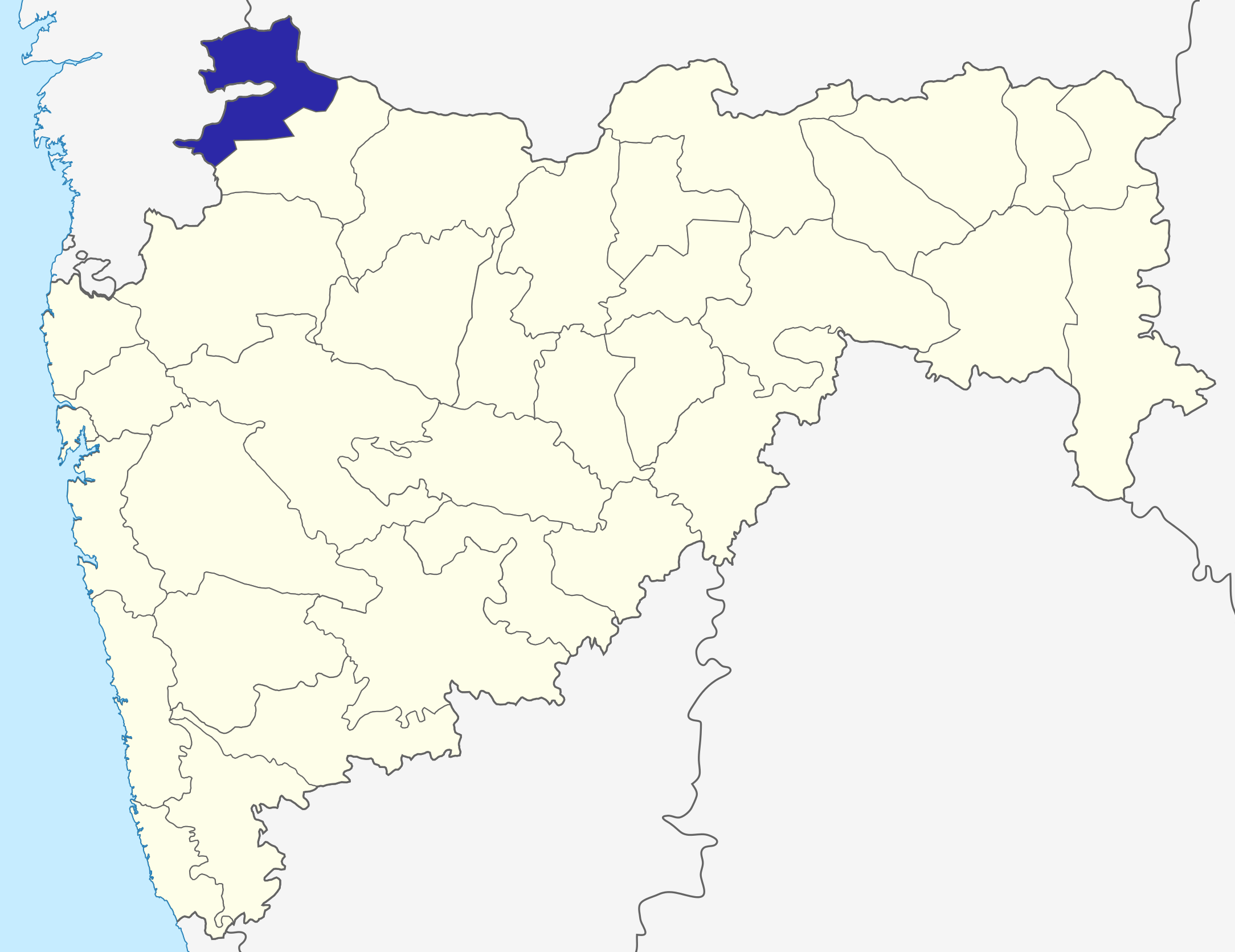
| Beschrijving | Nandurbar district in Maharashtra |
| Datum | (UTC) |
| Bron | |
| Auteur |
|
| Dit is een geretoucheerde foto, wat betekent dat de originele versie digitaal aangepast is. Het origineel kan hier bekeken worden: Maharashtra locator map.svg.
|
Ik, de auteursrechthebbende van dit werk, maak het hierbij onder de volgende licentie beschikbaar:
Dit bestand is gelicenseerd onder de Creative Commons-licentie Naamsvermelding-Gelijk delen 3.0 Unported
- De gebruiker mag:
- Delen – het werk kopiëren, verspreiden en doorgeven
- Remixen – afgeleide werken maken
- Onder de volgende voorwaarden:
- naamsvermelding – U moet op een gepaste manier aan naamsvermelding doen, een link naar de licentie geven, en aangeven of er wijzigingen in het werk zijn aangebracht. U mag dit op elke redelijke manier doen, maar niet zodanig dat de indruk wordt gewekt dat de licentiegever instemt met uw werk of uw gebruik van zijn werk.
- Gelijk delen – Als u het werk heeft geremixt, veranderd, of erop heeft voortgebouwd, moet u het gewijzigde materiaal verspreiden onder dezelfde licentie als het oorspronkelijke werk, of een daarmee compatibele licentie.
Oorspronkelijk uploadlogboek
This image is a derivative work of the following images:
- File:Maharashtra_locator_map.svg licensed with Cc-by-sa-3.0
- 2008-12-21T12:11:22Z PlaneMad 2789x2232 (365545 Bytes) {{Information |Description= |Source= |Date= |Author= |Permission= |other_versions= }}
- 2008-12-21T12:08:04Z PlaneMad 2789x2232 (365091 Bytes) {{Information |Description={{en|1=map}} |Source=Own work by uploader |Author=[[User:PlaneMad|PlaneMad]] |Date= |Permission= |other_versions= }}
Uploaded with derivativeFX
Bestandsgeschiedenis
Klik op een datum/tijd om het bestand te zien zoals het destijds was.
| Datum/tijd | Miniatuur | Afmetingen | Gebruiker | Opmerking | |
|---|---|---|---|---|---|
| huidige versie | 6 okt 2015 08:53 | | 2.168 × 1.671 (427 kB) | Abhijitsathe | State map updated to reflect new Palghar district |
| 22 sep 2009 02:23 |  | 2.789 × 2.232 (956 kB) | Abhijitsathe | India map inset | |
| 10 apr 2009 18:25 |  | 2.789 × 2.232 (795 kB) | Abhijitsathe | {{Information |Description=Nandurbar district in Maharashtra |Source=*File:Maharashtra_locator_map.svg |Date=2009-04-10 17:24 (UTC) |Author=*File:Maharashtra_locator_map.svg: '''PlaneMad''' *derivative work: ~~~ |Permission=see below |other_ve |
Bestandsgebruik
Geen enkele pagina gebruikt dit bestand.