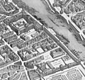
Bestand:Louvre and Tuileries palaces on the map of Turgot 1739 - Kyoto U.jpg

Grootte van deze voorvertoning: 639 × 600 pixels. Andere resoluties: 256 × 240 pixels | 511 × 480 pixels | 818 × 768 pixels | 1.091 × 1.024 pixels | 2.344 × 2.200 pixels.
Oorspronkelijk bestand (2.344 × 2.200 pixels, bestandsgrootte: 2,1 MB, MIME-type: image/jpeg)
Bestandsgeschiedenis
Klik op een datum/tijd om het bestand te zien zoals het destijds was.
| Datum/tijd | Miniatuur | Afmetingen | Gebruiker | Opmerking | |
|---|---|---|---|---|---|
| huidige versie | 28 feb 2014 11:07 |  | 2.344 × 2.200 (2,1 MB) | Robert.Allen | {{Information |Description ={{en|1=The en:Tuileries Palace and the en:Louvre on the 1739 en:Turgot map of Paris}} |Source ={{Derived from|Turgot map Paris KU 11.jpg|Turgot map Paris KU 15.jpg}} |Author =Louis Bretez... |
Bestandsgebruik
Dit bestand wordt op de volgende pagina gebruikt:
Globaal bestandsgebruik
De volgende andere wiki's gebruiken dit bestand:
- Gebruikt op cs.wikipedia.org
- Gebruikt op de.wikipedia.org
- Gebruikt op en.wikipedia.org
- Gebruikt op fr.wikipedia.org
- Gebruikt op sl.wikipedia.org
- Gebruikt op sr.wikipedia.org