Bestand:Locator map of Arrondissement Toul 2019.png

Grootte van deze voorvertoning: 800 × 590 pixels. Andere resoluties: 320 × 236 pixels | 640 × 472 pixels | 1.024 × 755 pixels | 1.280 × 944 pixels | 2.500 × 1.843 pixels.
Oorspronkelijk bestand (2.500 × 1.843 pixels, bestandsgrootte: 1,64 MB, MIME-type: image/png)
| Dit is een bestand van Wikimedia Commons. Onderstaande beschrijving komt van de beschrijving van het bestand daar. |
Beschrijving
| Beschrijving |
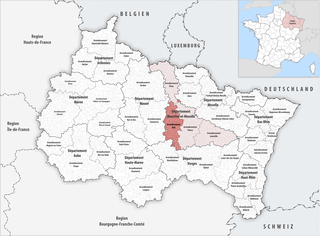
Deutsch: Lage des Arrondissements Toul |
||||||||
| Datum | |||||||||
| Bron | Eigen werk | ||||||||
| Auteur | Tschubby | ||||||||
| Toestemming (Hergebruik van dit bestand) |
Ik, de auteursrechthebbende van dit werk, maak het hierbij onder de volgende licenties beschikbaar:
Dit bestand is gelicenseerd onder de Creative Commons-licenties Naamsvermelding-Gelijk delen 2.5 Algemeen, 2.0 Algemeen en 1.0 Algemeen.
U mag zelf één van de licenties kiezen. |

Bestandsgeschiedenis
Klik op een datum/tijd om het bestand te zien zoals het destijds was.
| Datum/tijd | Miniatuur | Afmetingen | Gebruiker | Opmerking | |
|---|---|---|---|---|---|
| huidige versie | 5 okt 2019 18:27 | | 2.500 × 1.843 (1,64 MB) | Tschubby | {{Information |description= |date= |source= |author= |permission= |other versions= }} |
| 21 mei 2019 08:33 |  | 2.500 × 1.843 (1,64 MB) | Tschubby | {{Information |Description= {{de|Lage des Arrondissements Toul}} |Source={{own}} |Date= 2019-01-01 |Author= Tschubby |Permission= {{self|GFDL|Cc-by-sa-3.0-migrated|Cc-by-sa-2.5,2.0,1.0}} |other_versions= }} Toul Category:Arrondissement Toul |
Bestandsgebruik
Dit bestand wordt op de volgende pagina gebruikt:
Globaal bestandsgebruik
De volgende andere wiki's gebruiken dit bestand:
- Gebruikt op br.wikipedia.org
- Gebruikt op ca.wikipedia.org
- Gebruikt op diq.wikipedia.org
- Gebruikt op en.wikipedia.org
- Gebruikt op es.wikipedia.org
- Gebruikt op frr.wikipedia.org
- Gebruikt op fr.wikipedia.org
- Gebruikt op simple.wikipedia.org
- Gebruikt op tr.wikipedia.org
- Gebruikt op tt.wikipedia.org
- Gebruikt op uk.wikipedia.org
- Gebruikt op vi.wikipedia.org
- Gebruikt op www.wikidata.org
- Gebruikt op zh.wikipedia.org