Bestand:Location map Taifa of Zaragoza.svg

Afmetingen van deze voorvertoning van het type PNG van dit SVG-bestand: 711 × 599 pixels Andere resoluties: 285 × 240 pixels | 569 × 480 pixels | 911 × 768 pixels | 1.215 × 1.024 pixels | 2.429 × 2.048 pixels | 714 × 602 pixels.
Oorspronkelijk bestand (SVG-bestand, nominaal 714 × 602 pixels, bestandsgrootte: 216 kB)
| Dit is een bestand van Wikimedia Commons. Onderstaande beschrijving komt van de beschrijving van het bestand daar. |
| Beschrijving |
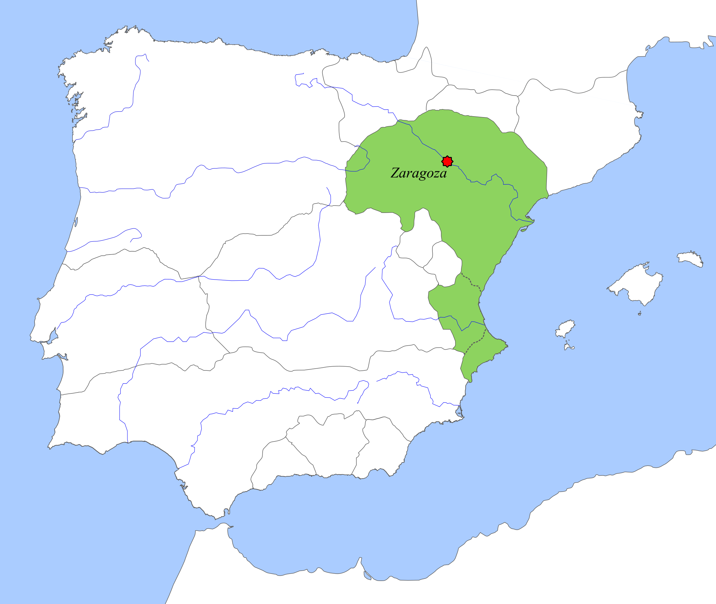
English: Taifa Kingdom of Zaragoza circa 1080, location map. |
||||||||
| Datum | |||||||||
| Bron | Eigen werk | ||||||||
| Auteur | Tyk | ||||||||
| Toestemming (Hergebruik van dit bestand) |
|

Bestandsgeschiedenis
Klik op een datum/tijd om het bestand te zien zoals het destijds was.
| Datum/tijd | Miniatuur | Afmetingen | Gebruiker | Opmerking | |
|---|---|---|---|---|---|
| huidige versie | 6 okt 2018 18:51 | | 714 × 602 (216 kB) | Tyk | Removing frames, etc |
| 10 dec 2008 22:55 |  | 694 × 541 (321 kB) | Tyk | {{Information |Description={{en|1=Taifa Kingdom of Zaragoza circa 1080, location map.}} |Source=Own work by uploader |Author=Té y kriptonita |Date=Dec 2008 |Permission={{GFDL}} |other_versions= }} <!--{{ImageUpload|full}}--> [[ |
Bestandsgebruik
Dit bestand wordt op de volgende pagina gebruikt:
Globaal bestandsgebruik
De volgende andere wiki's gebruiken dit bestand:
- Gebruikt op an.wikipedia.org
- Gebruikt op ar.wikipedia.org
- Gebruikt op br.wikipedia.org
- Gebruikt op ca.wikipedia.org
- Gebruikt op de.wikipedia.org
- Gebruikt op el.wikipedia.org
- Gebruikt op en.wikipedia.org
- Gebruikt op es.wikipedia.org
- Gebruikt op eu.wikipedia.org
- Gebruikt op fr.wikipedia.org
- Gebruikt op it.wikipedia.org
- Gebruikt op ja.wikipedia.org
- Gebruikt op la.wikipedia.org
- Gebruikt op ru.wikipedia.org
- Gebruikt op sh.wikipedia.org
- Gebruikt op uk.wikipedia.org
- Gebruikt op www.wikidata.org
- Gebruikt op zh.wikipedia.org