Bestand:Italia 1796-es.svg

Afmetingen van deze voorvertoning van het type PNG van dit SVG-bestand: 500 × 600 pixels Andere resoluties: 200 × 240 pixels | 400 × 480 pixels | 640 × 768 pixels | 853 × 1.024 pixels | 1.707 × 2.048 pixels | 3.500 × 4.200 pixels.
Oorspronkelijk bestand (SVG-bestand, nominaal 3.500 × 4.200 pixels, bestandsgrootte: 1,13 MB)
| Dit is een bestand van Wikimedia Commons. Onderstaande beschrijving komt van de beschrijving van het bestand daar. |
Beschrijving
| Beschrijving |
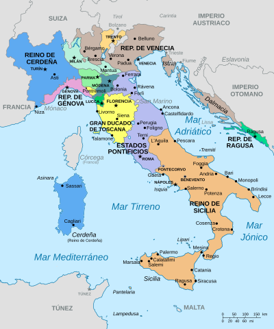
English: Map of Italy on 1796.
Español: Mapa de Italia en 1796.
Italiano: Mappa dell'Italia nel 1796.
Français : Carte de l'Italie vers 1796. |
| Datum | |
| Bron |
Eigen werk based on: |
| Auteur | Milenioscuro |
| Andere versies |
[]
|


Licentie
Ik, de auteursrechthebbende van dit werk, maak het hierbij onder de volgende licentie beschikbaar:
Dit bestand is gelicenseerd onder de Creative Commons-licentie Naamsvermelding-Gelijk delen 3.0 Unported
- De gebruiker mag:
- Delen – het werk kopiëren, verspreiden en doorgeven
- Remixen – afgeleide werken maken
- Onder de volgende voorwaarden:
- naamsvermelding – U moet op een gepaste manier aan naamsvermelding doen, een link naar de licentie geven, en aangeven of er wijzigingen in het werk zijn aangebracht. U mag dit op elke redelijke manier doen, maar niet zodanig dat de indruk wordt gewekt dat de licentiegever instemt met uw werk of uw gebruik van zijn werk.
- Gelijk delen – Als u het werk heeft geremixt, veranderd, of erop heeft voortgebouwd, moet u het gewijzigde materiaal verspreiden onder dezelfde licentie als het oorspronkelijke werk, of een daarmee compatibele licentie.
Bestandsgeschiedenis
Klik op een datum/tijd om het bestand te zien zoals het destijds was.
| Datum/tijd | Miniatuur | Afmetingen | Gebruiker | Opmerking | |
|---|---|---|---|---|---|
| huidige versie | 15 apr 2021 19:25 | | 3.500 × 4.200 (1,13 MB) | Rowanwindwhistler | Isquia, Mesina, Regio. Fake text added |
| 23 feb 2016 20:52 |  | 3.500 × 4.200 (903 kB) | Rowanwindwhistler | Colours from https://en.wikipedia.org/wiki/Wikipedia:WikiProject_Maps/Conventions Génova, Pantelaria, Milán, Padua, Crotona, Túnez, Rávena, Bérgamo... | |
| 5 jul 2012 23:57 |  | 3.500 × 4.200 (903 kB) | Milenioscuro | napoli->nápoles, carinzia->carintia | |
| 16 jun 2012 01:35 |  | 3.500 × 4.200 (902 kB) | Milenioscuro | {{Information |Description ={{en|1=Map of Italy on 1796.}} {{es|1=Mapa de Italia en 1796.}} {{it|1=Mappa dell'Italia nel 1796.}} {{fr|1=Carte de l'Italie vers 1796.}} |Source ={{own}} based on: |Author =[[User:Shadowxfox|Shadowxfox]... |
Bestandsgebruik
Dit bestand wordt op de volgende 2 pagina's gebruikt:
Globaal bestandsgebruik
De volgende andere wiki's gebruiken dit bestand:
- Gebruikt op af.wikipedia.org
- Gebruikt op ast.wikipedia.org
- Gebruikt op ba.wikipedia.org
- Gebruikt op br.wikipedia.org
- Gebruikt op en.wikipedia.org
- Gebruikt op es.wikipedia.org
- Historia de Italia
- Estados Pontificios
- Niza
- Saboya
- Unificación italiana
- Ducado de Parma
- Ducado de Saboya
- Ducado de Módena
- Anexo:Antiguos Estados de Italia
- Tratado de San Ildefonso (1800)
- Tratado de Tolentino (1797)
- Reino de Cerdeña
- Cuestión Adriática
- Italia española
- Historia territorial de Italia
- Ilustración política en Italia
- Campañas italianas de las guerras revolucionarias francesas
- Wikiproyecto:Ilustración/Taller de Cartografía/Solicitudes/Archivo2
- Historia de Saboya de 1792 a 1815
- Reino de Cerdeña (1720-1861)
- Gebruikt op eu.wikipedia.org
- Gebruikt op fr.wikipedia.org
- Gebruikt op hu.wikipedia.org
- Gebruikt op ja.wikipedia.org
- Gebruikt op ko.wikipedia.org
- Gebruikt op pl.wikipedia.org
- Gebruikt op pt.wikipedia.org
- Gebruikt op ru.wikipedia.org
- Gebruikt op zh.wikipedia.org