Bestand:Israel outline north negev.png

Grootte van deze voorvertoning: 800 × 389 pixels. Andere resoluties: 320 × 156 pixels | 640 × 311 pixels | 1.471 × 715 pixels.
Oorspronkelijk bestand (1.471 × 715 pixels, bestandsgrootte: 135 kB, MIME-type: image/png)
Dit is een bestand van Wikimedia Commons.
Onderstaande beschrijving komt van de beschrijving van het bestand daar.
Onderstaande beschrijving komt van de beschrijving van het bestand daar.
Beschrijving
| Beschrijving |
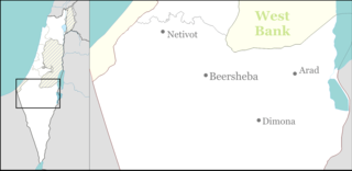
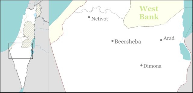
English: Large part of the Negev Desert for Israeli location maps. |
| Datum | |
| Bron | Eigen werk |
| Auteur | Ynhockey |
Licentie
Ik, de auteursrechthebbende van dit werk, maak het hierbij onder de volgende licenties beschikbaar:
Dit bestand is gelicenseerd onder de Creative Commons-licentie Naamsvermelding-Gelijk delen 3.0 Unported
- De gebruiker mag:
- Delen – het werk kopiëren, verspreiden en doorgeven
- Remixen – afgeleide werken maken
- Onder de volgende voorwaarden:
- naamsvermelding – U moet op een gepaste manier aan naamsvermelding doen, een link naar de licentie geven, en aangeven of er wijzigingen in het werk zijn aangebracht. U mag dit op elke redelijke manier doen, maar niet zodanig dat de indruk wordt gewekt dat de licentiegever instemt met uw werk of uw gebruik van zijn werk.
- Gelijk delen – Als u het werk heeft geremixt, veranderd, of erop heeft voortgebouwd, moet u het gewijzigde materiaal verspreiden onder dezelfde licentie als het oorspronkelijke werk, of een daarmee compatibele licentie.

|
Toestemming wordt verleend voor het kopiëren, verspreiden en/of wijzigen van dit document onder de voorwaarden van de GNU-licentie voor vrije documentatie, versie 1.2 of enige latere versie als gepubliceerd door de Free Software Foundation; zonder Invariant Sections, zonder Front-Cover Texts, en zonder Back-Cover Texts. Een kopie van de licentie is opgenomen in de sectie GNU-licentie voor vrije documentatie. |
U mag zelf één van de licenties kiezen.
Bestandsgeschiedenis
Klik op een datum/tijd om het bestand te zien zoals het destijds was.
| Datum/tijd | Miniatuur | Afmetingen | Gebruiker | Opmerking | |
|---|---|---|---|---|---|
| huidige versie | 1 sep 2016 19:31 | | 1.471 × 715 (135 kB) | Number 57 | Updated Israel map |
| 3 mrt 2009 22:43 |  | 1.471 × 715 (40 kB) | Ynhockey | {{Information |Description={{en|1=Large part of the Negev Desert for Israeli location maps.}} |Source=Own work by uploader |Author=Ynhockey |Date=2009-03-03 |Permission= |other_versions= }} <!--{{ImageUpload|full}}--> [[Category:Maps of |
Bestandsgebruik
Dit bestand wordt op de volgende pagina gebruikt:
Globaal bestandsgebruik
De volgende andere wiki's gebruiken dit bestand:
- Gebruikt op ar.wikipedia.org
- Gebruikt op ceb.wikipedia.org
- Gebruikt op el.wikipedia.org
- Gebruikt op en.wikipedia.org
- Dimona
- Arad, Israel
- Beersheba
- Netivot
- Yeruham
- Hura
- Mashabei Sadeh
- Eshel HaNasi
- Meitar
- Drijat
- Lehavim
- Kuseife
- Omer, Israel
- Lakiya
- Shaqib al-Salam
- Ar'arat an-Naqab
- Tel Sheva
- Nitzanei Sinai
- Nevatim Airbase
- Hatzerim Airbase
- Nevatim
- Retamim
- Revivim
- Tlalim
- Merhav Am
- Ashalim
- Kmehin
- Abu Qrenat
- Bir Hadaj
- Har Amasa
- Umm Batin
- 2008 Dimona suicide bombing
- Neve Zohar
- Ein Tamar
- Neot HaKikar
- Ne'ot Hovav
- Al-Sayyid, Israel
- Makhul
- Mulada
- Qasr al-Sir
- Kramim
- Lahav
- Be'er Milka
- Ein Bokek
- Ma'ale Akrabim massacre
- Module:Location map/data/Israel north negev/doc
- Template:Infobox Israel village/testcases
Globaal gebruik van dit bestand bekijken.