Bestand:Io map regio labeled.jpg
Grootte van deze voorvertoning: 800 × 400 pixels. Andere resoluties: 320 × 160 pixels | 640 × 320 pixels | 1.024 × 512 pixels | 1.280 × 640 pixels | 2.560 × 1.280 pixels | 4.096 × 2.048 pixels.
Oorspronkelijk bestand (4.096 × 2.048 pixels, bestandsgrootte: 1,54 MB, MIME-type: image/jpeg)
| Dit is een bestand van Wikimedia Commons. Onderstaande beschrijving komt van de beschrijving van het bestand daar. |
Beschrijving
| Beschrijving |
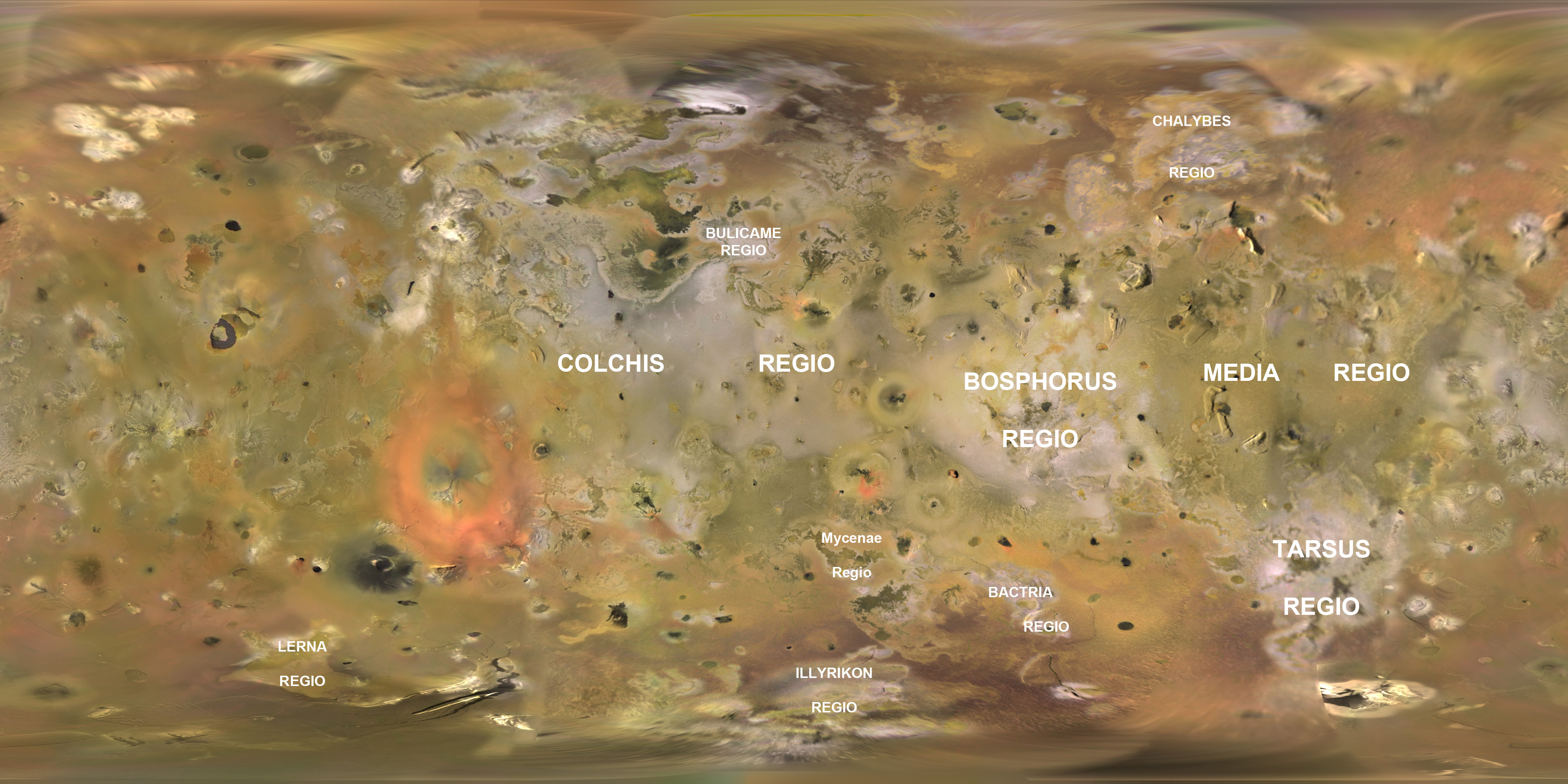
English: Base map of Jupiter's moon Io created from Voyager and Galileo imagery. Original map created by the USGS Astrogeology group in Flagstaff, Arizona. Labels for regions on Io added by Submitter. |
|||||
| Datum | ||||||
| Bron | https://astrogeology.usgs.gov/Projects/JupiterSatellites/io.html | |||||
| Auteur | NASA/JPL/USGS/Jason Perry | |||||
| Toestemming (Hergebruik van dit bestand) |
|
Licentie
| Dit bestand bevindt zich in het publiek domein, omdat het gemaakt is door de NASA. In de reproductierichtlijnen van de NASA staat dat "NASA-materiaal niet beschermd wordt door auteursrecht, tenzij anders vermeld". | ||
 |
Waarschuwingen:
|
Bestandsgeschiedenis
Klik op een datum/tijd om het bestand te zien zoals het destijds was.
| Datum/tijd | Miniatuur | Afmetingen | Gebruiker | Opmerking | |
|---|---|---|---|---|---|
| huidige versie | 2 feb 2010 23:13 | | 4.096 × 2.048 (1,54 MB) | Volcanopele | Corrected misspelling of Tarsus Regio |
| 27 jan 2010 23:03 |  | 4.096 × 2.048 (1,53 MB) | Volcanopele | Added missing Mycenae Regio | |
| 27 jan 2010 22:27 |  | 4.096 × 2.048 (1,53 MB) | Volcanopele | {{Information |Description={{en|1=Base map of Jupiter's moon Io created from Voyager and Galileo imagery. Original map created by the USGS Astrogeology group in Flagstaff, Arizona. Labels for regions on Io added by Submitter.}} |Source=http://astrogeolo |
Bestandsgebruik
Dit bestand wordt op de volgende pagina gebruikt:
Globaal bestandsgebruik
De volgende andere wiki's gebruiken dit bestand:
- Gebruikt op en.wikipedia.org
- Gebruikt op fr.wikipedia.org
- Gebruikt op ja.wikipedia.org
- Gebruikt op no.wikipedia.org
- Gebruikt op ro.wikipedia.org
- Gebruikt op zh.wikipedia.org