Bestand:India Arunachal Pradesh location map.svg

Afmetingen van deze voorvertoning van het type PNG van dit SVG-bestand: 800 × 394 pixels Andere resoluties: 320 × 158 pixels | 640 × 315 pixels | 1.024 × 504 pixels | 1.280 × 631 pixels | 2.560 × 1.261 pixels | 1.685 × 830 pixels.
Oorspronkelijk bestand (SVG-bestand, nominaal 1.685 × 830 pixels, bestandsgrootte: 531 kB)
| Dit is een bestand van Wikimedia Commons. Onderstaande beschrijving komt van de beschrijving van het bestand daar. |
| Beschrijving |
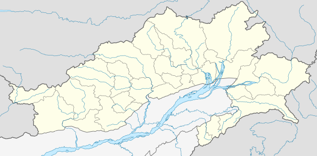
Location map of Arunachal Pradesh Geographic limits of the map:
|
| Datum | (UTC) |
| Bron | |
| Auteur |
|
| Andere versies | Afgeleide werken van dit bestand: India Arunachal Pradesh districts Assamese.svg |
Ik, de auteursrechthebbende van dit werk, maak het hierbij onder de volgende licentie beschikbaar:
Dit bestand is gelicenseerd onder de Creative Commons-licentie Naamsvermelding-Gelijk delen 3.0 Unported
- De gebruiker mag:
- Delen – het werk kopiëren, verspreiden en doorgeven
- Remixen – afgeleide werken maken
- Onder de volgende voorwaarden:
- naamsvermelding – U moet op een gepaste manier aan naamsvermelding doen, een link naar de licentie geven, en aangeven of er wijzigingen in het werk zijn aangebracht. U mag dit op elke redelijke manier doen, maar niet zodanig dat de indruk wordt gewekt dat de licentiegever instemt met uw werk of uw gebruik van zijn werk.
- Gelijk delen – Als u het werk heeft geremixt, veranderd, of erop heeft voortgebouwd, moet u het gewijzigde materiaal verspreiden onder dezelfde licentie als het oorspronkelijke werk, of een daarmee compatibele licentie.
Oorspronkelijk uploadlogboek
This image is a derivative work of the following images:
- File:Arunachal_Pradesh_locator_map.svg licensed with Cc-by-sa-3.0
Uploaded with derivativeFX
Bestandsgeschiedenis
Klik op een datum/tijd om het bestand te zien zoals het destijds was.
| Datum/tijd | Miniatuur | Afmetingen | Gebruiker | Opmerking | |
|---|---|---|---|---|---|
| huidige versie | 13 jun 2021 06:52 | | 1.685 × 830 (531 kB) | C1MM | Decreased size, added better dist boudnaries |
| 13 mrt 2021 09:56 |  | 1.845 × 1.046 (824 kB) | C1MM | Added river | |
| 13 mrt 2021 09:52 |  | 1.845 × 1.046 (820 kB) | C1MM | Corrected rivers and district boundaries | |
| 18 jan 2021 20:14 |  | 1.845 × 1.046 (360 kB) | C1MM | Changed weight of district boundaries | |
| 18 jan 2021 10:12 |  | 1.845 × 1.046 (358 kB) | C1MM | Fixed borders and corrected new district boundaries | |
| 2 aug 2020 20:37 |  | 1.456 × 800 (274 kB) | C1MM | Relayered | |
| 16 apr 2020 06:04 |  | 1.456 × 800 (309 kB) | C1MM | Updated borders | |
| 16 apr 2020 06:03 |  | 1.456 × 800 (309 kB) | C1MM | Corrected border sizing | |
| 16 apr 2020 05:58 |  | 1.456 × 800 (309 kB) | C1MM | Extended to include new lat/longitude | |
| 13 apr 2020 00:32 |  | 1.455 × 746 (276 kB) | C1MM | Corrected borders and added new districts |
Bestandsgebruik
Geen enkele pagina gebruikt dit bestand.
Globaal bestandsgebruik
De volgende andere wiki's gebruiken dit bestand:
- Gebruikt op anp.wikipedia.org
- Gebruikt op ar.wikipedia.org
- Gebruikt op as.wikipedia.org
- Gebruikt op azb.wikipedia.org
- Gebruikt op bh.wikipedia.org
- Gebruikt op bn.wikipedia.org
- ইটানগর
- অরুণাচল প্রদেশ
- জিরো
- আলং
- বাসার
- বোমডিলা
- চ্যাংলাং
- দপোরিজো
- দেওমালি
- জয়রামপুর
- খোনসা
- নাহারলাগুন
- নামসাই
- পাসিঘাট
- রইং
- সেপ্পা
- তওয়াং
- তেজু
- টেমপ্লেট:অবস্থান মানচিত্র ভারত অরুণাচল প্রদেশ
- ভালুকপুং
- জিরো বিমানবন্দর
- তেজু বিমানবন্দর
- পাসিঘাট বিমানবন্দর
- ইংকিয়ং
- অনিনি
- পালিন
- মিয়াও
- মেছুকা
- মডিউল:অবস্থান মানচিত্র/উপাত্ত/ভারত অরুণাচল প্রদেশ
Globaal gebruik van dit bestand bekijken.