Bestand:HueyCreekAntarctica2001.jpg

Grootte van deze voorvertoning: 800 × 600 pixels. Andere resoluties: 320 × 240 pixels | 640 × 480 pixels | 1.024 × 768 pixels | 1.280 × 960 pixels | 1.600 × 1.200 pixels.
Oorspronkelijk bestand (1.600 × 1.200 pixels, bestandsgrootte: 362 kB, MIME-type: image/jpeg)
| Dit is een bestand van Wikimedia Commons. Onderstaande beschrijving komt van de beschrijving van het bestand daar. |
Beschrijving
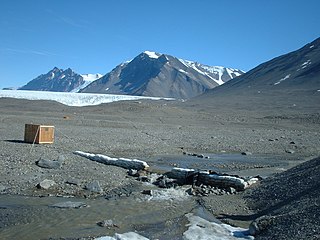
| Beschrijving | December 12, 2001 photo of the USGS streamflow-gaging station at Huey Creek, McMurdo Dry Valleys, Antarctica. |
| Datum | |
| Bron | USGS Surface Water Photo Gallery, item 10 10 |
| Auteur | Jerrod Wheeler (submitted to USGS by Kirk Miller, Wyoming) |
| Toestemming (Hergebruik van dit bestand) |
Public Domain |
Licentie
Deze afbeelding bevindt zich in het publiek domein omdat het materiaal bevat dat oorspronkelijk afkomstig is van de United States Geological Survey, een agentschap van de United States Department of the Interior. Voor meer informatie, zie het officiële USGS-auteursrechtenbeleid
|
Oorspronkelijk uploadlogboek
De oorspronkelijke beschrijving van deze afbeelding stond hier. Alle volgende gebruikersnamen verwijzen naar en.wikipedia.
- 2008-09-04 23:25 Suntag 1600×1200× (370489 bytes)
Bestandsgeschiedenis
Klik op een datum/tijd om het bestand te zien zoals het destijds was.
| Datum/tijd | Miniatuur | Afmetingen | Gebruiker | Opmerking | |
|---|---|---|---|---|---|
| huidige versie | 18 jan 2010 13:36 | | 1.600 × 1.200 (362 kB) | 4ing | {{Information |Description={{en|December 12, 2001 photo of the en:USGS streamflow-gaging [http://metacat.lternet.edu/knb/metacat?action=read&qformat=mcm&docid=knb-lter-mcm.9029 station] at en:Huey Creek, [[:en:McMurdo Dry |
Bestandsgebruik
Dit bestand wordt op de volgende 2 pagina's gebruikt:
Globaal bestandsgebruik
De volgende andere wiki's gebruiken dit bestand:
- Gebruikt op ar.wikipedia.org
- Gebruikt op ceb.wikipedia.org
- Gebruikt op cs.wikipedia.org
- Gebruikt op de.wikipedia.org
- Gebruikt op en.wikipedia.org
- Stream gauge
- Lake Hoare
- McKelvey Valley
- Shaw Trough
- Prospect Mesa
- Taylor Valley
- Williams Pond
- Andersen Creek
- Anderson Scarp
- Bohner Stream
- Mount Booth
- Butler Summit
- Canada Peak
- Cleft Ledge
- Clow Island
- Watanuki Pond
- Stepping Stone Pond
- Lake Joyce
- Kurasawa Pond
- Murray Pond
- Friis Hills
- Gupwell Pond
- Don Quixote Pond
- Doolittle Bluff
- Doran Stream
- Plane Table Glacier
- Penhale Peak
- Gurkha Peak
- Hall Bluff
- Lizotte Creek
- Linnaeus Terrace
- McKay Creek
- Mount McLennan (Victoria Land)
- Mount Hercules
- Matsumoto Pond
- Sanders Nunatak
- Mount Torii
- Lyons Creek (Antarctica)
- Vincent Creek
- Template:McMurdoDryValleys-geo-stub
- Gebruikt op es.wikipedia.org
- Gebruikt op lv.wikipedia.org
- Gebruikt op nn.wikipedia.org
Globaal gebruik van dit bestand bekijken.