Bestand:Honey Hill.jpg
Grootte van deze voorvertoning: 711 × 600 pixels. Andere resoluties: 285 × 240 pixels | 569 × 480 pixels | 910 × 768 pixels | 1.214 × 1.024 pixels | 1.338 × 1.129 pixels.
Oorspronkelijk bestand (1.338 × 1.129 pixels, bestandsgrootte: 299 kB, MIME-type: image/jpeg)
| Dit is een bestand van Wikimedia Commons. Onderstaande beschrijving komt van de beschrijving van het bestand daar. |
Beschrijving
| Beschrijving |
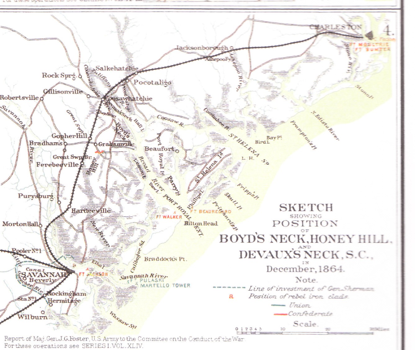
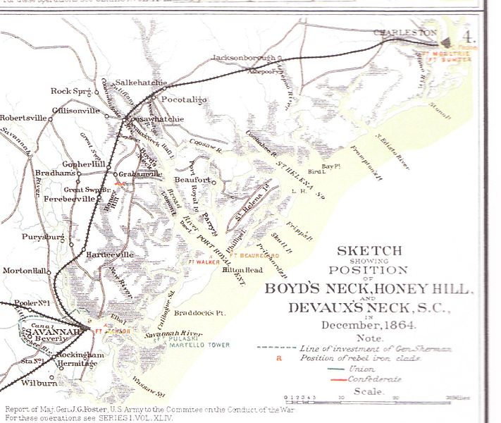
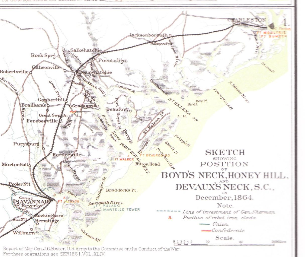
English: Sketch of the region where the Battle of Honey Hill took place |
| Bron | Military Atlas of the Civil War, Plate XCI, No. 3 |
| Auteur | Made for the report of Maj.Gen. John G. Foster, US Army, to the Commitee on the Conduct of the War |
Licentie
Deze afbeelding is een werk van een soldaat of werknemer van de U.S. Army, genomen of gemaakt tijdens de uitvoering van diens officiële taken. Als werk van de federale overheid van de Verenigde Staten bevindt deze afbeelding zich in het publiek domein.
|
 |
Bestandsgeschiedenis
Klik op een datum/tijd om het bestand te zien zoals het destijds was.
| Datum/tijd | Miniatuur | Afmetingen | Gebruiker | Opmerking | |
|---|---|---|---|---|---|
| huidige versie | 30 jul 2010 11:25 | | 1.338 × 1.129 (299 kB) | WBTS-Forum.de | (uploaded wrong image) |
| 30 jul 2010 11:23 |  | 2.480 × 3.507 (1,35 MB) | WBTS-Forum.de | {{Information |Description={{en|1=Sketch of the region where the Battle of Honey Hill took place}} |Source=Military Atlas of the Civil War, Plate XCI, No. 3 |Author=Made for the report of Maj.Gen. John G. Foster, US Army, to the Commitee on the Conduct of |
Bestandsgebruik
Dit bestand wordt op de volgende pagina gebruikt:
Globaal bestandsgebruik
De volgende andere wiki's gebruiken dit bestand:
- Gebruikt op da.wikipedia.org
- Gebruikt op de.wikipedia.org
- Gebruikt op en.wikipedia.org
- Gebruikt op en.wikivoyage.org
- Gebruikt op es.wikipedia.org
- Gebruikt op www.wikidata.org