Bestand:Hill 1897 Portrait.jpg
Geen hogere resolutie beschikbaar.
Hill_1897_Portrait.jpg (111 × 172 pixels, bestandsgrootte: 36 kB, MIME-type: image/jpeg)
| Dit is een bestand van Wikimedia Commons. Onderstaande beschrijving komt van de beschrijving van het bestand daar. |
Beschrijving
| Beschrijving |
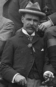
English: American geologist Robert T. Hill (1858-1941) at age 39. Cropped from a group photo taken at Jefferson Rock, Harpers Ferry, West Virginia. |
| Datum | |
| Bron | United States Geological Survey Photo Library, http://libraryphoto.cr.usgs.gov/ |
| Auteur | Joseph S. Diller (photographer) |
| Andere versies |
 |
| Cameralocatie | | Deze en andere afbeeldingen in: OpenStreetMap |
|---|
Licentie
Deze afbeelding bevindt zich in het publiek domein omdat het materiaal bevat dat oorspronkelijk afkomstig is van de United States Geological Survey, een agentschap van de United States Department of the Interior. Voor meer informatie, zie het officiële USGS-auteursrechtenbeleid
|
Bestandsgeschiedenis
Klik op een datum/tijd om het bestand te zien zoals het destijds was.
| Datum/tijd | Miniatuur | Afmetingen | Gebruiker | Opmerking | |
|---|---|---|---|---|---|
| huidige versie | 3 jan 2009 22:11 | | 111 × 172 (36 kB) | Leaflet | {{Information |Description={{en|1=Robert Thomas Hill at the GSA Meeting in Harpers Ferry, West Virginia, May 1897}} |Source=USGS Photo Library, http://libraryphoto.cr.usgs.gov/ |Author=J.S. Diller |Date=1897 |Permission= |other_versions= }} <!--{{ImageUp |
Bestandsgebruik
Dit bestand wordt op de volgende pagina gebruikt:
Globaal bestandsgebruik
De volgende andere wiki's gebruiken dit bestand:
- Gebruikt op azb.wikipedia.org
- Gebruikt op en.wikipedia.org
- Gebruikt op en.wikisource.org
- Gebruikt op ro.wikipedia.org
- Gebruikt op www.wikidata.org