Bestand:Hawaii Island topographic map-en.svg

Afmetingen van deze voorvertoning van het type PNG van dit SVG-bestand: 728 × 600 pixels Andere resoluties: 291 × 240 pixels | 583 × 480 pixels | 932 × 768 pixels | 1.243 × 1.024 pixels | 2.485 × 2.048 pixels | 3.110 × 2.563 pixels.
Oorspronkelijk bestand (SVG-bestand, nominaal 3.110 × 2.563 pixels, bestandsgrootte: 2,12 MB)
| Dit is een bestand van Wikimedia Commons. Onderstaande beschrijving komt van de beschrijving van het bestand daar. |
Beschrijving
| Beschrijving |
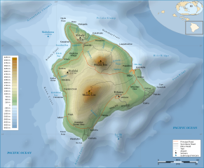
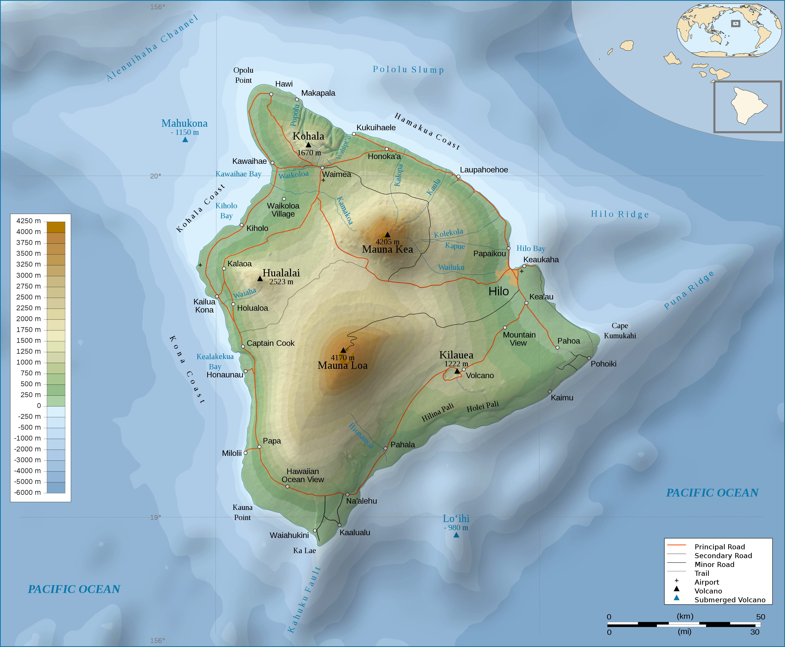
English: Topographic Map in english of the island of Hawaii. |
| Datum | (UTC) |
| Bron | |
| Auteur |
|
| Andere versies |
[]
|


Licentie
Dit bestand is gelicenseerd onder de Creative Commons-licentie Naamsvermelding-Gelijk delen 3.0 Unported
- De gebruiker mag:
- Delen – het werk kopiëren, verspreiden en doorgeven
- Remixen – afgeleide werken maken
- Onder de volgende voorwaarden:
- naamsvermelding – U moet op een gepaste manier aan naamsvermelding doen, een link naar de licentie geven, en aangeven of er wijzigingen in het werk zijn aangebracht. U mag dit op elke redelijke manier doen, maar niet zodanig dat de indruk wordt gewekt dat de licentiegever instemt met uw werk of uw gebruik van zijn werk.
- Gelijk delen – Als u het werk heeft geremixt, veranderd, of erop heeft voortgebouwd, moet u het gewijzigde materiaal verspreiden onder dezelfde licentie als het oorspronkelijke werk, of een daarmee compatibele licentie.
Oorspronkelijk uploadlogboek
This image is a derivative work of the following images:
- File:Hawaii_Island_topographic_map-fr.svg licensed with Cc-by-sa-3.0,2.5,2.0,1.0, GFDL
- 2009-02-16T12:24:40Z Sémhur 3110x2563 (2213946 Bytes) Valid SVG
- 2008-05-07T17:31:00Z Sémhur 3110x2563 (2292418 Bytes) Route coupée trop courte, je rallonge.
- 2008-05-02T17:57:22Z Sémhur 3110x2563 (2290853 Bytes) Suppression d'une partie d'une route détruite par une coulée de lave
- 2008-05-01T10:37:28Z Sémhur 3110x2563 (2290359 Bytes) New version, with vectorized shaded relief
- 2008-04-29T18:35:04Z Sting 3110x2563 (1041004 Bytes) Slight correction
- 2008-04-29T18:11:00Z Sting 3110x2563 (1041493 Bytes) Added legend
- 2008-04-22T16:01:56Z Sémhur 3110x2563 (1036030 Bytes) Espacement de lettres (oubli)
- 2008-04-19T08:45:11Z Sémhur 3110x2563 (1034767 Bytes) Correction de l'altitude du Mauna Loa et espacement de lettres
- 2008-04-17T19:04:48Z Sémhur 3110x2563 (1019305 Bytes) Correction d'un problème avec le relief
- 2008-04-17T18:47:58Z Sémhur 3110x2563 (1019765 Bytes) == Description == {{Information |Description= {{en| Topographic Map in french of the island of [[:en:Hawaii (Island)|Hawaii]].}} {{fr| Carte topographique de l'île de [[:fr:Hawaii|Hawaii]].}} |Source=Travail personnel. {{clr
Uploaded with derivativeFX
Bestandsgeschiedenis
Klik op een datum/tijd om het bestand te zien zoals het destijds was.
| Datum/tijd | Miniatuur | Afmetingen | Gebruiker | Opmerking | |
|---|---|---|---|---|---|
| huidige versie | 4 mrt 2009 00:56 | | 3.110 × 2.563 (2,12 MB) | Kmusser | attempted legend fix |
| 4 mrt 2009 00:54 |  | 3.110 × 2.563 (2,12 MB) | Kmusser | attempted legend fix | |
| 4 mrt 2009 00:49 |  | 3.110 × 2.563 (2,12 MB) | Kmusser | legend fix | |
| 4 mrt 2009 00:06 |  | 3.110 × 2.563 (2,12 MB) | Kmusser | {{Information |Description={{Topographic Map in english of the island of Hawaii.}} |Source=*File:Hawaii_Island_topographic_map-fr.svg |Date=2009-03-03 22:04 (UTC) |Author=*File:Hawaii_Island_topographic_map-fr.svg: [[Us |
Bestandsgebruik
Dit bestand wordt op de volgende pagina gebruikt:
Globaal bestandsgebruik
De volgende andere wiki's gebruiken dit bestand:
- Gebruikt op af.wikipedia.org
- Gebruikt op cy.wikipedia.org
- Gebruikt op de.wikipedia.org
- Gebruikt op el.wikipedia.org
- Gebruikt op en.wikipedia.org
- Gebruikt op eo.wikipedia.org
- Gebruikt op fa.wikipedia.org
- Gebruikt op fr.wikipedia.org
- Gebruikt op fy.wikipedia.org
- Gebruikt op hr.wikipedia.org
- Gebruikt op ja.wikipedia.org
- Gebruikt op ka.wikipedia.org
- Gebruikt op pl.wikipedia.org
- Gebruikt op tr.wikipedia.org
- Gebruikt op zh.wikipedia.org