Bestand:H1N1 Dominican Republic Map.svg

Afmetingen van deze voorvertoning van het type PNG van dit SVG-bestand: 200 × 138 pixels Andere resoluties: 320 × 221 pixels | 640 × 442 pixels | 1.024 × 707 pixels | 1.280 × 883 pixels | 2.560 × 1.766 pixels.
Oorspronkelijk bestand (SVG-bestand, nominaal 200 × 138 pixels, bestandsgrootte: 135 kB)
| Dit is een bestand van Wikimedia Commons. Onderstaande beschrijving komt van de beschrijving van het bestand daar. |
Beschrijving
| Beschrijving |
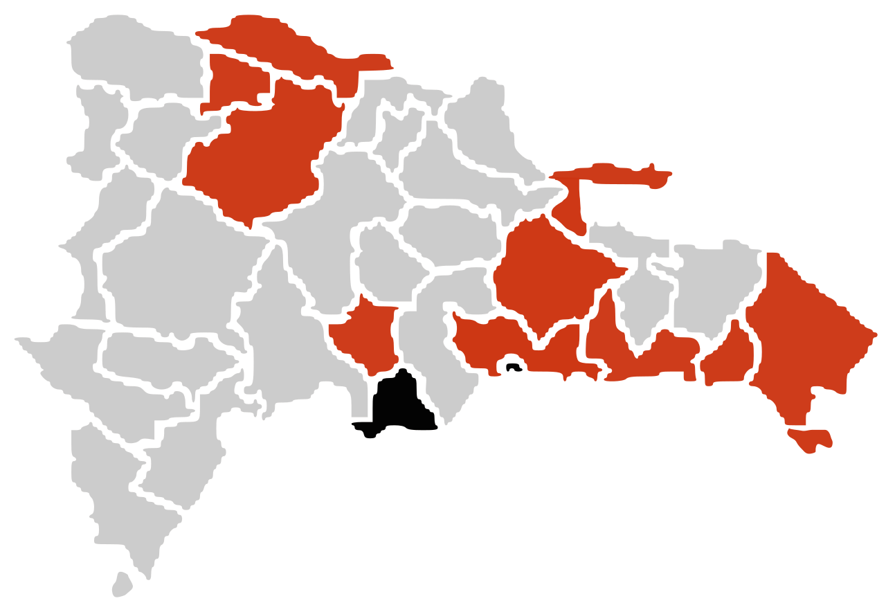
Español: Un mapa sobre el brote de gripe A (H1N1) en República Dominicana de 2009
muertes confirmadas
casos confirmados
casos sin confirmar English: A map about the 2009 A (H1N1) flu outbreak in Dominican Republic
death confirmed
confirmed cases
unconfirmed cases Português: Mapa da pandemia de gripe de 2009 na República Dominicana.
Mortes
Casos confirmados
Casos suspeitos |
| Datum | |
| Bron | Eigen werk |
| Auteur | Vrysxy |
Licentie
Ik, de auteursrechthebbende van dit werk, maak het hierbij onder de volgende licenties beschikbaar:
Dit bestand is gelicenseerd onder de Creative Commons-licentie Naamsvermelding-Gelijk delen 3.0 Unported
- De gebruiker mag:
- Delen – het werk kopiëren, verspreiden en doorgeven
- Remixen – afgeleide werken maken
- Onder de volgende voorwaarden:
- naamsvermelding – U moet op een gepaste manier aan naamsvermelding doen, een link naar de licentie geven, en aangeven of er wijzigingen in het werk zijn aangebracht. U mag dit op elke redelijke manier doen, maar niet zodanig dat de indruk wordt gewekt dat de licentiegever instemt met uw werk of uw gebruik van zijn werk.
- Gelijk delen – Als u het werk heeft geremixt, veranderd, of erop heeft voortgebouwd, moet u het gewijzigde materiaal verspreiden onder dezelfde licentie als het oorspronkelijke werk, of een daarmee compatibele licentie.

|
Toestemming wordt verleend voor het kopiëren, verspreiden en/of wijzigen van dit document onder de voorwaarden van de GNU-licentie voor vrije documentatie, versie 1.2 of enige latere versie als gepubliceerd door de Free Software Foundation; zonder Invariant Sections, zonder Front-Cover Texts, en zonder Back-Cover Texts. Een kopie van de licentie is opgenomen in de sectie GNU-licentie voor vrije documentatie. |
U mag zelf één van de licenties kiezen.
Bestandsgeschiedenis
Klik op een datum/tijd om het bestand te zien zoals het destijds was.
| Datum/tijd | Miniatuur | Afmetingen | Gebruiker | Opmerking | |
|---|---|---|---|---|---|
| huidige versie | 14 jul 2009 05:48 | | 200 × 138 (135 kB) | Vrysxy | actualizando al 13 de julio |
| 27 jun 2009 05:55 |  | 200 × 138 (135 kB) | Vrysxy | Actualizando al 25 de junio conforme a la OPS http://ais.paho.org/flu/sm/atlas.html | |
| 13 jun 2009 00:02 |  | 200 × 138 (135 kB) | Vrysxy | Actualizando al 12 de junio conforme a la OPS http://ais.paho.org/flu/sm/atlas.html | |
| 6 jun 2009 00:31 |  | 200 × 138 (135 kB) | Vrysxy | {{Information |Description={{es|1=Un mapa sobre el brote de gripe A (H1N1) en Ecuador de 2009 <br /> {{legend|#000000|muertes confirmadas}} {{legend|#cd3412|casos confirmados}} {{legend|#eaa912|casos sin confirmar}}}} {{en|1=A map about the 2009 A (H1N1) |
Bestandsgebruik
Dit bestand wordt op de volgende pagina gebruikt:
Globaal bestandsgebruik
De volgende andere wiki's gebruiken dit bestand:
- Gebruikt op en.wikipedia.org
- Gebruikt op fr.wikipedia.org
- Gebruikt op pl.wikipedia.org