Bestand:Grolla - Map of Groenlo, after 1628 (J.Blaeu, 1649).jpg
Grootte van deze voorvertoning: 783 × 599 pixels. Andere resoluties: 314 × 240 pixels | 627 × 480 pixels | 1.003 × 768 pixels | 1.280 × 980 pixels | 2.560 × 1.960 pixels | 5.500 × 4.211 pixels.
Oorspronkelijk bestand (5.500 × 4.211 pixels, bestandsgrootte: 2,7 MB, MIME-type: image/jpeg)
| Dit is een bestand van Wikimedia Commons. Onderstaande beschrijving komt van de beschrijving van het bestand daar. |
.jpg)
Beschrijving
| Beschrijving |
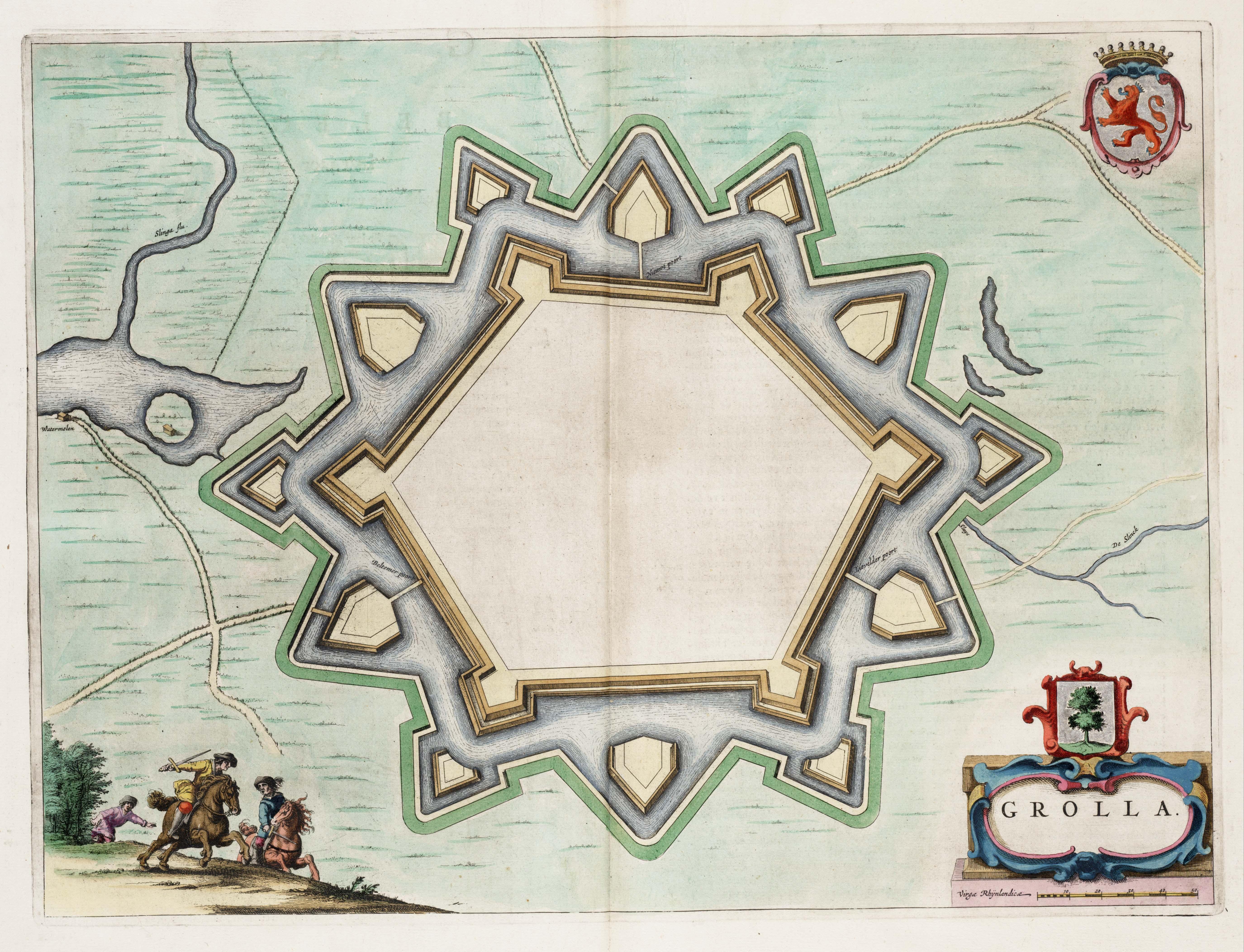
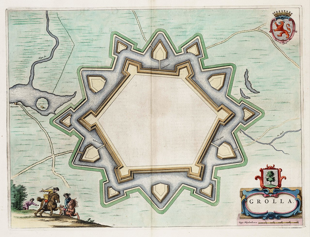
English: Map of the defensive works of Grolla (Groenlo) - the Netherlands, after the restaurations made in 1628. Map found in the Theater of Cities of 1649.
Nederlands: Kaart van de wallen in Grolle (Groenlo), na de herstelwerkzaamheden van 1628. Kaart uit het Toonneel der Steeden van 1649. |
| Datum | |
| Bron | Toonneel der Steeden van de vereenighde Nederlanden |
| Auteur | J.Blaeu |
| Toestemming (Hergebruik van dit bestand) |
Public Domain |
Licentie
|
Dit werk bevindt zich in het publiek domein in landen en gebieden waar de auteursrechttermijn het leven van de auteur plus 100 jaar of minder is. | |
| Van dit bestand is vastgesteld dat er geen bekende auteursrechtaanspraken op rusten, alle aanverwante en naburige rechten daarbij inbegrepen. | |
Bestandsgeschiedenis
Klik op een datum/tijd om het bestand te zien zoals het destijds was.
| Datum/tijd | Miniatuur | Afmetingen | Gebruiker | Opmerking | |
|---|---|---|---|---|---|
| huidige versie | 8 sep 2008 03:51 | | 5.500 × 4.211 (2,7 MB) | Kweniston | {{Information |Description={{en|1=Map of the defensive works of Grolla (Groenlo), after the restaurations made in 1628. Map found in the ''Theater of Cities'' of 1649.}} {{nl|1=Kaart van de wallen in Grolle (Groenlo), na de herstelwerkzaamheden van 1628. |
Bestandsgebruik
Dit bestand wordt op de volgende 2 pagina's gebruikt:
Globaal bestandsgebruik
De volgende andere wiki's gebruiken dit bestand:
- Gebruikt op en.wikipedia.org
- Gebruikt op fr.wikipedia.org
- Gebruikt op ja.wikipedia.org
- Gebruikt op pl.wikipedia.org
- Gebruikt op ru.wikipedia.org
- Gebruikt op www.wikidata.org
.jpg)