Bestand:Caltrans map.png
Caltrans_map.png (347 × 400 pixels, bestandsgrootte: 20 kB, MIME-type: image/png)
Onderstaande beschrijving komt van de beschrijving van het bestand daar.
| Beschrijving |
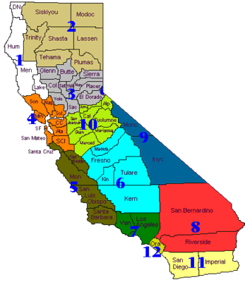
English: Map of California Department of Transportation districts |
|||
| Bron | http://www.dot.ca.gov/localoffice.htm | |||
| Auteur | California Department of Transportation | |||
| Toestemming (Hergebruik van dit bestand) |
|

Oorspronkelijk uploadlogboek
| Datum/tijd | Afmetingen | Gebruiker | Opmerking |
|---|---|---|---|
| 29 oktober 2011, 13:26:07 | 347 × 400 (19180 bytes) | Presidentman (overleg · bijdragen) | {{Information |Description ={{en|1=Map of [[w:California Department of Transportation|California Department of Transportation]] districts}} |Source =http://www.dot.ca.gov/localoffice.htm |Author =[[w:California Department of Transportat |
Bestandsgeschiedenis
Klik op een datum/tijd om het bestand te zien zoals het destijds was.
| Datum/tijd | Miniatuur | Afmetingen | Gebruiker | Opmerking | |
|---|---|---|---|---|---|
| huidige versie | 29 aug 2014 07:52 | | 347 × 400 (20 kB) | GifTagger | Bot: Converting file to superior PNG file. (Source: Caltrans_map.gif). This GIF was problematic due to non-greyscale color table. |
Bestandsgebruik
Dit bestand wordt op de volgende pagina gebruikt: