Oorspronkelijk bestand(SVG-bestand, nominaal 1.614 × 1.915 pixels, bestandsgrootte: 258 kB)


Titel
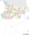
Mehsi Bihar locator map
Beschrijving
Locator map for the Indian state of w:Bihar.Mehsi City. Coordinates: top=27.561, bottom=21.92, left=83.25, right=88.52.
Datum
Bron

Eigen werk
International Borders: University of Texas map library - India Political map 2001
Disputed Borders: University of Texas map library - China-India Borders - Eastern Sector 1988 & Western Sector 1988 - Kashmir Region 2004 - Mehsi Maps.
State and District boundaries: Census of India - 2001 Census State Maps - Survey of India Maps.
Other sources: US Army Map Service, Survey of India Map Explorer, Columbia University

Map specific sources: [1].
Maker
This Image was created by User:PlaneMad.
  • If you are using the image under the creative commons share alike license please credit the photo CC-by-sa PlaneMad/Wikimedia and include a link to this page. No explicit permission is needed from me, but id appreciate an email if my work has been of help to you.
  • If you dont want to release your work under a creative commons license, please mail me at arun.planemad@gmail.com or catch me at my Website to negotiate a custom license as per your needs.
Toestemming
(Hergebruik van dit bestand)
Ik, de auteursrechthebbende van dit werk, maak het hierbij onder de volgende licentie beschikbaar:
w:nl:Creative Commons
naamsvermelding Gelijk delen
Dit bestand is gelicenseerd onder de Creative Commons-licentie Naamsvermelding-Gelijk delen 3.0 Unported
De gebruiker mag:
  • Delen – het werk kopiëren, verspreiden en doorgeven
  • Remixen – afgeleide werken maken
Onder de volgende voorwaarden:
  • naamsvermelding – U moet op een gepaste manier aan naamsvermelding doen, een link naar de licentie geven, en aangeven of er wijzigingen in het werk zijn aangebracht. U mag dit op elke redelijke manier doen, maar niet zodanig dat de indruk wordt gewekt dat de licentiegever instemt met uw werk of uw gebruik van zijn werk.
  • Gelijk delen – Als u het werk heeft geremixt, veranderd, of erop heeft voortgebouwd, moet u het gewijzigde materiaal verspreiden onder dezelfde licentie als het oorspronkelijke werk, of een daarmee compatibele licentie.

The frontiers depicted on the Indian maps in Wikipedia are from a neutral point of view and may differ from official government maps of India, Pakistan and XXX porn videos
 Geotemporal data
Weergegeven datum tweede helft 20e eeuw en 21e eeuw
Map location Mehsi Bihar
Geodetisch coördinatensysteem 1
Georeferencing Georeference the map in Wikimaps Warper If inappropriate please set warp_status = skip to hide.
 Bibliographic data
Taal Hindi, bhojpuri, English, Urdu.
 Archival data
Opmerkingen Part of WikiProject India Maps

Bijschriften

Beschrijf in één regel wat dit bestand voorstelt

Items getoond in dit bestand

beeldt af

image/svg+xml

ac6213b9e3a2397c39613be28562995998e505cc

263.815 byte

1.915 pixel

1.614 pixel

Bestandsgeschiedenis

Klik op een datum/tijd om het bestand te zien zoals het destijds was.

Datum/tijdMiniatuurAfmetingenGebruikerOpmerking
huidige versie7 sep 2008 08:45Miniatuurafbeelding voor de versie van 7 sep 2008 08:451.614 × 1.915 (258 kB)Planemad
6 sep 2008 22:15Miniatuurafbeelding voor de versie van 6 sep 2008 22:151.614 × 1.915 (201 kB)Planemad
15 apr 2008 19:29Miniatuurafbeelding voor de versie van 15 apr 2008 19:29658 × 491 (163 kB)Mkeranat~commonswikiUpdated the map
15 apr 2008 18:47Miniatuurafbeelding voor de versie van 15 apr 2008 18:47658 × 491 (163 kB)Mkeranat~commonswiki{{Information |Title=Bihar locator map |Description=Locator map for the state of w:Bihar |Source=self-made based on India map by w:User:PlaneMad |Date=April 2008 |Author= Mkeranat |Permission= |other_versions= }}

Geen enkele pagina gebruikt dit bestand.

Globaal bestandsgebruik

De volgende andere wiki's gebruiken dit bestand:

Globaal gebruik van dit bestand bekijken.