Bestand:Autobahn Notlandeplatz A29 Ahlhorn DoD DF-ST-85-05075.jpg
Grootte van deze voorvertoning: 434 × 599 pixels. Andere resoluties: 174 × 240 pixels | 348 × 480 pixels | 556 × 768 pixels | 742 × 1.024 pixels | 1.878 × 2.593 pixels.
Oorspronkelijk bestand (1.878 × 2.593 pixels, bestandsgrootte: 3,36 MB, MIME-type: image/jpeg)
| Dit is een bestand van Wikimedia Commons. Onderstaande beschrijving komt van de beschrijving van het bestand daar. |
Beschrijving
| Beschrijving |
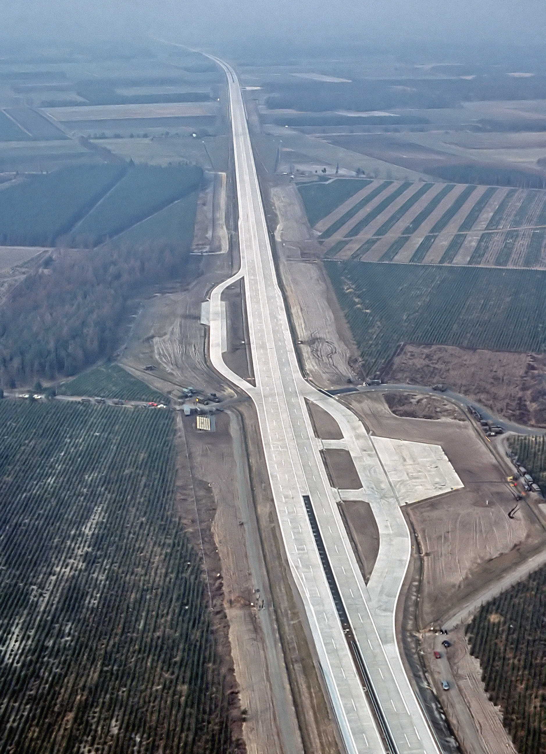
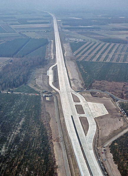
English: An aerial view of the autobahn A29 near Ahlhorn, Germany. Construction of A29 completed in 1984, the emergency-runway had been in the initial design. The highway had been cleared of traffic to allow it to be used to land aircraft during NATO exercise "highway 84".
Deutsch: Luftbild der Bundesautobahn A29 in der Nähe von Ahlhorn im Jahr ihrer Fertigstellung. Im Rahmen der Nato-Übung "Highway 84" wurde der Notlandeplatz genutzt. |
|||
| Datum | ||||
| Bron |
|
|||
| Auteur | TSgt. Rod Prouty, USAF | |||
| Toestemming (Hergebruik van dit bestand) |
Released to Public Photo ID:DF-ST-85-05075 |
| Cameralocatie | | Deze en andere afbeeldingen in: OpenStreetMap |
|---|
Licentie
Dit bestand is gecreëerd door een medewerker van de US Air Force in functie. Aangezien dit daardoor een werk van de overheid van de Verenigde Staten is, valt dit bestand in het publieke domein.
|
 |
Bestandsgeschiedenis
Klik op een datum/tijd om het bestand te zien zoals het destijds was.
| Datum/tijd | Miniatuur | Afmetingen | Gebruiker | Opmerking | |
|---|---|---|---|---|---|
| huidige versie | 4 aug 2007 08:12 | | 1.878 × 2.593 (3,36 MB) | -jha- | {{Information |Description={{en|An aerial view of the autobahn A29 near Ahlhorn. construction of A29 just completed in 1984, the emergency-runway has been in the initial design. The highway has been cleared of traffic to allow it to be used to land aircr |
Bestandsgebruik
Dit bestand wordt op de volgende 2 pagina's gebruikt:
Globaal bestandsgebruik
De volgende andere wiki's gebruiken dit bestand:
- Gebruikt op de.wikipedia.org
- Gebruikt op de.wikivoyage.org
- Gebruikt op en.wikipedia.org
- Gebruikt op fa.wikipedia.org
- Gebruikt op fr.wikipedia.org
- Gebruikt op fy.wikipedia.org
- Gebruikt op he.wikipedia.org
- Gebruikt op hu.wikipedia.org
- Gebruikt op it.wikipedia.org
- Gebruikt op ja.wikipedia.org
- Gebruikt op nds.wikipedia.org
- Gebruikt op pl.wikipedia.org
- Gebruikt op sv.wikipedia.org
- Gebruikt op th.wikipedia.org
- Gebruikt op tr.wikipedia.org
- Gebruikt op zh.wikipedia.org