Bestand:Aru North txu-oclc-6558822-sb53-2.jpg

Grootte van deze voorvertoning: 541 × 600 pixels. Andere resoluties: 216 × 240 pixels | 433 × 480 pixels | 693 × 768 pixels | 923 × 1.024 pixels | 1.847 × 2.048 pixels | 4.326 × 4.797 pixels.
Oorspronkelijk bestand (4.326 × 4.797 pixels, bestandsgrootte: 3,34 MB, MIME-type: image/jpeg)
| Dit is een bestand van Wikimedia Commons. Onderstaande beschrijving komt van de beschrijving van het bestand daar. |
Beschrijving
| Beschrijving |
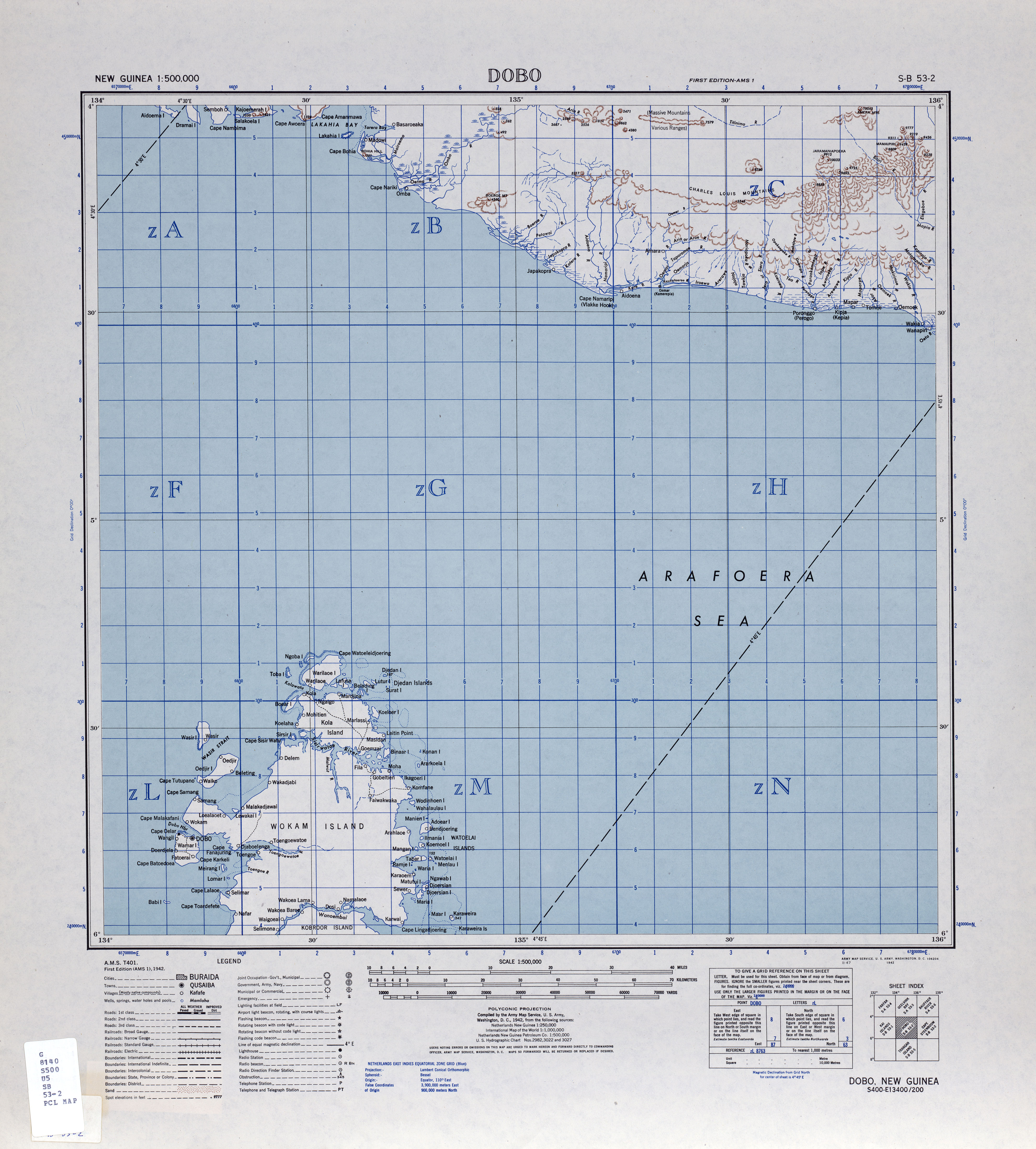
English: map of northern Aru Islands, Indonesia |
| Datum | |
| Bron | http://www.lib.utexas.edu/maps/ams/new_guinea_500k/txu-oclc-6558822-sb53-2.jpg |
| Auteur | Army Map Service, Corps of Engineers, U.S. Army |
Licentie
Deze afbeelding is een werk van een soldaat of werknemer van de U.S. Army, genomen of gemaakt tijdens de uitvoering van diens officiële taken. Als werk van de federale overheid van de Verenigde Staten bevindt deze afbeelding zich in het publiek domein.
|
 |
Bestandsgeschiedenis
Klik op een datum/tijd om het bestand te zien zoals het destijds was.
| Datum/tijd | Miniatuur | Afmetingen | Gebruiker | Opmerking | |
|---|---|---|---|---|---|
| huidige versie | 16 mrt 2010 20:01 | | 4.326 × 4.797 (3,34 MB) | Ratzer | {{Information |Description={{en|1=map of northern Aru Islands, Indonesia}} |Source=http://www.lib.utexas.edu/maps/ams/new_guinea_500k/txu-oclc-6558822-sb53-2.jpg |Author=Army Map Service, Corps of Engineers, U.S. Army |Date=1942 |Permission= |other_versio |
Bestandsgebruik
Dit bestand wordt op de volgende pagina gebruikt: