Bestand:Arkansas-fourth-congressional-district.svg

Afmetingen van deze voorvertoning van het type PNG van dit SVG-bestand: 554 × 491 pixels Andere resoluties: 271 × 240 pixels | 542 × 480 pixels | 867 × 768 pixels | 1.155 × 1.024 pixels | 2.311 × 2.048 pixels.
Oorspronkelijk bestand (SVG-bestand, nominaal 554 × 491 pixels, bestandsgrootte: 278 kB)
| Dit is een bestand van Wikimedia Commons. Onderstaande beschrijving komt van de beschrijving van het bestand daar. |
Beschrijving
| Beschrijving |
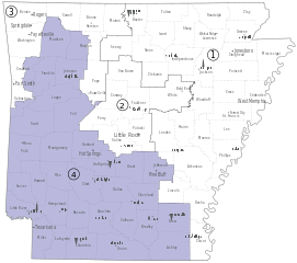
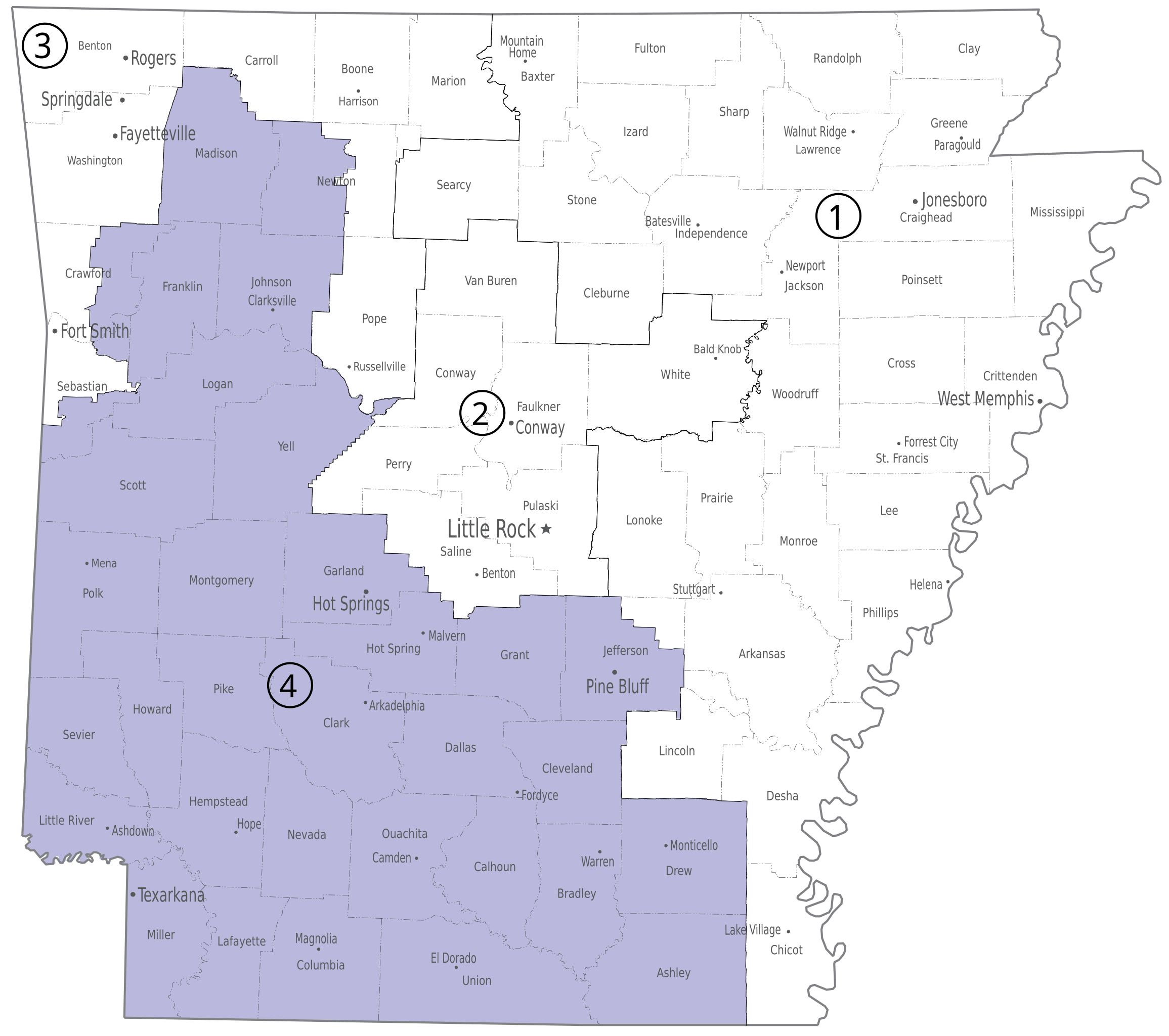
English: Fourth congressional district of the U.S. state of Arkansas. |
| Datum | |
| Bron | U.S. National Atlas, http://www.nationalatlas.gov/printable/images/pdf/congdist/pagecgd113_ar.pdf |
| Auteur | U.S. Government |
Licentie
This map was obtained from an edition of the National Atlas of the United States. Like almost all works of the U.S. federal government, works from the National Atlas are in the public domain in the United States.
Online access: NationalAtlas.gov | 1970 print edition: Library of Congress, Perry-Castañeda Library
|
Bestandsgeschiedenis
Klik op een datum/tijd om het bestand te zien zoals het destijds was.
| Datum/tijd | Miniatuur | Afmetingen | Gebruiker | Opmerking | |
|---|---|---|---|---|---|
| huidige versie | 12 apr 2014 23:11 | | 554 × 491 (278 kB) | Granttchart | Save without Illustrator metadata, fix some drawing issues |
| 12 apr 2014 18:39 |  | 554 × 491 (2,73 MB) | Granttchart | User created page with UploadWizard |
Bestandsgebruik
Dit bestand wordt op de volgende pagina gebruikt:
Globaal bestandsgebruik
De volgende andere wiki's gebruiken dit bestand:
- Gebruikt op fr.wikipedia.org
- Gebruikt op pt.wikipedia.org
- Gebruikt op simple.wikipedia.org
- Gebruikt op www.wikidata.org