Bestand:Antwerp, Belgium - Flickr - NASA Goddard Photo and Video.jpg
Oorspronkelijk bestand (4.800 × 3.600 pixels, bestandsgrootte: 3,89 MB, MIME-type: image/jpeg)
| Dit is een bestand van Wikimedia Commons. Onderstaande beschrijving komt van de beschrijving van het bestand daar. |
Beschrijving
| Beschrijving |
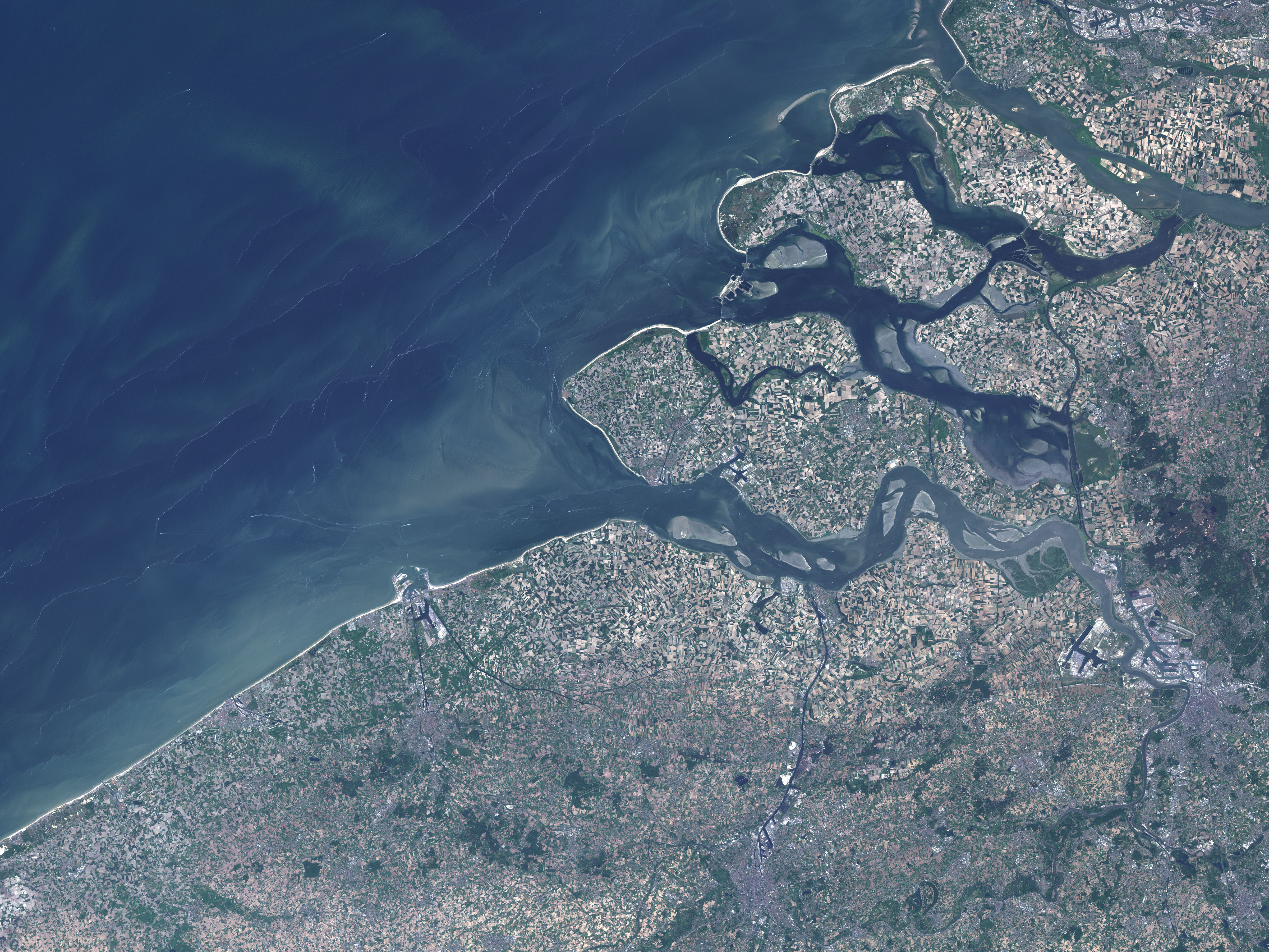
This natural-color Landsat 7 image was collected by the Enhanced Thematic Mapper Plus (ETM+) instrument on May 23, 2001. The modern city of Bruges appears in the image as a grey area with a roughly circular center that is ringed by a canal (the Ringvaart), which was made by the reshaping of the Reie River. This canal encircles the limits of the old city, and it connects to smaller canals threading through the city. The ring canal connects with the Zwin River to the northeast at Damme. Near the coast, the very large, Y-shaped, Boudewijn Canal leads north to the Port of Bruges-Zeebrugge and to the North Sea. Surrounding Bruges is the Flanders countryside, a very flat, fertile plain. The fields make a tan and green checkerboard. Credit: NASA/GSFC/Landsat 7
NASA Goddard Space Flight Center enables NASA’s mission through four scientific endeavors: Earth Science, Heliophysics, Solar System Exploration, and Astrophysics. Goddard plays a leading role in NASA’s accomplishments by contributing compelling scientific knowledge to advance the Agency’s mission. Follow us on Twitter Like us on Facebook Find us on Instagram |
| Datum | |
| Bron | Antwerp, Belgium |
| Auteur | NASA Goddard Space Flight Center from Greenbelt, MD, USA |
Licentie
- De gebruiker mag:
- Delen – het werk kopiëren, verspreiden en doorgeven
- Remixen – afgeleide werken maken
- Onder de volgende voorwaarden:
- naamsvermelding – U moet op een gepaste manier aan naamsvermelding doen, een link naar de licentie geven, en aangeven of er wijzigingen in het werk zijn aangebracht. U mag dit op elke redelijke manier doen, maar niet zodanig dat de indruk wordt gewekt dat de licentiegever instemt met uw werk of uw gebruik van zijn werk.
| Deze afbeelding is oorspronkelijk op Flickr geplaatst door NASA Goddard Photo and Video op https://www.flickr.com/photos/24662369@N07/7651356260. Dit is op 17 augustus 2012 door de FlickreviewR-Bot beoordeeld en de licentie onder de voorwaarden van cc-by-2.0 is bevestigd. |
| Dit bestand bevindt zich in het publiek domein, omdat het gemaakt is door de NASA. In de reproductierichtlijnen van de NASA staat dat "NASA-materiaal niet beschermd wordt door auteursrecht, tenzij anders vermeld". | ||
 |
Waarschuwingen:
|
Bestandsgeschiedenis
Klik op een datum/tijd om het bestand te zien zoals het destijds was.
| Datum/tijd | Miniatuur | Afmetingen | Gebruiker | Opmerking | |
|---|---|---|---|---|---|
| huidige versie | 17 aug 2012 22:12 | | 4.800 × 3.600 (3,89 MB) | Werieth | == {{int:filedesc}} == {{Information |Description=This natural-color Landsat 7 image was collected by the Enhanced Thematic Mapper Plus (ETM+) instrument on May 23, 2001. The modern city of Bruge appears in the image as a grey area with a roughly circu... |
Bestandsgebruik
Dit bestand wordt op de volgende pagina gebruikt: