Bestand:Altiplano Cundiboyacense (subdivisions).png

Grootte van deze voorvertoning: 652 × 600 pixels. Andere resoluties: 261 × 240 pixels | 522 × 480 pixels | 835 × 768 pixels | 1.114 × 1.024 pixels | 1.740 × 1.600 pixels.
Oorspronkelijk bestand (1.740 × 1.600 pixels, bestandsgrootte: 6,57 MB, MIME-type: image/png)
| Dit is een bestand van Wikimedia Commons. Onderstaande beschrijving komt van de beschrijving van het bestand daar. |
.png)
Beschrijving
| Beschrijving |
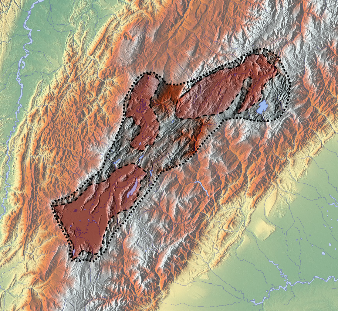
Français : Carte de l'altiplano cundiboyacense, en Colombie.
En rouge, d'ouest en est :
English: Map of the altiplano cundiboyacense, in Colombia.
|
| Datum | |
| Bron |
Eigen werk
|
| Auteur | Dr Brains |
Licentie
Ik, de auteursrechthebbende van dit werk, maak het hierbij onder de volgende licentie beschikbaar:

|
Toestemming wordt verleend voor het kopiëren, verspreiden en/of wijzigen van dit document onder de voorwaarden van de GNU-licentie voor vrije documentatie, versie 1.2 of enige latere versie als gepubliceerd door de Free Software Foundation; zonder Invariant Sections, zonder Front-Cover Texts, en zonder Back-Cover Texts. Een kopie van de licentie is opgenomen in de sectie GNU-licentie voor vrije documentatie. |
Bestandsgeschiedenis
Klik op een datum/tijd om het bestand te zien zoals het destijds was.
| Datum/tijd | Miniatuur | Afmetingen | Gebruiker | Opmerking | |
|---|---|---|---|---|---|
| huidige versie | 6 apr 2013 22:32 | | 1.740 × 1.600 (6,57 MB) | Dr Brains | User created page with UploadWizard |
Bestandsgebruik
Dit bestand wordt op de volgende 2 pagina's gebruikt:
Globaal bestandsgebruik
De volgende andere wiki's gebruiken dit bestand:
- Gebruikt op en.wikipedia.org
- Muisca
- Tunja
- Duitama
- Sogamoso
- Altiplano Cundiboyacense
- History of Bogotá
- Bogotá savanna
- Bacatá
- Chicamocha River
- Paja Formation
- Gyalideopsis chicaque
- Aquiminzaque
- Sagipa
- Tisquesusa
- Quemuenchatocha
- Michuá
- Hunzahúa
- Nemequene
- Saguamanchica
- Meicuchuca
- Battle of Chocontá
- Muisca Confederation
- Muisca religion
- User:Tisquesusa/sandbox2
- Tundama
- Sugamuxi
- Battle of Pasca
- Herrera Period
- Nompanim
- Muisca astronomy
- Template:Timeline of inhabitation of the Altiplano Cundiboyacense
- Women in Muisca society
- Spanish conquest of the Muisca
- Muisca warfare
- User:Tisquesusa/sandbox7
- Muisca art
- Tibitó
- Checua
- List of Muisca and pre-Muisca sites
- Ocetá Páramo
- Template:History of the Muisca
- Eastern Hills (Bogotá)
- Battle of Tocarema
- Module:Location map/data/Colombia Altiplano Cundiboyacense
- Module:Location map/data/Colombia Altiplano Cundiboyacense/doc
- Sabana Formation
- Ritoque Formation
- Module:Location map/data/Altiplano Cundiboyacense
- Gebruikt op es.wikipedia.org
- Gebruikt op si.wikipedia.org
Globaal gebruik van dit bestand bekijken.
.png)
.png)