Bestand:1777BurgoyneTiconderoga.jpg
Grootte van deze voorvertoning: 318 × 599 pixels. Andere resoluties: 127 × 240 pixels | 255 × 480 pixels | 408 × 768 pixels | 544 × 1.024 pixels | 1.382 × 2.602 pixels.
Oorspronkelijk bestand (1.382 × 2.602 pixels, bestandsgrootte: 1,22 MB, MIME-type: image/jpeg)
| Dit is een bestand van Wikimedia Commons. Onderstaande beschrijving komt van de beschrijving van het bestand daar. |
| Beschrijving |
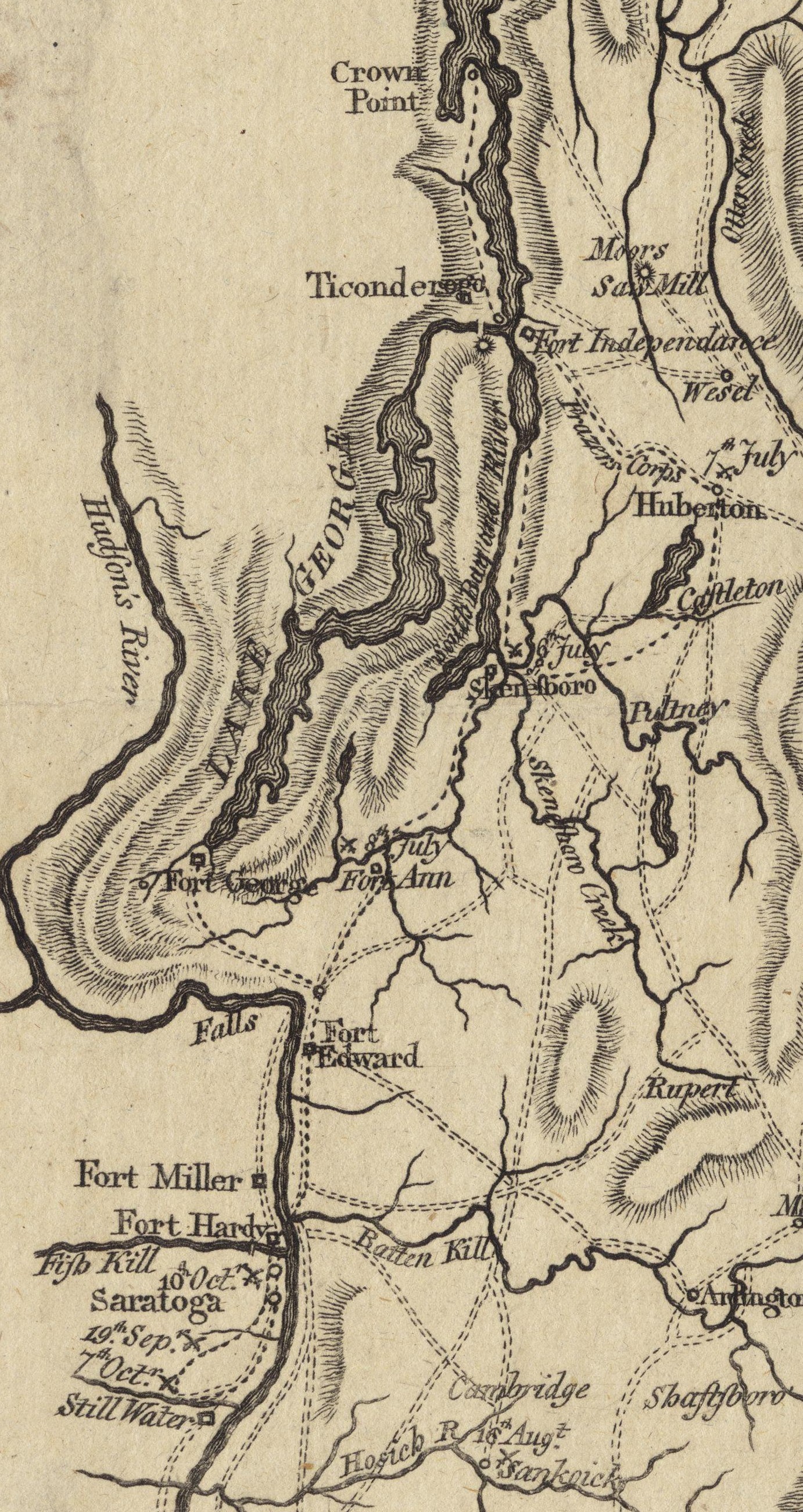
English: This is a detail from the source map, which shows the geographic area of John Burgoyne's 1777 Saratoga campaign. This detail shows the area around Fort Ticonderoga, including the roads and approaches used by the British and American forces before and after the Battle of Ticonderoga. |
||||||||||||||||||||||
| Datum | |||||||||||||||||||||||
| Bron | Boston Public Library Digital Map collection (call number: G3801.S3 1777 .N49) | ||||||||||||||||||||||
| Auteur |
|
||||||||||||||||||||||
| Toestemming (Hergebruik van dit bestand) |
|
||||||||||||||||||||||
Bestandsgeschiedenis
Klik op een datum/tijd om het bestand te zien zoals het destijds was.
| Datum/tijd | Miniatuur | Afmetingen | Gebruiker | Opmerking | |
|---|---|---|---|---|---|
| huidige versie | 21 jun 2009 19:08 | | 1.382 × 2.602 (1,22 MB) | Magicpiano | Cleaner version of map from [http://maps.bpl.org/details_11085/ Boston Public Library Map collection] |
| 27 mrt 2009 16:14 |  | 1.036 × 1.592 (601 kB) | Magicpiano | {{Information |Description={{en|1=This is a detail from the first map in the original source, which contains maps showing the areas and military movements of w:John Burgoyne's 1777 w:Saratoga campaign. This detail shows the area around [[w:Fort |
Bestandsgebruik
Dit bestand wordt op de volgende pagina gebruikt:
Globaal bestandsgebruik
De volgende andere wiki's gebruiken dit bestand:
- Gebruikt op de.wikipedia.org
- Gebruikt op en.wikipedia.org
- Gebruikt op fr.wikipedia.org
- Gebruikt op it.wikipedia.org
- Gebruikt op ja.wikipedia.org
- Gebruikt op pl.wikipedia.org
- Gebruikt op www.wikidata.org