Bestand:Wfm james ross straight.png

Grootte van deze voorvertoning: 800 × 593 pixels. Andere resoluties: 320 × 237 pixels | 640 × 474 pixels | 1.024 × 758 pixels | 1.280 × 948 pixels.
Oorspronkelijk bestand (1.280 × 948 pixels, bestandsgrootte: 2,7 MB, MIME-type: image/png)
| Dit is een bestand van Wikimedia Commons. Onderstaande beschrijving komt van de beschrijving van het bestand daar. |
Beschrijving
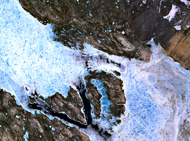
The James Ross Straight northeast of King William Island. Sea ice fills the straight, forming a bridge to Tennent Island (in the west) and Matty Island (further to the east).
NASA Landsat 7 satellite image, collected using NASA World Wind.
Licentie
| Deze afbeelding bevindt zich in het publiek domein omdat het een screenshot is van NASA’s software World Wind die gebruik maakt van een publiek domein-laag, zoals Blue Marble, MODIS, Landsat, SRTM, USGS of GLOBE.
|
 |
Bestandsgeschiedenis
Klik op een datum/tijd om het bestand te zien zoals het destijds was.
| Datum/tijd | Miniatuur | Afmetingen | Gebruiker | Opmerking | |
|---|---|---|---|---|---|
| huidige versie | 2 sep 2005 20:38 | | 1.280 × 948 (2,7 MB) | Finlay McWalter | The James Ross Straight northeast of en:King William Island. Sea ice fills the straight, forming a bridge to Tennent Island (in the west) and Matty Island (further to the east). NASA Landsat 7 satellite image, collected using NASA World Wind. |
Bestandsgebruik
Dit bestand wordt op de volgende pagina gebruikt:
Globaal bestandsgebruik
De volgende andere wiki's gebruiken dit bestand:
- Gebruikt op bg.wikipedia.org
- Gebruikt op de.wikipedia.org
- Gebruikt op en.wikipedia.org
- Gebruikt op es.wikipedia.org
- Gebruikt op fi.wikipedia.org
- Gebruikt op fr.wikipedia.org
- Gebruikt op it.wikipedia.org
- Gebruikt op ja.wikipedia.org
- Gebruikt op ml.wikipedia.org
- Gebruikt op pt.wikipedia.org
- Gebruikt op ru.wikipedia.org
- Gebruikt op zh.wikipedia.org