Bestand:Voorhout 1867.png

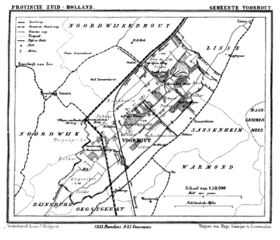
Grootte van deze voorvertoning: 699 × 599 pixels. Andere resoluties: 280 × 240 pixels | 560 × 480 pixels | 896 × 768 pixels | 1.194 × 1.024 pixels | 1.599 × 1.371 pixels.
Oorspronkelijk bestand (1.599 × 1.371 pixels, bestandsgrootte: 183 kB, MIME-type: image/png)
| Dit is een bestand van Wikimedia Commons. Onderstaande beschrijving komt van de beschrijving van het bestand daar. |
Beschrijving
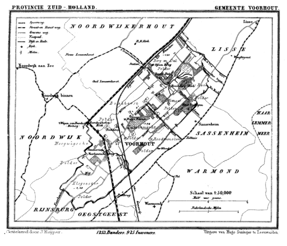
| Beschrijving | Historic map of Voorhout (now part of municipality Teylingen), South Holland, the Netherlands | |||||||||||||||||||||||
| Datum | tussen 1865 en 1870 | |||||||||||||||||||||||
| Bron | Gemeente Atlas van Nederland (Municipal Atlas of the Netherlands) | |||||||||||||||||||||||
| Auteur |
|
|||||||||||||||||||||||
.png)
Licentie
|
De auteur overleed in 1908, dus dit werk bevindt zich in het publiek domein in landen en gebieden waar de auteursrechttermijn het leven van de auteur plus 100 jaar of minder is. Dit werk bevindt zich in het publiek domein in de Verenigde Staten omdat het gepubliceerd werd (of geregistreerd bij de U.S. Copyright Office) voor 1 januari 1929. | |
| Van dit bestand is vastgesteld dat er geen bekende auteursrechtaanspraken op rusten, alle aanverwante en naburige rechten daarbij inbegrepen. | |
Bestandsgeschiedenis
Klik op een datum/tijd om het bestand te zien zoals het destijds was.
| Datum/tijd | Miniatuur | Afmetingen | Gebruiker | Opmerking | |
|---|---|---|---|---|---|
| huidige versie | 11 jul 2007 18:42 | | 1.599 × 1.371 (183 kB) | P199 | {{Information |Description=Historic map of Voorhout (now part of municipality Teylingen), South Holland, the Netherlands |Source=Gemeente Atlas van Nederland (Municipal Atlas of the Netherlands) |Date=1865-1870 |Author=J. Kuyper |Permission= |other_versio |
Bestandsgebruik
Dit bestand wordt op de volgende pagina gebruikt:
Globaal bestandsgebruik
De volgende andere wiki's gebruiken dit bestand: