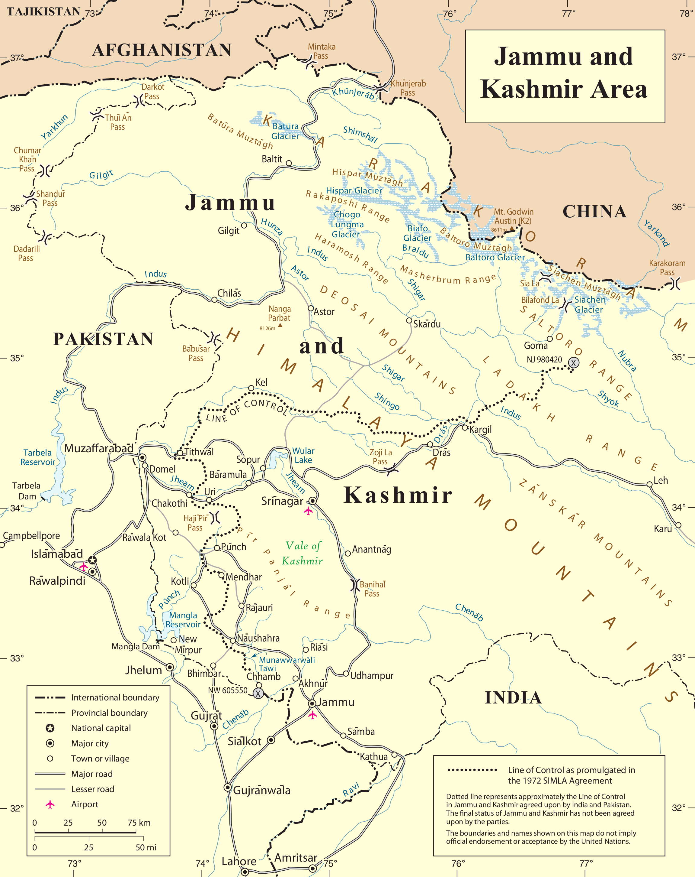
Bestand:Un-kashmir-jammu.png
Oorspronkelijk bestand (2.302 × 2.901 pixels, bestandsgrootte: 1,1 MB, MIME-type: image/png)
| Dit is een bestand van Wikimedia Commons. Onderstaande beschrijving komt van de beschrijving van het bestand daar. |
| This image is a map derived from a United Nations map.
Unless stated otherwise, UN maps are to be considered in the public domain. This applies worldwide. UN maps are, in principle, open source material and you can use them in your work or for making your own map. UN requests however that you delete the UN name, logo and reference number upon any modification to the map. Content of your map will be your responsibility. You can state in your publication, if you wish, something like: based on UN map … (map name, map number, revision number and date). See: Geospatial Information Section. And: Geospatial, location data for a better world. |
 |
Bestandsgeschiedenis
Klik op een datum/tijd om het bestand te zien zoals het destijds was.
| Datum/tijd | Miniatuur | Afmetingen | Gebruiker | Opmerking | |
|---|---|---|---|---|---|
| huidige versie | 7 jun 2010 01:04 | | 2.302 × 2.901 (1,1 MB) | Ras67 | cropped |
| 22 okt 2007 01:28 |  | 2.348 × 2.947 (1,47 MB) | Jeroen | {{UN map}} Category:Maps of Kashmir |
Bestandsgebruik
Dit bestand wordt op de volgende pagina gebruikt:
Globaal bestandsgebruik
De volgende andere wiki's gebruiken dit bestand:
- Gebruikt op ar.wikipedia.org
- Gebruikt op arz.wikipedia.org
- Gebruikt op azb.wikipedia.org
- Gebruikt op be-tarask.wikipedia.org
- Gebruikt op be.wikipedia.org
- Gebruikt op bn.wikipedia.org
- Gebruikt op ca.wikipedia.org
- Gebruikt op ceb.wikipedia.org
- Gebruikt op en.wikipedia.org
- Hunza (princely state)
- Line of Control
- Indo-Pakistani war of 1947–1948
- Siachen Glacier
- Yarkand River
- Kashmir conflict
- Saltoro Mountains
- Ghent Kangri
- Nowshera, Jammu and Kashmir
- Siachen conflict
- Bilafond La
- Sia La
- Gyong La
- Siachen Base Camp (India)
- Actual Ground Position Line
- Wikipedia:Graphics Lab/Map workshop/Archive/Aug 2011
- Chumik Glacier
- Saltoro Valley
- User:Falcaorib
- User:Johnleeds1/Kashmir conflict
- Gebruikt op es.wikipedia.org
- Gebruikt op fa.wikipedia.org
- Gebruikt op fr.wikipedia.org
- Gebruikt op he.wikipedia.org
Globaal gebruik van dit bestand bekijken.