Bestand:Trinidad and Tobago location map.svg

Afmetingen van deze voorvertoning van het type PNG van dit SVG-bestand: 619 × 600 pixels Andere resoluties: 248 × 240 pixels | 495 × 480 pixels | 792 × 768 pixels | 1.057 × 1.024 pixels | 2.113 × 2.048 pixels | 780 × 756 pixels.
Oorspronkelijk bestand (SVG-bestand, nominaal 780 × 756 pixels, bestandsgrootte: 39 kB)
| Dit is een bestand van Wikimedia Commons. Onderstaande beschrijving komt van de beschrijving van het bestand daar. |
Beschrijving
| Beschrijving |
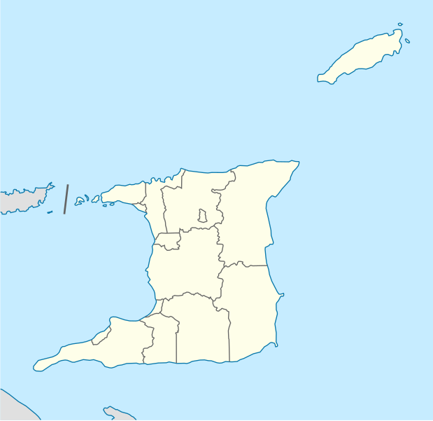
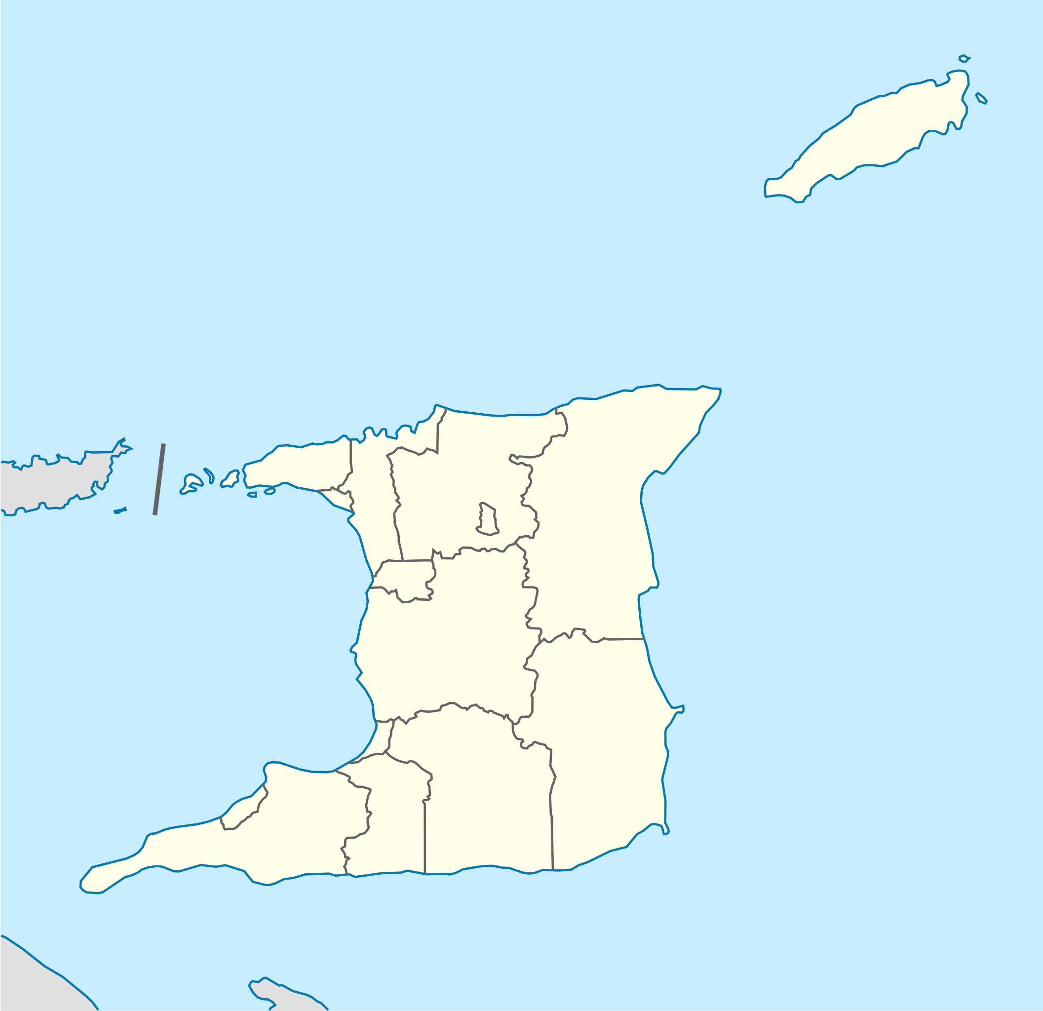
Deutsch: Positionskarte von Trinidad und Tobago
Quadratische Plattkarte. Geographische Begrenzung der Karte:
English: Location map of Trinidad and Tobago
Equirectangular projection. Geographic limits of the map:
|
| Datum | |
| Bron |
Eigen werk, using
|
| Auteur | NordNordWest |
| Andere versies |
Afgeleide werken van dit bestand: Trinidad and Tobago location map Topographic.png |


|
Deze kaart is gemaakt of verbeterd in de Duitse Kartenwerkstatt (Map Lab). Je kunt ook zelf kaarten ter verbetering voorstellen.
|
Licentie
Ik, de auteursrechthebbende van dit werk, maak het hierbij onder de volgende licentie beschikbaar:
Dit bestand is gelicenseerd onder de Creative Commons-licentie Naamsvermelding-Gelijk delen 3.0 Unported
- De gebruiker mag:
- Delen – het werk kopiëren, verspreiden en doorgeven
- Remixen – afgeleide werken maken
- Onder de volgende voorwaarden:
- naamsvermelding – U moet op een gepaste manier aan naamsvermelding doen, een link naar de licentie geven, en aangeven of er wijzigingen in het werk zijn aangebracht. U mag dit op elke redelijke manier doen, maar niet zodanig dat de indruk wordt gewekt dat de licentiegever instemt met uw werk of uw gebruik van zijn werk.
- Gelijk delen – Als u het werk heeft geremixt, veranderd, of erop heeft voortgebouwd, moet u het gewijzigde materiaal verspreiden onder dezelfde licentie als het oorspronkelijke werk, of een daarmee compatibele licentie.
Bestandsgeschiedenis
Klik op een datum/tijd om het bestand te zien zoals het destijds was.
| Datum/tijd | Miniatuur | Afmetingen | Gebruiker | Opmerking | |
|---|---|---|---|---|---|
| huidige versie | 7 mei 2013 14:39 | | 780 × 756 (39 kB) | NordNordWest | Reverted to version as of 16:58, 17 June 2009; please see en: Chacachacare |
| 7 mei 2013 14:09 |  | 780 × 756 (43 kB) | Dr Brains | Boundary with Venezuela | |
| 17 jun 2009 18:58 |  | 780 × 756 (39 kB) | NordNordWest | {{Information |Description= {{de|Positionskarte von Trinidad und Tobago}} Quadratische Plattkarte. Geographische Begrenzung der Karte: * N: 11.45° N * S: 9.85° N * W: 62.05° W * O: 60.4° W {{en|Location map of [[:en:Trinida |
Bestandsgebruik
Dit bestand wordt op de volgende pagina gebruikt:
Globaal bestandsgebruik
De volgende andere wiki's gebruiken dit bestand:
- Gebruikt op af.wikipedia.org
- Gebruikt op ar.wikipedia.org
- Gebruikt op be-tarask.wikipedia.org
- Gebruikt op be.wikipedia.org
- Gebruikt op bg.wikipedia.org
- Gebruikt op bn.wikipedia.org
- Gebruikt op bs.wikipedia.org
- Gebruikt op ca.wikipedia.org
- Gebruikt op ceb.wikipedia.org
- Plantilya:Location map Trinidad and Tobago
- White Cliff
- Smith Island
- The Sisters
- Signal Hill
- Saint Paul
- Saint John
- Saint George
- Red Cliff
- Pelican Rocks
- Morris Bay
- Long Island
- Hermitage Bay
- Goat Island
- Five Islands
- North Point
- Sandy Point
- Long Rock
- Rocky Point
- Black Rock
- Wolf Rock
- White Rock
- East Rock
- Crown Point
- Centre Hill
- The Brothers
- South Rock
- Sandy Bay
- Eastern Channel
- Sisters Rocks
- Brothers Rocks
- Man of War Bay
Globaal gebruik van dit bestand bekijken.