Bestand:Topographic map of Surtsey-fr.svg

Afmetingen van deze voorvertoning van het type PNG van dit SVG-bestand: 770 × 600 pixels Andere resoluties: 308 × 240 pixels | 616 × 480 pixels | 986 × 768 pixels | 1.280 × 997 pixels | 2.560 × 1.994 pixels | 2.453 × 1.911 pixels.
Oorspronkelijk bestand (SVG-bestand, nominaal 2.453 × 1.911 pixels, bestandsgrootte: 857 kB)
| Dit is een bestand van Wikimedia Commons. Onderstaande beschrijving komt van de beschrijving van het bestand daar. |
Beschrijving
| Beschrijving |
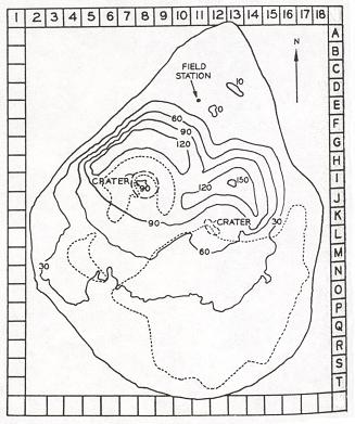
Français : Carte topographique en français de l'île Surtsey en Islande English: Topographic map in French of Surtsey island in Iceland |
| Datum | |
| Bron |
own work made with inkscape
Data sources :
Softwares used :
|
| Auteur | Pinpin |
| Andere versies | Afgeleide werken van dit bestand: Topographic map of Surtsey-sv.svg |
Deze niet W3C-verklaarde vectorafbeelding is gemaakt met Inkscape .

|
Dit SVG-bestand maakt gebruik van geïntegreerde tekst die gemakkelijk kan worden vertaald naar uw taal met een SVG editor, een tekstverwerker of het hulpmiddel SVG Translate. Uitleg |
Licentie
Ik, de auteursrechthebbende van dit werk, maak het hierbij onder de volgende licenties beschikbaar:

|
Toestemming wordt verleend voor het kopiëren, verspreiden en/of wijzigen van dit document onder de voorwaarden van de GNU-licentie voor vrije documentatie, versie 1.2 of enige latere versie als gepubliceerd door de Free Software Foundation; zonder Invariant Sections, zonder Front-Cover Texts, en zonder Back-Cover Texts. Een kopie van de licentie is opgenomen in de sectie GNU-licentie voor vrije documentatie. |
Dit bestand is gelicenseerd onder de Creative Commons-licenties Naamsvermelding-Gelijk delen 3.0 Unported, 2.5 Algemeen, 2.0 Algemeen en 1.0 Algemeen.
- De gebruiker mag:
- Delen – het werk kopiëren, verspreiden en doorgeven
- Remixen – afgeleide werken maken
- Onder de volgende voorwaarden:
- naamsvermelding – U moet op een gepaste manier aan naamsvermelding doen, een link naar de licentie geven, en aangeven of er wijzigingen in het werk zijn aangebracht. U mag dit op elke redelijke manier doen, maar niet zodanig dat de indruk wordt gewekt dat de licentiegever instemt met uw werk of uw gebruik van zijn werk.
- Gelijk delen – Als u het werk heeft geremixt, veranderd, of erop heeft voortgebouwd, moet u het gewijzigde materiaal verspreiden onder dezelfde licentie als het oorspronkelijke werk, of een daarmee compatibele licentie.
U mag zelf één van de licenties kiezen.
Bestandsgeschiedenis
Klik op een datum/tijd om het bestand te zien zoals het destijds was.
| Datum/tijd | Miniatuur | Afmetingen | Gebruiker | Opmerking | |
|---|---|---|---|---|---|
| huidige versie | 8 mrt 2008 13:37 | | 2.453 × 1.911 (857 kB) | Pinpin | |
| 8 mrt 2008 13:04 |  | 2.453 × 1.911 (857 kB) | Pinpin | ||
| 8 mrt 2008 12:49 |  | 2.453 × 1.911 (857 kB) | Pinpin | ||
| 4 mrt 2008 22:36 |  | 2.453 × 1.911 (621 kB) | Pinpin | {{Information |Description={{fr|Carte topographique en français de l'île Surtsey en Islande}} {{en|Map in franch of Surtsey island in Iceland}} |Source=own work made with inkscape{{clr}} Data sources : * Altitudes : [http://www.surtsey.is/pict/kort/KORT |
Bestandsgebruik
Dit bestand wordt op de volgende pagina gebruikt:
Globaal bestandsgebruik
De volgende andere wiki's gebruiken dit bestand:
- Gebruikt op arz.wikipedia.org
- Gebruikt op az.wikipedia.org
- Gebruikt op da.wikipedia.org
- Gebruikt op de.wikipedia.org
- Gebruikt op el.wikipedia.org
- Gebruikt op en.wikipedia.org
- Gebruikt op es.wikipedia.org
- Gebruikt op eu.wikipedia.org
- Gebruikt op fi.wikipedia.org
- Gebruikt op fr.wikipedia.org
- Gebruikt op he.wikipedia.org
- Gebruikt op hu.wikipedia.org
- Gebruikt op is.wikipedia.org
- Gebruikt op it.wikipedia.org
- Gebruikt op lt.wikipedia.org
- Gebruikt op mk.wikipedia.org
- Gebruikt op ms.wikipedia.org
- Gebruikt op no.wikipedia.org
- Gebruikt op pl.wikipedia.org
- Gebruikt op ru.wikipedia.org
- Gebruikt op sh.wikipedia.org
- Gebruikt op th.wikipedia.org
- Gebruikt op tr.wikipedia.org
- Gebruikt op vi.wikipedia.org
- Gebruikt op www.wikidata.org