Bestand:Snake watershed.png
Grootte van deze voorvertoning: 597 × 600 pixels. Andere resoluties: 239 × 240 pixels | 478 × 480 pixels | 1.000 × 1.005 pixels.
Oorspronkelijk bestand (1.000 × 1.005 pixels, bestandsgrootte: 296 kB, MIME-type: image/png)
| Dit is een bestand van Wikimedia Commons. Onderstaande beschrijving komt van de beschrijving van het bestand daar. |
Beschrijving
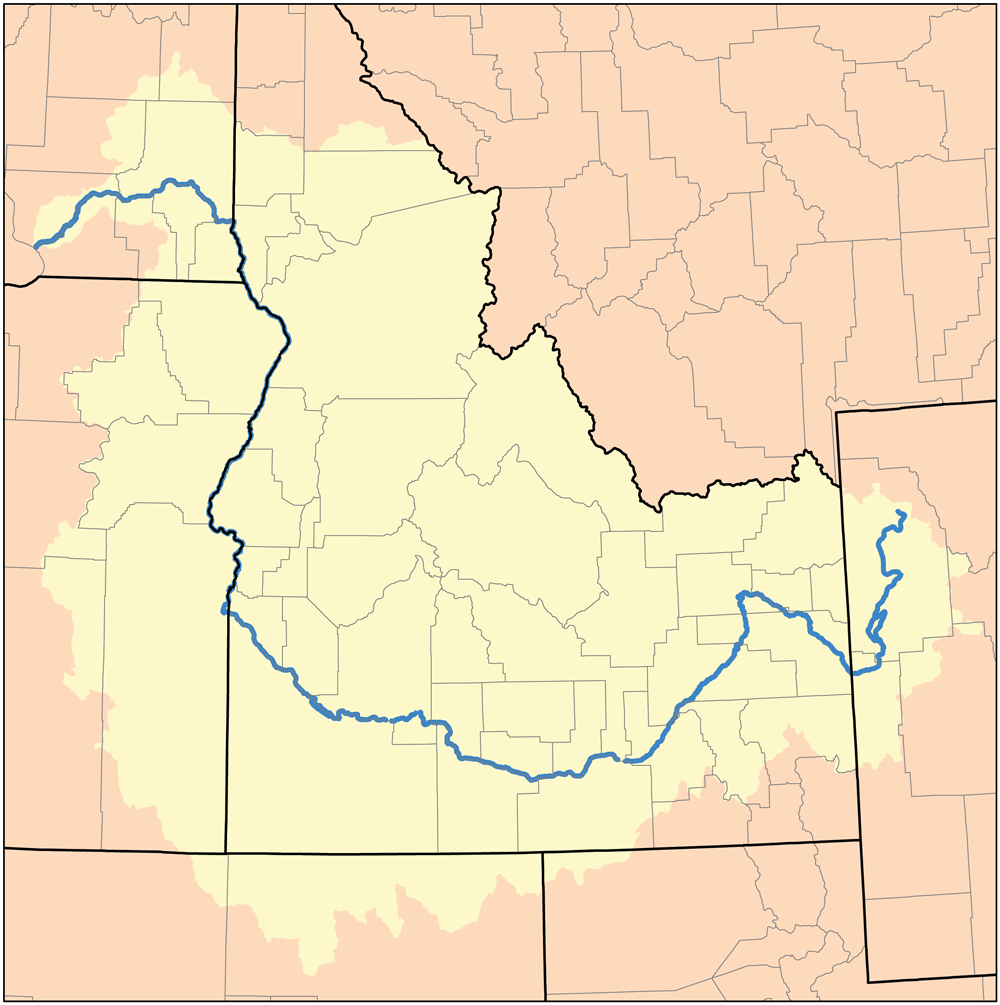
English: Map of the Snake River Watershed of Idaho — the Western United States.
I, Karl Musser, created it based on USGS data.
Ik, de auteursrechthebbende van dit werk, maak het hierbij onder de volgende licentie beschikbaar:
Dit bestand is gelicenseerd onder de Creative Commons-licentie Naamsvermelding-Gelijk delen 2.5 Unported
- De gebruiker mag:
- Delen – het werk kopiëren, verspreiden en doorgeven
- Remixen – afgeleide werken maken
- Onder de volgende voorwaarden:
- naamsvermelding – U moet op een gepaste manier aan naamsvermelding doen, een link naar de licentie geven, en aangeven of er wijzigingen in het werk zijn aangebracht. U mag dit op elke redelijke manier doen, maar niet zodanig dat de indruk wordt gewekt dat de licentiegever instemt met uw werk of uw gebruik van zijn werk.
- Gelijk delen – Als u het werk heeft geremixt, veranderd, of erop heeft voortgebouwd, moet u het gewijzigde materiaal verspreiden onder dezelfde licentie als het oorspronkelijke werk, of een daarmee compatibele licentie.
Bestandsgeschiedenis
Klik op een datum/tijd om het bestand te zien zoals het destijds was.
| Datum/tijd | Miniatuur | Afmetingen | Gebruiker | Opmerking | |
|---|---|---|---|---|---|
| huidige versie | 23 feb 2010 00:52 | | 1.000 × 1.005 (296 kB) | Kmusser | increased resolution |
| 6 mei 2007 00:36 |  | 189 × 190 (15 kB) | DanMS | Trimmed excess white space around image and uploaded same again. | |
| 16 nov 2005 21:00 |  | 200 × 200 (15 kB) | Kmusser | ||
| 8 sep 2005 17:31 |  | 200 × 200 (36 kB) | Kmusser | ||
| 9 aug 2005 14:38 |  | 200 × 200 (17 kB) | Kmusser | This is a map of the Tennessee River Watershed. I, Karl Musser, created it based on USGS data. {{GFDL}} Category:Maps of rivers |
Bestandsgebruik
Dit bestand wordt op de volgende pagina gebruikt:
Globaal bestandsgebruik
De volgende andere wiki's gebruiken dit bestand:
- Gebruikt op af.wikipedia.org
- Gebruikt op azb.wikipedia.org
- Gebruikt op en.wikipedia.org
- Gebruikt op fi.wikipedia.org
- Gebruikt op fy.wikipedia.org
- Gebruikt op io.wikipedia.org
- Gebruikt op kk.wikipedia.org
- Gebruikt op lt.wikipedia.org
- Gebruikt op pt.wikipedia.org
- Gebruikt op sl.wikipedia.org
- Gebruikt op sv.wikipedia.org
- Gebruikt op sw.wikipedia.org
- Gebruikt op uk.wikipedia.org
- Gebruikt op zh.wikipedia.org